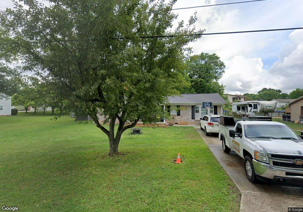
425 Carroll Rd Morristown, TN 37813
Estimated Value: $217,000 - $293,000
3
Beds
2
Baths
1,286
Sq Ft
$204/Sq Ft
Est. Value
About This Home
This home is located at 425 Carroll Rd, Morristown, TN 37813 and is currently estimated at $262,684, approximately $204 per square foot. 425 Carroll Rd is a home located in Hamblen County with nearby schools including John Hay Elementary School, Meadowview Middle School, and Morristown East High School.
Ownership History
Date
Name
Owned For
Owner Type
Purchase Details
Closed on
Jun 22, 2015
Sold by
Conry Ruth P
Bought by
Murdock Michael
Current Estimated Value
Home Financials for this Owner
Home Financials are based on the most recent Mortgage that was taken out on this home.
Original Mortgage
$99,897
Outstanding Balance
$77,839
Interest Rate
3.92%
Mortgage Type
New Conventional
Estimated Equity
$184,845
Purchase Details
Closed on
Sep 9, 2004
Sold by
Cloninger Lonnie R
Bought by
Conry Ruth P
Home Financials for this Owner
Home Financials are based on the most recent Mortgage that was taken out on this home.
Original Mortgage
$60,160
Interest Rate
5.78%
Purchase Details
Closed on
Aug 17, 1977
Bought by
Cloninger Lonnie R and Cloninger Patsy L
Create a Home Valuation Report for This Property
The Home Valuation Report is an in-depth analysis detailing your home's value as well as a comparison with similar homes in the area
Home Values in the Area
Average Home Value in this Area
Purchase History
| Date | Buyer | Sale Price | Title Company |
|---|---|---|---|
| Murdock Michael | $97,900 | -- | |
| Conry Ruth P | $75,200 | -- | |
| Cloninger Lonnie R | $23,000 | -- |
Source: Public Records
Mortgage History
| Date | Status | Borrower | Loan Amount |
|---|---|---|---|
| Open | Murdock Michael | $99,897 | |
| Previous Owner | Cloninger Lonnie R | $60,160 | |
| Previous Owner | Cloninger Lonnie R | $15,040 |
Source: Public Records
Tax History Compared to Growth
Tax History
| Year | Tax Paid | Tax Assessment Tax Assessment Total Assessment is a certain percentage of the fair market value that is determined by local assessors to be the total taxable value of land and additions on the property. | Land | Improvement |
|---|---|---|---|---|
| 2024 | $550 | $27,900 | $6,500 | $21,400 |
| 2023 | $550 | $27,900 | $0 | $0 |
| 2022 | $550 | $27,900 | $6,500 | $21,400 |
| 2021 | $550 | $27,900 | $6,500 | $21,400 |
| 2020 | $550 | $27,900 | $6,500 | $21,400 |
| 2019 | $566 | $26,550 | $6,250 | $20,300 |
| 2018 | $566 | $26,550 | $6,250 | $20,300 |
| 2017 | $566 | $26,550 | $6,250 | $20,300 |
| 2016 | $528 | $26,550 | $6,250 | $20,300 |
| 2015 | $491 | $26,550 | $6,250 | $20,300 |
| 2014 | -- | $26,550 | $6,250 | $20,300 |
| 2013 | -- | $27,675 | $0 | $0 |
Source: Public Records
Map
Nearby Homes
- 3661 Halifax Cir
- Lot 1 E Andrew Johnson Hwy
- 3115 Eloise Dr
- 3003 Eloise Dr
- 1689 Carroll Rd
- 542 Cliff St
- 512 Cliff St
- 517 Cliff St
- 4270 Brockland Dr
- 3113 Berna Way
- 358 Dover Rd
- 1575 Thompson Creek Rd
- 0 Thompson Creek Rd
- Lot 2 Morelock Rd
- 0 Morelock Rd N
- 1148 George Byrd Rd
- 4458 Brockland Dr
- 288 Fuller Estate Cir
- 4091 White Wood Cir
- 4027 White Wood Cir
- 429 Carroll Rd
- 3867 Halifax Cir
- 3847 Halifax Cir
- 3610 Halifax Cir
- 3616 Halifax Cir
- 437 Carroll Rd
- 3827 Halifax Cir
- 3620 Halifax Cir
- 445 Carroll Rd
- 3868 Halifax Cir
- 3626 Halifax Cir
- 3848 Halifax Cir
- 3609 Halifax Cir
- 3795 Halifax Cir
- 3615 Halifax Cir
- 3828 Halifax Cir
- 3621 Halifax Cir
- 3814 Halifax Cir
- 3787 Halifax Cir
- 460 Carroll Rd