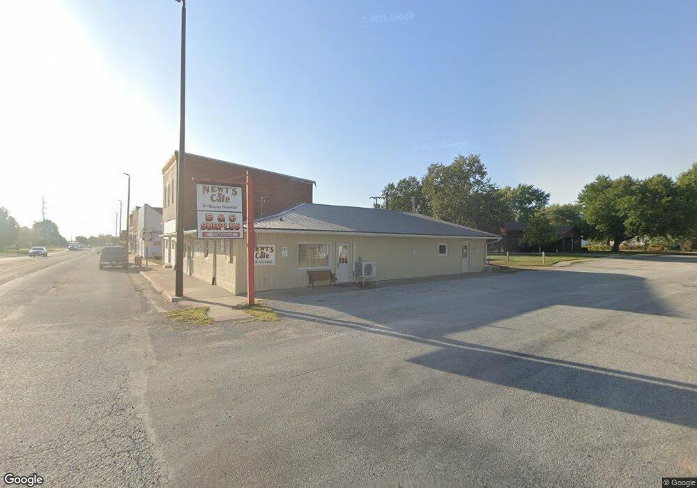
425 Main St Nichols, IA 52766
Estimated Value: $93,025
--
Bed
--
Bath
3,000
Sq Ft
$31/Sq Ft
Est. Value
About This Home
This home is located at 425 Main St, Nichols, IA 52766 and is currently estimated at $93,025, approximately $31 per square foot. 425 Main St is a home located in Muscatine County with nearby schools including Early Childhood Center, West Liberty Middle School, and West Liberty High School.
Ownership History
Date
Name
Owned For
Owner Type
Purchase Details
Closed on
May 11, 2018
Sold by
Gerot William F and Gerot Elizabeth J
Bought by
Newts Cafe Llc
Current Estimated Value
Home Financials for this Owner
Home Financials are based on the most recent Mortgage that was taken out on this home.
Original Mortgage
$51,000
Outstanding Balance
$41,248
Interest Rate
4.4%
Mortgage Type
Future Advance Clause Open End Mortgage
Estimated Equity
$51,777
Purchase Details
Closed on
Aug 24, 2015
Sold by
Tavern Inc
Bought by
Gerot William F
Create a Home Valuation Report for This Property
The Home Valuation Report is an in-depth analysis detailing your home's value as well as a comparison with similar homes in the area
Home Values in the Area
Average Home Value in this Area
Purchase History
| Date | Buyer | Sale Price | Title Company |
|---|---|---|---|
| Newts Cafe Llc | $58,000 | None Available | |
| Gerot William F | $8,000 | None Available |
Source: Public Records
Mortgage History
| Date | Status | Borrower | Loan Amount |
|---|---|---|---|
| Open | Newts Cafe Llc | $51,000 |
Source: Public Records
Tax History Compared to Growth
Tax History
| Year | Tax Paid | Tax Assessment Tax Assessment Total Assessment is a certain percentage of the fair market value that is determined by local assessors to be the total taxable value of land and additions on the property. | Land | Improvement |
|---|---|---|---|---|
| 2025 | $1,092 | $80,610 | $5,120 | $75,490 |
| 2024 | $1,092 | $78,550 | $5,120 | $73,430 |
| 2023 | $477 | $75,170 | $5,120 | $70,050 |
| 2022 | $2,196 | $74,740 | $5,120 | $69,620 |
| 2021 | $2,190 | $64,860 | $5,120 | $59,740 |
| 2020 | $2,359 | $66,730 | $5,120 | $61,610 |
| 2019 | $2,161 | $62,150 | $0 | $0 |
| 2018 | $1,146 | $62,150 | $0 | $0 |
| 2017 | $1,146 | $35,130 | $0 | $0 |
| 2016 | $1,202 | $63,480 | $0 | $0 |
| 2015 | $1,202 | $52,980 | $0 | $0 |
| 2014 | $1,624 | $52,980 | $0 | $0 |
Source: Public Records
Map
Nearby Homes