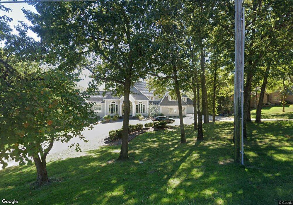
425 NE St Andrews Cir Lee's Summit, MO 64064
Chapel Ridge NeighborhoodEstimated Value: $1,500,000 - $4,130,000
4
Beds
5
Baths
6,544
Sq Ft
$496/Sq Ft
Est. Value
About This Home
This home is located at 425 NE St Andrews Cir, Lee's Summit, MO 64064 and is currently estimated at $3,246,333, approximately $496 per square foot. 425 NE St Andrews Cir is a home located in Jackson County with nearby schools including Chapel Lakes Elementary School, Delta Woods Middle School, and Blue Springs South High School.
Ownership History
Date
Name
Owned For
Owner Type
Purchase Details
Closed on
Nov 8, 2016
Sold by
Healy Michael P and Healy Sonya R
Bought by
Healy Michael P and Healy Sonya R
Current Estimated Value
Purchase Details
Closed on
Jul 31, 2006
Sold by
Finch Harold L and Finch Peggy D
Bought by
Healy Michael and Healy Sonya
Home Financials for this Owner
Home Financials are based on the most recent Mortgage that was taken out on this home.
Original Mortgage
$600,000
Interest Rate
6.66%
Mortgage Type
Stand Alone First
Purchase Details
Closed on
Sep 28, 1995
Sold by
Three G Enterprises Inc
Bought by
Finch Harold L and Finch Peggy D
Home Financials for this Owner
Home Financials are based on the most recent Mortgage that was taken out on this home.
Original Mortgage
$350,000
Interest Rate
7.88%
Create a Home Valuation Report for This Property
The Home Valuation Report is an in-depth analysis detailing your home's value as well as a comparison with similar homes in the area
Home Values in the Area
Average Home Value in this Area
Purchase History
| Date | Buyer | Sale Price | Title Company |
|---|---|---|---|
| Healy Michael P | -- | None Available | |
| Healy Michael | -- | Kansas City Title | |
| Finch Harold L | -- | Chicago Title Insurance Co |
Source: Public Records
Mortgage History
| Date | Status | Borrower | Loan Amount |
|---|---|---|---|
| Previous Owner | Healy Michael | $600,000 | |
| Previous Owner | Finch Harold L | $350,000 |
Source: Public Records
Tax History Compared to Growth
Tax History
| Year | Tax Paid | Tax Assessment Tax Assessment Total Assessment is a certain percentage of the fair market value that is determined by local assessors to be the total taxable value of land and additions on the property. | Land | Improvement |
|---|---|---|---|---|
| 2025 | $16,134 | $242,282 | $28,650 | $213,632 |
| 2024 | $15,844 | $210,682 | $14,596 | $196,086 |
| 2023 | $15,844 | $210,682 | $14,596 | $196,086 |
| 2022 | $19,346 | $227,810 | $4,997 | $222,813 |
| 2021 | $19,329 | $227,810 | $4,997 | $222,813 |
| 2020 | $18,619 | $217,031 | $4,997 | $212,034 |
| 2019 | $18,047 | $217,031 | $4,997 | $212,034 |
| 2018 | $16,169 | $188,620 | $34,940 | $153,680 |
| 2017 | $16,169 | $188,620 | $34,940 | $153,680 |
| 2016 | $15,712 | $183,893 | $14,250 | $169,643 |
| 2014 | $15,811 | $183,893 | $14,250 | $169,643 |
Source: Public Records
Map
Nearby Homes
- 425 NE Saint Andrews Cir
- 5136 NE Ash Grove Dr
- 801 NE Fairway Homes Ct
- 633 NE St Andrews Cir
- 5416 NE Northgate Crossing
- 708 NE Lake Pointe Dr
- 637 NE Shoreline Dr
- 4517 NE Fairway Homes Dr
- 5605 NE Misty Meadow Place
- 327 NE Landings Dr
- 5808 NE Coral Dr
- 917 NE Kenwood Dr
- 400 NE Emerald Dr
- 4524 NE Kingston Dr
- 4600 NE Kingston Dr
- 214 NE Landings Cir
- 5556 NW Moonlight Meadow Dr
- 1225 NE Kenwood Dr
- 4605 NE Kingston Dr
- 201 NW Hackberry St
- 415 NE Saint Andrews Cir
- 5105 NE Ash Grove Place
- 5107 NE Ash Grove Place
- 401 NE Saint Andrews Cir
- 5101 NE Ash Grove Place
- 5109 NE Ash Grove Place
- 5111 NE Ash Grove Place
- 5113 NE Ash Grove Place
- 505 NE Olympic Ct
- 5108 NE Ash Grove Dr
- 5117 NE Ash Grove Dr
- 351 NE Saint Andrews Cir
- 501 NE Olympic Ct
- 509 NE Olympic Ct
- 513 NE Olympic Ct
- 5121 NE Ash Grove Dr
- 517 NE Olympic Ct
- 521 NE Olympic Ct
- 5295 NE Ash Grove Ct
- 5129 NE Ash Grove Dr