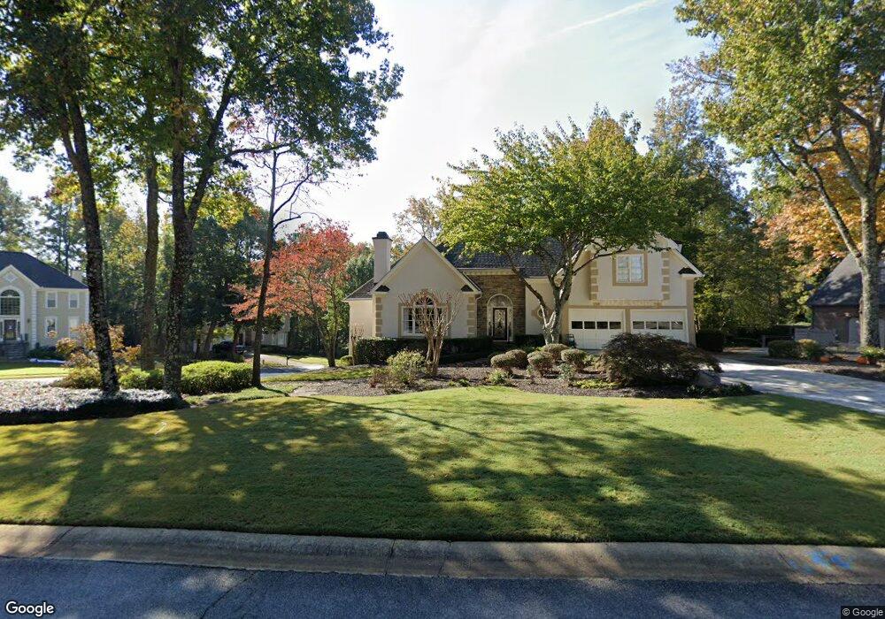
4250 N Mountain Rd NE Marietta, GA 30066
Sandy Plains NeighborhoodEstimated Value: $589,000 - $729,000
4
Beds
3
Baths
2,760
Sq Ft
$235/Sq Ft
Est. Value
About This Home
This home is located at 4250 N Mountain Rd NE, Marietta, GA 30066 and is currently estimated at $647,361, approximately $234 per square foot. 4250 N Mountain Rd NE is a home located in Cobb County with nearby schools including Davis Elementary School, Mabry Middle School, and Lassiter High School.
Ownership History
Date
Name
Owned For
Owner Type
Purchase Details
Closed on
Mar 30, 1998
Sold by
Hughes Shawn R and Hughes Sandra
Bought by
Hancock John P and Hancock Cynthia
Current Estimated Value
Home Financials for this Owner
Home Financials are based on the most recent Mortgage that was taken out on this home.
Original Mortgage
$150,000
Outstanding Balance
$27,538
Interest Rate
7.06%
Mortgage Type
New Conventional
Estimated Equity
$619,823
Create a Home Valuation Report for This Property
The Home Valuation Report is an in-depth analysis detailing your home's value as well as a comparison with similar homes in the area
Home Values in the Area
Average Home Value in this Area
Purchase History
| Date | Buyer | Sale Price | Title Company |
|---|---|---|---|
| Hancock John P | $225,000 | -- |
Source: Public Records
Mortgage History
| Date | Status | Borrower | Loan Amount |
|---|---|---|---|
| Open | Hancock John P | $150,000 |
Source: Public Records
Tax History Compared to Growth
Tax History
| Year | Tax Paid | Tax Assessment Tax Assessment Total Assessment is a certain percentage of the fair market value that is determined by local assessors to be the total taxable value of land and additions on the property. | Land | Improvement |
|---|---|---|---|---|
| 2025 | $1,239 | $213,096 | $54,000 | $159,096 |
| 2024 | $1,243 | $213,096 | $54,000 | $159,096 |
| 2023 | $1,037 | $213,096 | $54,000 | $159,096 |
| 2022 | $1,103 | $166,284 | $40,000 | $126,284 |
| 2021 | $1,047 | $147,520 | $30,000 | $117,520 |
| 2020 | $1,047 | $147,520 | $30,000 | $117,520 |
| 2019 | $1,047 | $147,520 | $30,000 | $117,520 |
| 2018 | $1,040 | $145,220 | $30,000 | $115,220 |
| 2017 | $933 | $145,220 | $30,000 | $115,220 |
| 2016 | $940 | $145,220 | $30,000 | $115,220 |
| 2015 | $954 | $130,976 | $30,000 | $100,976 |
| 2014 | $921 | $117,192 | $0 | $0 |
Source: Public Records
Map
Nearby Homes
- 4243 N Mountain Rd NE
- 4219 N Mountain Rd NE
- 4302 Highborne Dr NE Unit 3
- 4380 Wood Creek Dr
- 4734 Outlook Way NE
- 3333 Devaughn Dr NE
- 4563 Ashmore Cir NE
- 4397 Windsor Oaks Cir
- 3350 Brookhill Cir
- 3043 Sawyer Trace NE
- 4589 Wigley Estates Rd
- 3870 Sweat Creek Run
- 2855 Lamer Trace
- 3465 Township Ridge Point
- 3480 Pebble Hill Dr
- 4032 Ashmont Ct
- 4019 Wesley Chapel Rd
- 3130 Maley Ct
- 4211 Long Branch Dr NE
- 4248 N Mountain Rd NE
- 4252 N Mountain Rd NE
- 4212 Long Branch Dr NE
- 4209 Long Branch Dr NE Unit 1
- 4255 N Mountain Rd NE
- 4257 N Mountain Rd NE Unit 1
- 4253 N Mountain Rd NE
- 4210 Long Branch Dr NE
- 4259 N Mountain Rd NE
- 4254 N Mountain Rd NE
- 4208 Long Branch Dr NE
- 4244 N Mountain Rd NE
- 4205 Long Branch Dr NE Unit 1
- 4251 N Mountain Rd NE
- 3500 Lone Indian Way Unit 2
- 4261 N Mountain Rd NE Unit 307
- 4261 N Mountain Rd NE
- 3624 Lone Indian Trail Unit 2
- 4242 N Mountain Rd NE Unit 1