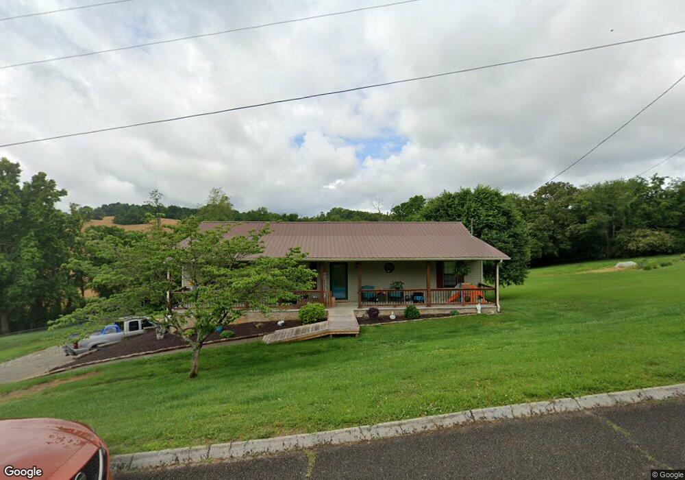
4251 Danbury Dr Morristown, TN 37813
Estimated Value: $255,000 - $325,000
--
Bed
2
Baths
1,394
Sq Ft
$208/Sq Ft
Est. Value
About This Home
This home is located at 4251 Danbury Dr, Morristown, TN 37813 and is currently estimated at $290,020, approximately $208 per square foot. 4251 Danbury Dr is a home located in Hamblen County with nearby schools including John Hay Elementary School, Meadowview Middle School, and Morristown East High School.
Ownership History
Date
Name
Owned For
Owner Type
Purchase Details
Closed on
Mar 24, 2017
Sold by
Kinsler Donette P
Bought by
Sandifer Donette Pearl and Sandifer Michael Wayne
Current Estimated Value
Purchase Details
Closed on
Jul 30, 2007
Sold by
Kinsler John A
Bought by
Kinsler Donette P
Purchase Details
Closed on
Oct 26, 1997
Bought by
Kinsler John A and Mcnabb Donette P
Purchase Details
Closed on
Sep 29, 1993
Bought by
Bible Roger L
Purchase Details
Closed on
Jan 27, 1993
Bought by
Parker James E and Parker Charlotte
Purchase Details
Closed on
Dec 12, 1991
Bought by
Franklin Federal Savings Bank
Purchase Details
Closed on
Apr 26, 1989
Bought by
Drinnon Lloyd T
Purchase Details
Closed on
Mar 31, 1978
Bought by
Brock James T and Brock Helen C
Create a Home Valuation Report for This Property
The Home Valuation Report is an in-depth analysis detailing your home's value as well as a comparison with similar homes in the area
Home Values in the Area
Average Home Value in this Area
Purchase History
| Date | Buyer | Sale Price | Title Company |
|---|---|---|---|
| Sandifer Donette Pearl | -- | -- | |
| Kinsler Donette P | -- | -- | |
| Kinsler John A | $85,000 | -- | |
| Bible Roger L | $72,500 | -- | |
| Parker James E | $10,000 | -- | |
| Franklin Federal Savings Bank | $15,000 | -- | |
| Drinnon Lloyd T | -- | -- | |
| Brock James T | -- | -- |
Source: Public Records
Tax History Compared to Growth
Tax History
| Year | Tax Paid | Tax Assessment Tax Assessment Total Assessment is a certain percentage of the fair market value that is determined by local assessors to be the total taxable value of land and additions on the property. | Land | Improvement |
|---|---|---|---|---|
| 2024 | $661 | $33,575 | $5,275 | $28,300 |
| 2023 | $661 | $33,575 | $0 | $0 |
| 2022 | $661 | $33,575 | $5,275 | $28,300 |
| 2021 | $661 | $33,575 | $5,275 | $28,300 |
| 2020 | $661 | $33,575 | $5,275 | $28,300 |
| 2019 | $635 | $29,825 | $5,125 | $24,700 |
| 2018 | $635 | $29,825 | $5,125 | $24,700 |
| 2017 | $635 | $29,825 | $5,125 | $24,700 |
| 2016 | $594 | $29,825 | $5,125 | $24,700 |
| 2015 | $552 | $29,825 | $5,125 | $24,700 |
| 2014 | -- | $29,825 | $5,125 | $24,700 |
| 2013 | -- | $33,900 | $0 | $0 |
Source: Public Records
Map
Nearby Homes
- 4270 Brockland Dr
- 4458 Brockland Dr
- 1148 George Byrd Rd
- 4581 Lockley Ct
- 4705 E Hampton Blvd
- 4510 Westover Place
- 358 Dover Rd
- 670 Jones Franklin Rd
- 1689 Carroll Rd
- 288 Fuller Estate Cir
- 3661 Halifax Cir
- 4907 Barton Springs Dr
- 1342 Slop Creek Rd
- 1496 Dover Rd
- 1744 Carroll Rd
- 4271 Stansberry Rd
- 00 Shinbone E Sugar Hollow Rd
- 4027 White Wood Cir
- Lot 1 E Andrew Johnson Hwy
- 4091 White Wood Cir
- 4241 Danbury Dr
- 4250 Danbury Dr
- 4260 Danbury Dr
- 4269 Danbury Dr
- 4240 Danbury Dr
- 4277 Danbury Dr
- 4280 Danbury Dr
- 873 Norland Dr
- 4342 Ashford Dr
- 703 Dover Rd
- 881 Norland Dr
- 4372 Danbury Dr
- 4352 Ashford Dr
- 862 Norland Dr
- 4382 Danbury Dr
- 831 Dover Rd
- 4404 Danbury Dr
- 4337 Danbury Dr
- 4362 Ashford Dr
- 4361 Ashford Dr