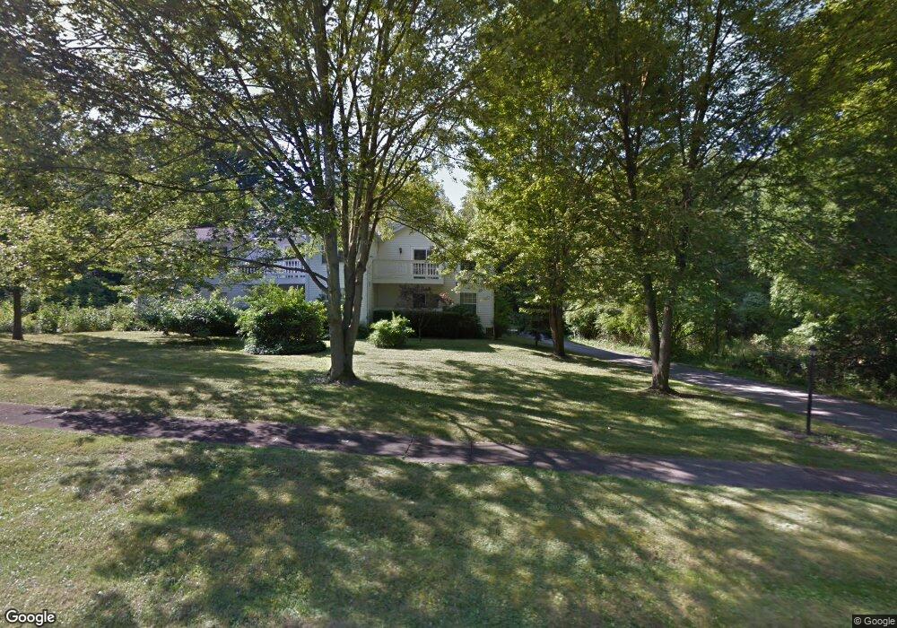
4253 Devonshire Dr Youngstown, OH 44512
Estimated Value: $112,000 - $136,000
2
Beds
2
Baths
1,278
Sq Ft
$97/Sq Ft
Est. Value
About This Home
This home is located at 4253 Devonshire Dr, Youngstown, OH 44512 and is currently estimated at $123,667, approximately $96 per square foot. 4253 Devonshire Dr is a home located in Mahoning County with nearby schools including Boardman Center Middle School, Boardman High School, and Horizon Science Academy - Youngstown.
Ownership History
Date
Name
Owned For
Owner Type
Purchase Details
Closed on
Oct 1, 2020
Bought by
Alyscam Llc
Current Estimated Value
Home Financials for this Owner
Home Financials are based on the most recent Mortgage that was taken out on this home.
Interest Rate
2.88%
Purchase Details
Closed on
Jun 8, 2003
Sold by
Cifalde Beverly and Masko John
Bought by
Nestor Sean
Home Financials for this Owner
Home Financials are based on the most recent Mortgage that was taken out on this home.
Original Mortgage
$50,400
Interest Rate
5.78%
Mortgage Type
Purchase Money Mortgage
Purchase Details
Closed on
Sep 10, 2002
Sold by
Estate Of Helen E Aaron
Bought by
Cifalde Beverly and Masko John
Purchase Details
Closed on
Jul 27, 1987
Bought by
Aaron Helen E
Create a Home Valuation Report for This Property
The Home Valuation Report is an in-depth analysis detailing your home's value as well as a comparison with similar homes in the area
Home Values in the Area
Average Home Value in this Area
Purchase History
| Date | Buyer | Sale Price | Title Company |
|---|---|---|---|
| Alyscam Llc | $65,000 | -- | |
| Nestor Sean | $56,000 | -- | |
| Cifalde Beverly | -- | -- | |
| Aaron Helen E | -- | -- |
Source: Public Records
Mortgage History
| Date | Status | Borrower | Loan Amount |
|---|---|---|---|
| Closed | Alyscam Llc | -- | |
| Previous Owner | Nestor Sean | $50,400 |
Source: Public Records
Tax History
| Year | Tax Paid | Tax Assessment Tax Assessment Total Assessment is a certain percentage of the fair market value that is determined by local assessors to be the total taxable value of land and additions on the property. | Land | Improvement |
|---|---|---|---|---|
| 2025 | $1,429 | $27,860 | $3,500 | $24,360 |
| 2024 | $1,463 | $27,860 | $3,500 | $24,360 |
| 2023 | $1,444 | $27,860 | $3,500 | $24,360 |
| 2022 | $1,118 | $16,390 | $2,620 | $13,770 |
| 2021 | $1,119 | $16,390 | $2,620 | $13,770 |
| 2020 | $1,124 | $16,390 | $2,620 | $13,770 |
| 2019 | $1,170 | $15,320 | $2,450 | $12,870 |
| 2018 | $1,024 | $15,320 | $2,450 | $12,870 |
| 2017 | $1,010 | $15,320 | $2,450 | $12,870 |
| 2016 | $1,303 | $19,650 | $3,500 | $16,150 |
| 2015 | $1,278 | $19,650 | $3,500 | $16,150 |
| 2014 | $1,282 | $19,650 | $3,500 | $16,150 |
| 2013 | $1,267 | $19,650 | $3,500 | $16,150 |
Source: Public Records
Map
Nearby Homes
- 4389 Devonshire Dr Unit 15
- 4141 Windsor Rd
- 153 Overhill Rd
- 4250 Oak Knoll Dr
- 132 Jennette Dr
- 4061 Riverside Dr
- 91 Lakeshore Dr
- 85 Lake Shore Dr
- 537 W Ravenwood Ave
- 334 Mistletoe Ave
- 28 Jennette Dr
- 3911 Arden Blvd
- 3916 Howard St
- 435 Parkcliffe Ave
- 3560 Arden Blvd
- 3401 Idlewood Ave Unit 403
- 3419 Hillman St
- 322 Shields Rd
- 4833 Oak Knoll Dr
- 252 Shields Rd
- 4253 Devonshire Dr Unit C
- 4255 Devonshire Dr Unit D1
- 4257 Devonshire Dr Unit A
- 4259 Devonshire Dr
- 4325 Devonshire Dr
- 163 Devonshire
- 145 Devonshire
- 143 Devonshire
- 144 Devonshire
- 142 Devonshire
- 4102 Devonshire Dr
- 4323 Devonshire Dr
- 4319 Devonshire Dr
- 4317 Devonshire Dr
- 4070 Glenwood Ave
- 4320 Devonshire Dr
- 4315 Devonshire Dr Unit 4315
- 4313 Devonshire Dr
- 4311 Devonshire Dr Unit 4311
- 4309 Devonshire Dr Unit 4309
Your Personal Tour Guide
Ask me questions while you tour the home.