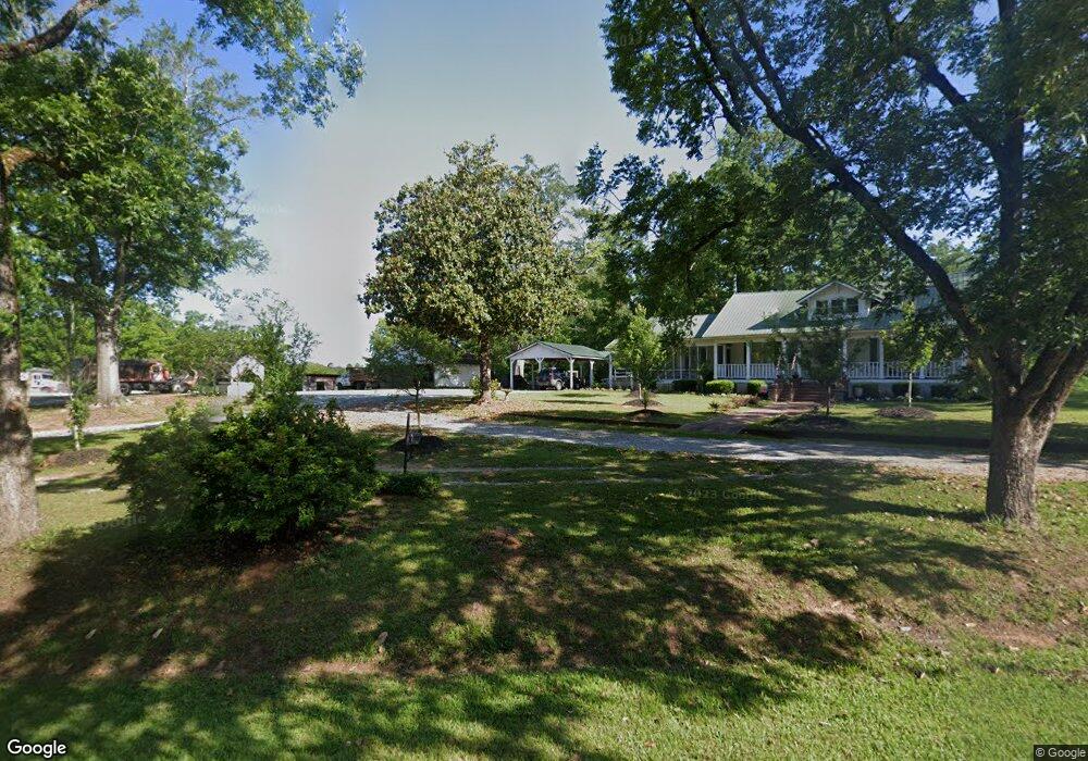
4253 Ga Highway 83 S Forsyth, GA 31029
Estimated Value: $252,000 - $331,000
--
Bed
2
Baths
2,166
Sq Ft
$130/Sq Ft
Est. Value
About This Home
This home is located at 4253 Ga Highway 83 S, Forsyth, GA 31029 and is currently estimated at $280,557, approximately $129 per square foot. 4253 Ga Highway 83 S is a home located in Monroe County with nearby schools including Samuel E. Hubbard Elementary School and Mary Persons High School.
Ownership History
Date
Name
Owned For
Owner Type
Purchase Details
Closed on
Jun 15, 2018
Sold by
Haygood Trevitt Annice
Bought by
Trevitt Donnie H and Trevitt Frances K
Current Estimated Value
Home Financials for this Owner
Home Financials are based on the most recent Mortgage that was taken out on this home.
Original Mortgage
$137,464
Outstanding Balance
$119,544
Interest Rate
4.75%
Mortgage Type
FHA
Estimated Equity
$161,013
Purchase Details
Closed on
Feb 14, 1995
Bought by
Trevitt Annice Haygood
Create a Home Valuation Report for This Property
The Home Valuation Report is an in-depth analysis detailing your home's value as well as a comparison with similar homes in the area
Home Values in the Area
Average Home Value in this Area
Purchase History
| Date | Buyer | Sale Price | Title Company |
|---|---|---|---|
| Trevitt Donnie H | $140,000 | -- | |
| Trevitt Annice Haygood | -- | -- |
Source: Public Records
Mortgage History
| Date | Status | Borrower | Loan Amount |
|---|---|---|---|
| Open | Trevitt Donnie H | $137,464 |
Source: Public Records
Tax History Compared to Growth
Tax History
| Year | Tax Paid | Tax Assessment Tax Assessment Total Assessment is a certain percentage of the fair market value that is determined by local assessors to be the total taxable value of land and additions on the property. | Land | Improvement |
|---|---|---|---|---|
| 2024 | $1,092 | $70,804 | $22,480 | $48,324 |
| 2023 | $1,048 | $63,084 | $22,480 | $40,604 |
| 2022 | $842 | $63,084 | $22,480 | $40,604 |
| 2021 | $871 | $63,084 | $22,480 | $40,604 |
| 2020 | $893 | $63,084 | $22,480 | $40,604 |
| 2019 | $1,827 | $63,084 | $22,480 | $40,604 |
| 2018 | $1,484 | $63,084 | $22,480 | $40,604 |
| 2017 | $1,834 | $63,084 | $22,480 | $40,604 |
| 2016 | $841 | $63,084 | $22,480 | $40,604 |
| 2015 | $797 | $63,084 | $22,480 | $40,604 |
| 2014 | $768 | $63,084 | $22,480 | $40,604 |
Source: Public Records
Map
Nearby Homes
- 355 Dumas Rd
- 1721 Old Zebulon Rd
- 0 Ramah Church Rd Unit 10480661
- 0 Ramah Church Rd Unit 7542675
- 305 Zellner Rd
- 144 Means Rd
- 293 AC Hopewell Rd
- 202 Community House Rd
- 208 Community House Rd
- 342 Ramah Church Rd
- TRACT 9 Ramah Church Rd Unit 9
- TRACT 6 Ramah Church Rd Unit 6
- 737 Pine Grove Church Rd
- 0 Abercrombie Rd Unit 24572833
- 3319 Highway 42 S
- 0 Old Zebulon Rd Unit 25091896
- 0 Old Zebulon Rd Unit 25062362
- 0 Old Zebulon Rd Unit 25091897
- 5588 Ga Highway 42 S Unit LOT 3
- 519 Barbara Ct
- 4175 Ga Highway 83 S
- 4160 Ga Highway 83 S
- 4072 Ga Highway 83 S
- 4110 Ga Highway 83 S
- 83 Shaw Ave
- 00 Highway 83
- 000 Highway 83
- 0 Spear Rd Unit Parcel One 8299179
- 0 Spear Rd Unit 8432352
- 0 Spear Rd Unit M142517
- 0 Spear Rd Unit M145881
- 0 Spear Rd Unit 176912
- Lot 4 Highway 83 Unit lot 4
- 86 Spear Rd
- 92 Spear Rd
- 101 Spear Rd
- 3924 Ga Highway 83 S
- 3924 Georgia 83
- 4636 Ga Highway 83 S
- 177 Spear Rd