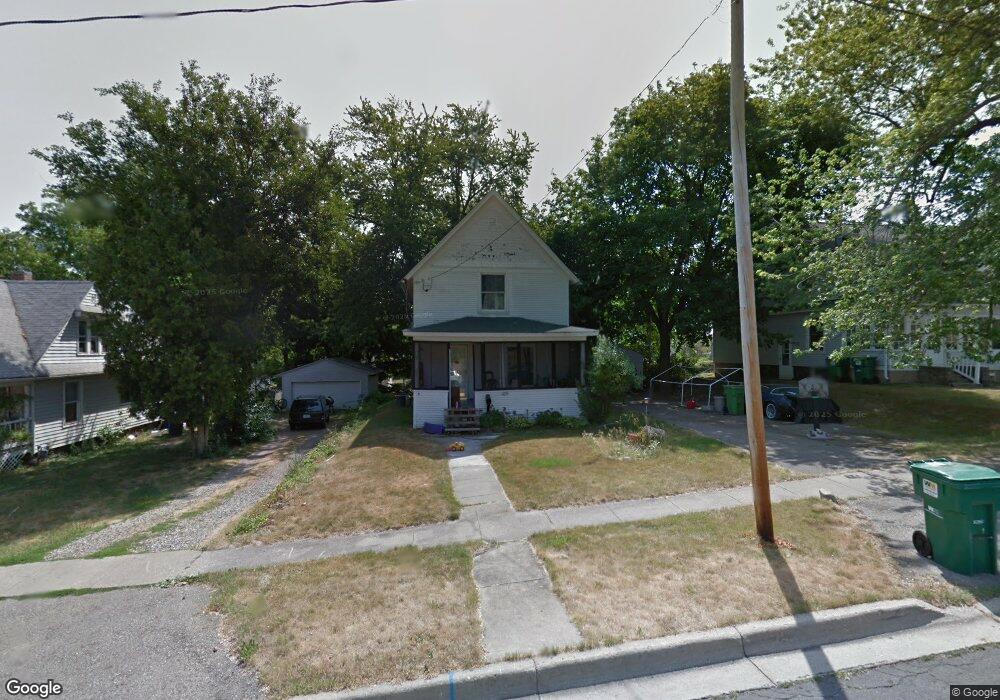
426 23rd St N Springfield, MI 49037
Estimated Value: $98,000 - $149,000
4
Beds
2
Baths
1,478
Sq Ft
$85/Sq Ft
Est. Value
About This Home
This home is located at 426 23rd St N, Springfield, MI 49037 and is currently estimated at $126,193, approximately $85 per square foot. 426 23rd St N is a home located in Calhoun County with nearby schools including Valley View Elementary School, Springfield Middle School, and Battle Creek Central High School.
Ownership History
Date
Name
Owned For
Owner Type
Purchase Details
Closed on
Jun 18, 2015
Sold by
Meek Kebin and Meek Tammy P
Bought by
Meek Kebin and Meek Tammy P
Current Estimated Value
Home Financials for this Owner
Home Financials are based on the most recent Mortgage that was taken out on this home.
Original Mortgage
$22,818
Outstanding Balance
$15,963
Interest Rate
3.86%
Mortgage Type
VA
Estimated Equity
$110,230
Purchase Details
Closed on
Dec 18, 2000
Sold by
Carr Steven L
Bought by
Meek Kebin
Purchase Details
Closed on
Sep 19, 1995
Sold by
Hilborn Martha
Bought by
Carr Steven L
Create a Home Valuation Report for This Property
The Home Valuation Report is an in-depth analysis detailing your home's value as well as a comparison with similar homes in the area
Home Values in the Area
Average Home Value in this Area
Purchase History
| Date | Buyer | Sale Price | Title Company |
|---|---|---|---|
| Meek Kebin | -- | Attorney | |
| Meek Kebin | $68,000 | -- | |
| Carr Steven L | $39,900 | -- |
Source: Public Records
Mortgage History
| Date | Status | Borrower | Loan Amount |
|---|---|---|---|
| Open | Meek Kebin | $22,818 |
Source: Public Records
Tax History Compared to Growth
Tax History
| Year | Tax Paid | Tax Assessment Tax Assessment Total Assessment is a certain percentage of the fair market value that is determined by local assessors to be the total taxable value of land and additions on the property. | Land | Improvement |
|---|---|---|---|---|
| 2025 | $901 | $48,832 | $0 | $0 |
| 2024 | $659 | $49,003 | $0 | $0 |
| 2023 | $759 | $43,490 | $0 | $0 |
| 2022 | $598 | $37,756 | $0 | $0 |
| 2021 | $711 | $28,478 | $0 | $0 |
| 2020 | $701 | $24,938 | $0 | $0 |
| 2019 | $1,099 | $22,339 | $0 | $0 |
| 2018 | $0 | $20,009 | $6,435 | $13,574 |
| 2017 | $0 | $20,005 | $0 | $0 |
| 2016 | $0 | $18,599 | $0 | $0 |
| 2015 | -- | $14,236 | $0 | $0 |
| 2014 | -- | $17,682 | $0 | $0 |
Source: Public Records
Map
Nearby Homes
- 431 22nd St N
- 446 24th St N
- 261 Avenue C
- V/L Avenue C
- 690 Upton Ave
- 396 & 398 N 20th St
- 0 Avenue B
- 41 Avenue B
- 19 24th Ct
- V/L Betterly Rd
- 531 Avenue A
- V/L Lafayette Ave Unit 33
- V/L Lafayette Ave Unit 32
- V/L Lafayette Ave Unit 16
- V/L Lafayette Ave Unit 11
- 1131 Frisbie Blvd
- 1127 Frisbie Blvd
- 294 20th St N
- 276 Lafayette Ave
- 254 Lafayette Ave