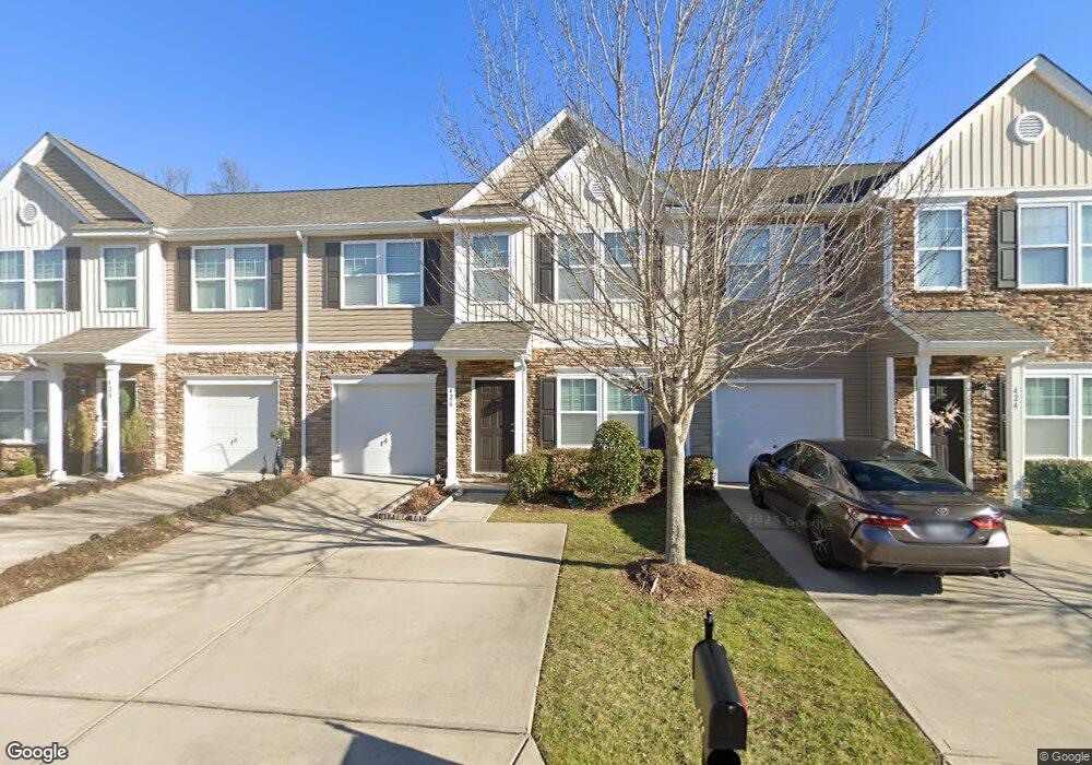
426 Battery Cir Unit 1023C Clover, SC 29710
Estimated Value: $291,000 - $335,714
3
Beds
3
Baths
1,747
Sq Ft
$183/Sq Ft
Est. Value
About This Home
This home is located at 426 Battery Cir Unit 1023C, Clover, SC 29710 and is currently estimated at $319,679, approximately $182 per square foot. 426 Battery Cir Unit 1023C is a home located in York County with nearby schools including Crowders Creek Elementary School, Oakridge Middle School, and Clover High School.
Ownership History
Date
Name
Owned For
Owner Type
Purchase Details
Closed on
May 18, 2015
Sold by
True Homes Llc
Bought by
Laidman Brent M
Current Estimated Value
Home Financials for this Owner
Home Financials are based on the most recent Mortgage that was taken out on this home.
Original Mortgage
$149,823
Outstanding Balance
$115,214
Interest Rate
3.79%
Mortgage Type
New Conventional
Estimated Equity
$204,466
Purchase Details
Closed on
Oct 20, 2014
Sold by
Park Sterling Bank
Bought by
True Homes Llc
Create a Home Valuation Report for This Property
The Home Valuation Report is an in-depth analysis detailing your home's value as well as a comparison with similar homes in the area
Home Values in the Area
Average Home Value in this Area
Purchase History
| Date | Buyer | Sale Price | Title Company |
|---|---|---|---|
| Laidman Brent M | $166,470 | -- | |
| True Homes Llc | $88,000 | -- |
Source: Public Records
Mortgage History
| Date | Status | Borrower | Loan Amount |
|---|---|---|---|
| Open | Laidman Brent M | $149,823 |
Source: Public Records
Tax History Compared to Growth
Tax History
| Year | Tax Paid | Tax Assessment Tax Assessment Total Assessment is a certain percentage of the fair market value that is determined by local assessors to be the total taxable value of land and additions on the property. | Land | Improvement |
|---|---|---|---|---|
| 2025 | $1,137 | $8,306 | $1,344 | $6,962 |
| 2024 | $1,020 | $7,222 | $1,286 | $5,936 |
| 2023 | $1,046 | $7,222 | $1,286 | $5,936 |
| 2022 | $862 | $7,222 | $1,286 | $5,936 |
| 2021 | -- | $7,222 | $1,286 | $5,936 |
| 2020 | $818 | $7,222 | $0 | $0 |
| 2019 | $776 | $6,280 | $0 | $0 |
| 2018 | $779 | $6,280 | $0 | $0 |
| 2017 | $726 | $6,280 | $0 | $0 |
| 2016 | $684 | $6,280 | $0 | $0 |
| 2014 | $87 | $1,860 | $1,860 | $0 |
| 2013 | $87 | $2,040 | $2,040 | $0 |
Source: Public Records
Map
Nearby Homes
- 450 Battery Cir
- 433 Battery Cir
- 431 Battery Cir
- 370 Battery Cir Unit 20
- 00 Hwy
- 304 Inland Cove Ct
- 319 Inland Cove Ct
- 335 Carroll Cove
- 2678 Landing Pointe Dr
- 1715 Curtis Dr
- 1911 Marlin Dr
- 126 Misty Woods Dr
- 447 Leaf Arbor Ct
- 121 Misty Woods Dr
- 5141 Sapp Cir
- 2180 Shady Pond Dr
- 1727 Mineral Springs Rd
- 5165 Sapp Cir
- 341 Windy Pine Dr
- 1437 Harpers Inlet Dr
- 426 Battery Cir
- 426 Battery Cir Unit 83
- 428 Battery Cir Unit 84
- 424 Battery Cir Unit 82
- 430 Battery Cir Unit 1023A
- 430 Battery Cir Unit 85
- 420 Battery Cir
- 420 Battery Cir
- 420 Battery Cir Unit 81
- 420 Battery Cir Unit 1020B
- 418 Battery Cir Unit 22
- 418 Battery Cir Unit 80
- 434 Battery Cir Unit 434
- 434 Battery Cir Unit 86
- 434 Battery Cir
- 416 Battery Cir
- 436 Battery Cir
- 436 Battery Cir
- 425 Battery Cir Unit 425
- 425 Battery Cir Unit 61