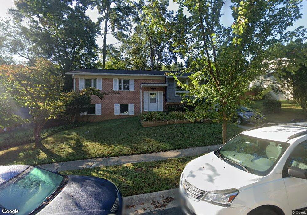
426 Branch Dr Silver Spring, MD 20901
Woodmoor NeighborhoodEstimated Value: $695,503 - $715,000
4
Beds
3
Baths
1,474
Sq Ft
$480/Sq Ft
Est. Value
About This Home
This home is located at 426 Branch Dr, Silver Spring, MD 20901 and is currently estimated at $706,876, approximately $479 per square foot. 426 Branch Dr is a home located in Montgomery County with nearby schools including Montgomery Knolls Elementary School, Pine Crest Elementary School, and Eastern Middle School.
Ownership History
Date
Name
Owned For
Owner Type
Purchase Details
Closed on
May 3, 2014
Sold by
Young Amy C and Allen James M
Bought by
Young Amy C and Allen James M
Current Estimated Value
Purchase Details
Closed on
Jan 16, 2014
Sold by
Young Amy C
Bought by
Young Amy C and Allen James M
Home Financials for this Owner
Home Financials are based on the most recent Mortgage that was taken out on this home.
Original Mortgage
$443,200
Outstanding Balance
$335,616
Interest Rate
4.47%
Mortgage Type
Construction
Estimated Equity
$371,260
Purchase Details
Closed on
Nov 10, 2010
Sold by
Pfanstiehl Margaret W and Pfanstiehl C
Bought by
Young Amy C
Home Financials for this Owner
Home Financials are based on the most recent Mortgage that was taken out on this home.
Original Mortgage
$384,817
Interest Rate
4.35%
Mortgage Type
FHA
Create a Home Valuation Report for This Property
The Home Valuation Report is an in-depth analysis detailing your home's value as well as a comparison with similar homes in the area
Home Values in the Area
Average Home Value in this Area
Purchase History
| Date | Buyer | Sale Price | Title Company |
|---|---|---|---|
| Young Amy C | -- | Eagle Title Llc | |
| Young Amy C | -- | Eagle Title Llc | |
| Young Amy C | $390,000 | -- |
Source: Public Records
Mortgage History
| Date | Status | Borrower | Loan Amount |
|---|---|---|---|
| Open | Young Amy C | $443,200 | |
| Closed | Young Amy C | $384,817 |
Source: Public Records
Tax History
| Year | Tax Paid | Tax Assessment Tax Assessment Total Assessment is a certain percentage of the fair market value that is determined by local assessors to be the total taxable value of land and additions on the property. | Land | Improvement |
|---|---|---|---|---|
| 2025 | $7,747 | $651,000 | $258,400 | $392,600 |
| 2024 | $7,747 | $609,400 | $0 | $0 |
| 2023 | $6,553 | $567,800 | $0 | $0 |
| 2022 | $5,768 | $526,200 | $258,400 | $267,800 |
| 2021 | $5,490 | $518,200 | $0 | $0 |
| 2020 | $5,490 | $510,200 | $0 | $0 |
| 2019 | $5,366 | $502,200 | $258,400 | $243,800 |
| 2018 | $5,320 | $499,933 | $0 | $0 |
| 2017 | $5,384 | $497,667 | $0 | $0 |
| 2016 | $3,879 | $495,400 | $0 | $0 |
| 2015 | $3,879 | $495,400 | $0 | $0 |
| 2014 | $3,879 | $387,167 | $0 | $0 |
Source: Public Records
Map
Nearby Homes
- 413 Williamsburg Dr
- 10018 Brookmoor Dr
- 414 Waterford Rd
- 10611 Meadowhill Rd
- 10304 Ridgemoor Dr
- 10708 Woodsdale Dr
- 10832 Margate Rd
- 224 University Blvd E
- 9801 Arbor Hill Dr
- 11006 Childs St
- 10812 Lombardy Rd
- 9950 Moss Ave
- 413 Southwest Dr
- 405 Southwest Dr
- 315 Ladson Rd
- 414 Kerwin Rd
- 411 Dennis Ave
- 9313 Sudbury Rd
- 603 Perth Place
- 11158 Oak Leaf Dr
- 424 Branch Dr
- 429 Saint Lawrence Dr
- 427 Saint Lawrence Dr
- 428 Branch Dr
- 431 Saint Lawrence Dr
- 422 Branch Dr
- 425 Saint Lawrence Dr
- 425 Branch Dr
- 427 Branch Dr
- 423 Branch Dr
- 433 Saint Lawrence Dr
- 423 Saint Lawrence Dr
- 420 Branch Dr
- 421 Branch Dr
- 429 Branch Dr
- 421 Saint Lawrence Dr
- 422 Saint Lawrence Dr
- 419 Branch Dr
- 418 Branch Dr
- 432 Branch Dr
Your Personal Tour Guide
Ask me questions while you tour the home.