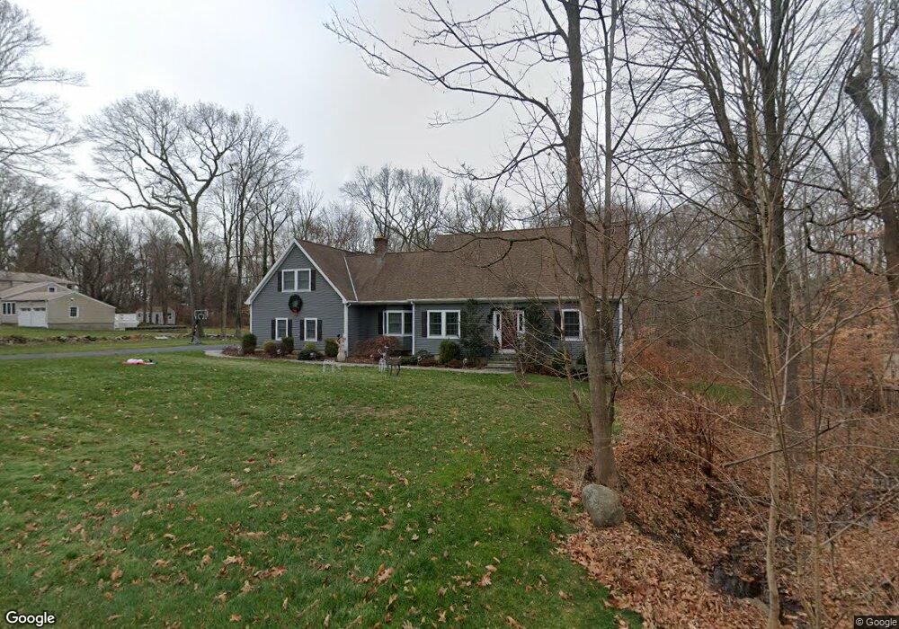
426 Lambert Rd Orange, CT 06477
Estimated Value: $680,000 - $849,000
4
Beds
4
Baths
2,426
Sq Ft
$308/Sq Ft
Est. Value
About This Home
This home is located at 426 Lambert Rd, Orange, CT 06477 and is currently estimated at $747,733, approximately $308 per square foot. 426 Lambert Rd is a home located in New Haven County with nearby schools including Mary L. Tracy School, Peck Place School, and Amity Middle School: Orange.
Ownership History
Date
Name
Owned For
Owner Type
Purchase Details
Closed on
Apr 29, 2011
Sold by
Hansen Brian P and Hansen Eileen F
Bought by
Ballas Paul J and Ballas Mary T
Current Estimated Value
Home Financials for this Owner
Home Financials are based on the most recent Mortgage that was taken out on this home.
Original Mortgage
$400,500
Interest Rate
4.76%
Create a Home Valuation Report for This Property
The Home Valuation Report is an in-depth analysis detailing your home's value as well as a comparison with similar homes in the area
Home Values in the Area
Average Home Value in this Area
Purchase History
| Date | Buyer | Sale Price | Title Company |
|---|---|---|---|
| Ballas Paul J | $445,000 | -- | |
| Ballas Paul J | $445,000 | -- |
Source: Public Records
Mortgage History
| Date | Status | Borrower | Loan Amount |
|---|---|---|---|
| Open | Ballas Paul J | $405,500 | |
| Closed | Ballas Paul J | $400,500 | |
| Previous Owner | Ballas Paul J | $134,100 |
Source: Public Records
Tax History
| Year | Tax Paid | Tax Assessment Tax Assessment Total Assessment is a certain percentage of the fair market value that is determined by local assessors to be the total taxable value of land and additions on the property. | Land | Improvement |
|---|---|---|---|---|
| 2025 | $12,315 | $423,200 | $182,200 | $241,000 |
| 2024 | $13,119 | $423,200 | $182,200 | $241,000 |
| 2023 | $9,422 | $291,600 | $133,000 | $158,600 |
| 2022 | $9,430 | $288,300 | $133,000 | $155,300 |
| 2021 | $9,586 | $288,300 | $133,000 | $155,300 |
| 2020 | $9,439 | $288,300 | $133,000 | $155,300 |
| 2019 | $9,396 | $288,300 | $133,000 | $155,300 |
| 2018 | $9,226 | $288,300 | $133,000 | $155,300 |
| 2017 | $9,162 | $275,300 | $119,700 | $155,600 |
| 2016 | $8,865 | $275,300 | $119,700 | $155,600 |
| 2015 | $8,644 | $275,300 | $119,700 | $155,600 |
| 2014 | $8,397 | $275,300 | $119,700 | $155,600 |
Source: Public Records
Map
Nearby Homes
- 424 Racebrook Rd
- 589 Racebrook Rd
- 148 Kennedy Dr
- 317 Narrow Ln
- 100 Prindle Rd
- 24 Brierwood Dr
- 155 Bull Hill Ln Unit 201
- 157 Bull Hill Ln Unit 102
- 588 Summit Dr
- 129 Cynthia Dr
- 149 Canton St Unit 18
- 120 Canton St
- 53 Pheasant Rd
- 63 Cynthia Dr
- 109 Green Meadow Rd
- 7 Ipswich St
- 84 Eileen Rd
- 11 Marble Ln
- 134 McQuillan Dr
- 489 Derby Milford Rd
- 432 Lambert Rd
- 420 Lambert Rd
- 427 Taulman Rd
- 431 Taulman Rd
- 444 Lambert Rd
- 87 Wellington Dr
- 414 Lambert Rd
- 80 Wellington Dr
- 415 Taulman Rd
- 417 Lambert Rd
- 437 Taulman Rd
- 450 Lambert Rd
- 75 Wellington Dr
- 408 Lambert Rd
- 66 Putting Green Ln
- 411 Lambert Rd
- 409 Taulman Rd
- 72 Wellington Dr
- 469 Taulman Rd
- 449 Taulman Rd
Your Personal Tour Guide
Ask me questions while you tour the home.