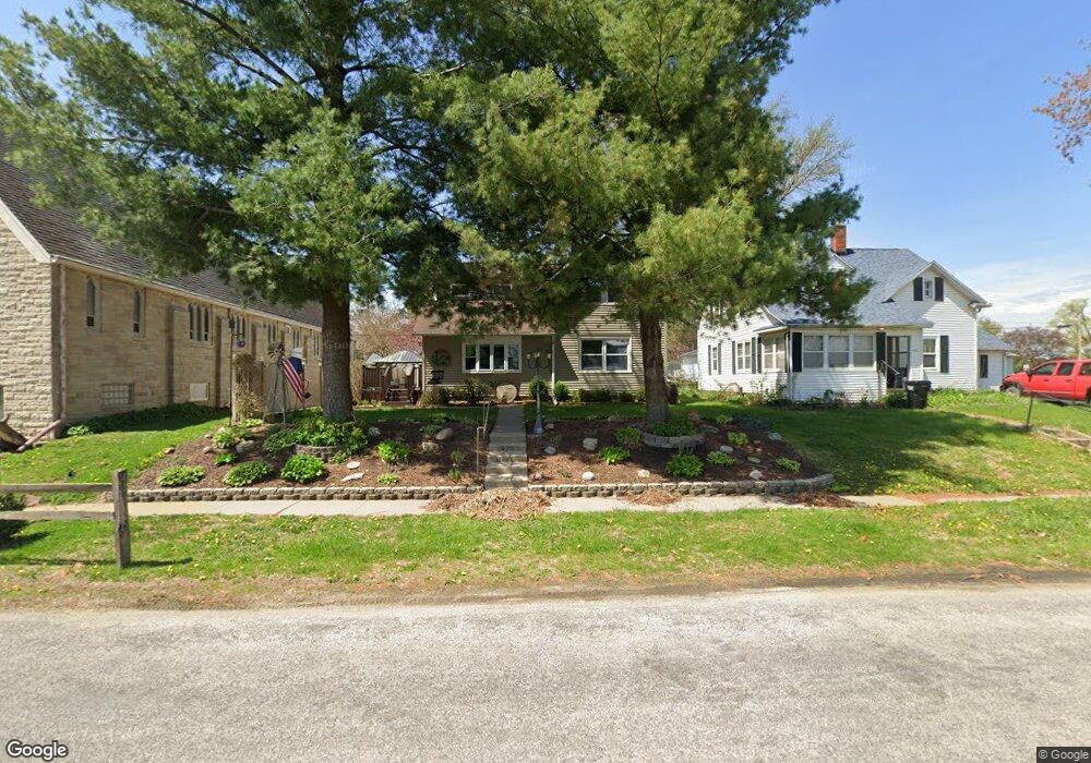
426 Maple St Bennett, IA 52721
Estimated Value: $126,000 - $272,000
3
Beds
1
Bath
1,413
Sq Ft
$121/Sq Ft
Est. Value
About This Home
This home is located at 426 Maple St, Bennett, IA 52721 and is currently estimated at $170,621, approximately $120 per square foot. 426 Maple St is a home located in Cedar County with nearby schools including Bennett Elementary School.
Ownership History
Date
Name
Owned For
Owner Type
Purchase Details
Closed on
Mar 23, 2017
Sold by
Peace Church Of Christ United Ucc
Bought by
Powers Michael A and Powers Vickie S
Current Estimated Value
Purchase Details
Closed on
Nov 4, 2015
Sold by
Powers Michael A and Powers Vickie S
Bought by
Powers Michael A and Powers Vickie S
Create a Home Valuation Report for This Property
The Home Valuation Report is an in-depth analysis detailing your home's value as well as a comparison with similar homes in the area
Purchase History
| Date | Buyer | Sale Price | Title Company |
|---|---|---|---|
| Powers Michael A | -- | None Available | |
| Powers Michael A | -- | None Available |
Source: Public Records
Tax History
| Year | Tax Paid | Tax Assessment Tax Assessment Total Assessment is a certain percentage of the fair market value that is determined by local assessors to be the total taxable value of land and additions on the property. | Land | Improvement |
|---|---|---|---|---|
| 2025 | $1,332 | $117,860 | $10,400 | $107,460 |
| 2024 | $1,332 | $96,790 | $10,400 | $86,390 |
| 2023 | $1,178 | $92,920 | $10,400 | $82,520 |
| 2022 | $1,014 | $70,110 | $9,100 | $61,010 |
| 2021 | $1,044 | $70,110 | $9,100 | $61,010 |
| 2020 | $1,042 | $70,110 | $9,100 | $61,010 |
| 2019 | $974 | $62,340 | $9,100 | $61,010 |
| 2018 | $930 | $61,840 | $0 | $0 |
| 2017 | $930 | $61,820 | $0 | $0 |
| 2016 | $932 | $61,790 | $0 | $0 |
| 2015 | $972 | $61,180 | $0 | $0 |
| 2014 | $972 | $61,180 | $0 | $0 |
Source: Public Records
Map
Nearby Homes
- 235 Main St
- 2248 250th St
- TBD 102nd Ave
- 2239 290th St
- 1614 270th St
- Lot 37 280th St
- Lot 42 280th St
- Lot 38 280th St
- Tbd 102nd Ave
- Lot 14 Linda Ln
- Lot 13 Linda Ln
- 475 Rhonda Rd
- 445 Rhonda Rd
- 455 Rhonda Rd
- Lot 29 Rhonda Rd
- Lot 35 Rhonda Rd
- Lot 36 Rhonda Rd
- 829 Union Ave
- 0 200th St Unit NOC6335338
- 1748 190th St
Your Personal Tour Guide
Ask me questions while you tour the home.