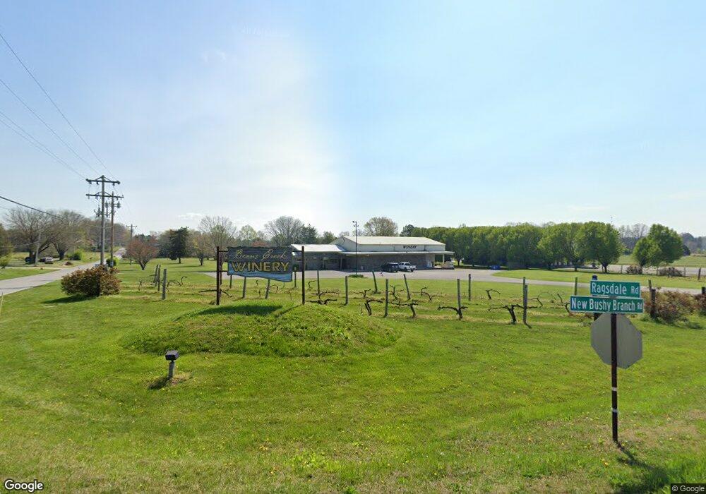
426 Ragsdale Rd Manchester, TN 37355
Estimated Value: $345,000 - $522,830
--
Bed
4
Baths
6,798
Sq Ft
$68/Sq Ft
Est. Value
About This Home
This home is located at 426 Ragsdale Rd, Manchester, TN 37355 and is currently estimated at $459,610, approximately $67 per square foot. 426 Ragsdale Rd is a home located in Coffee County with nearby schools including Westwood Middle School and Temple Baptist Christian School.
Ownership History
Date
Name
Owned For
Owner Type
Purchase Details
Closed on
Apr 19, 2004
Sold by
Brown Thomas B
Bought by
Beans Creek Winery Llc
Current Estimated Value
Purchase Details
Closed on
Mar 12, 2003
Sold by
Mckee James D and Mckee Tammy R
Bought by
Brown Thomas B and Brown Rebecca J
Home Financials for this Owner
Home Financials are based on the most recent Mortgage that was taken out on this home.
Original Mortgage
$96,000
Interest Rate
5.82%
Purchase Details
Closed on
Jul 25, 1997
Sold by
Price Leonard S
Bought by
Mckee Derek and Mckee Tammy
Purchase Details
Closed on
Sep 16, 1987
Bought by
Price Leonard S
Create a Home Valuation Report for This Property
The Home Valuation Report is an in-depth analysis detailing your home's value as well as a comparison with similar homes in the area
Home Values in the Area
Average Home Value in this Area
Purchase History
| Date | Buyer | Sale Price | Title Company |
|---|---|---|---|
| Beans Creek Winery Llc | $153,000 | -- | |
| Brown Thomas B | $112,900 | -- | |
| Mckee Derek | $75,000 | -- | |
| Price Leonard S | $2,000 | -- |
Source: Public Records
Mortgage History
| Date | Status | Borrower | Loan Amount |
|---|---|---|---|
| Previous Owner | Price Leonard S | $96,000 |
Source: Public Records
Tax History Compared to Growth
Tax History
| Year | Tax Paid | Tax Assessment Tax Assessment Total Assessment is a certain percentage of the fair market value that is determined by local assessors to be the total taxable value of land and additions on the property. | Land | Improvement |
|---|---|---|---|---|
| 2024 | $7,488 | $177,640 | $30,040 | $147,600 |
| 2023 | $7,488 | $177,640 | $0 | $0 |
| 2022 | $6,448 | $177,640 | $30,040 | $147,600 |
| 2021 | $6,532 | $142,640 | $25,680 | $116,960 |
| 2020 | $6,532 | $142,640 | $25,680 | $116,960 |
| 2019 | $6,532 | $142,640 | $25,680 | $116,960 |
| 2018 | $6,532 | $142,640 | $25,680 | $116,960 |
| 2017 | $6,888 | $131,320 | $17,120 | $114,200 |
| 2016 | $6,888 | $131,320 | $17,120 | $114,200 |
| 2015 | $6,888 | $131,320 | $17,120 | $114,200 |
| 2014 | $6,888 | $131,311 | $0 | $0 |
Source: Public Records
Map
Nearby Homes
- 627 Ragsdale Rd
- 775 Ragsdale Rd
- 1292 McMinnville Hwy
- 793 Old Bushy Branch Rd
- 416 Powers Rd
- 215 Wellington Dr
- 54 Stonehenge Ln E
- 31 Stonehenge Ln S
- 1989 Elevation JKL Plan at Stonehenge
- 1726 Elevation JKL Plan at Stonehenge
- 1824 Elevation JKL Plan at Stonehenge
- 1258 Stonehenge Plan at Stonehenge
- 2073 Elevation JKL Plan at Stonehenge
- 1624 Elevation JKL Plan at Stonehenge
- Henry Plan at Stonehenge
- 1315 Elevation JKL Plan at Stonehenge
- 1489 Elevation JKL Plan at Stonehenge
- 2151 Elevation JKL Plan at Stonehenge
- 1567 Elevation JKL Plan at Stonehenge
- 1220 - Stonehenge Plan at Stonehenge
- 460 Ragsdale Rd
- 71 New Bushy Branch Rd
- 96 Dove Hollow Ln
- 455 Ragsdale Rd
- 159 New Bushy Branch Rd
- 160 Dove Hollow Ln
- 263 Ragsdale Rd
- 524 Ragsdale Rd
- 110 Lavergne St
- 593 Ragsdale Rd
- 88 Lavergne St
- 74 Lavergne St
- 618 Ragsdale Rd
- 109 Lavergne St
- 58 Lavergne St
- 89 Lavergne St
- 42 Lavergne St
- 73 Lavergne St
- 28 Lavergne St
- 120 Veneer St