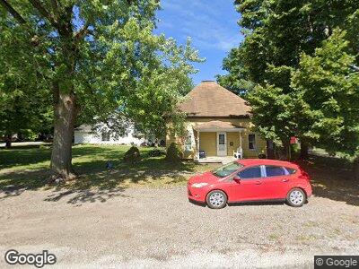
426 S Macon St Moweaqua, IL 62550
Estimated Value: $75,596 - $92,000
3
Beds
1
Bath
810
Sq Ft
$102/Sq Ft
Est. Value
About This Home
This home is located at 426 S Macon St, Moweaqua, IL 62550 and is currently estimated at $82,399, approximately $101 per square foot. 426 S Macon St is a home located in Shelby County with nearby schools including Central A&M High School.
Ownership History
Date
Name
Owned For
Owner Type
Purchase Details
Closed on
May 22, 2015
Sold by
Falk Stoney G
Bought by
Ater Justin R
Current Estimated Value
Home Financials for this Owner
Home Financials are based on the most recent Mortgage that was taken out on this home.
Original Mortgage
$56,163
Outstanding Balance
$44,408
Interest Rate
3.62%
Mortgage Type
New Conventional
Estimated Equity
$35,516
Create a Home Valuation Report for This Property
The Home Valuation Report is an in-depth analysis detailing your home's value as well as a comparison with similar homes in the area
Home Values in the Area
Average Home Value in this Area
Purchase History
| Date | Buyer | Sale Price | Title Company |
|---|---|---|---|
| Ater Justin R | $60,000 | Shelbyville Abs & Title |
Source: Public Records
Mortgage History
| Date | Status | Borrower | Loan Amount |
|---|---|---|---|
| Open | Ater Justin R | $56,163 |
Source: Public Records
Tax History Compared to Growth
Tax History
| Year | Tax Paid | Tax Assessment Tax Assessment Total Assessment is a certain percentage of the fair market value that is determined by local assessors to be the total taxable value of land and additions on the property. | Land | Improvement |
|---|---|---|---|---|
| 2023 | $1,102 | $19,326 | $6,602 | $12,724 |
| 2022 | $961 | $17,604 | $6,014 | $11,590 |
| 2021 | $898 | $16,796 | $5,738 | $11,058 |
| 2020 | $922 | $16,796 | $5,738 | $11,058 |
| 2019 | $922 | $16,796 | $5,738 | $11,058 |
| 2018 | $858 | $15,598 | $5,329 | $10,269 |
| 2017 | $815 | $15,598 | $5,329 | $10,269 |
| 2016 | $815 | $15,598 | $5,329 | $10,269 |
| 2015 | -- | $15,598 | $5,329 | $10,269 |
| 2014 | -- | $15,598 | $5,329 | $10,269 |
| 2013 | -- | $15,598 | $5,329 | $10,269 |
Source: Public Records
Map
Nearby Homes
- 0 E Wall St
- 413 E Wall St
- 241 W Main St
- 229 W Madison St
- 317 W Madison St
- 0 E Main St
- 7 Sunnyside Estate
- 1776 N 2525 Rd E
- 101 Cardinal Dr
- 290 W Cole St
- 150 W Bell St
- 206 W Andrews St
- 499 N Miller St
- 150 W Ruby St
- 305 N Poplar St
- 407 W Leafland
- 206 W North St
- 205 N Poplar St
- 208 N Saint John St
- 110 N Poplar St