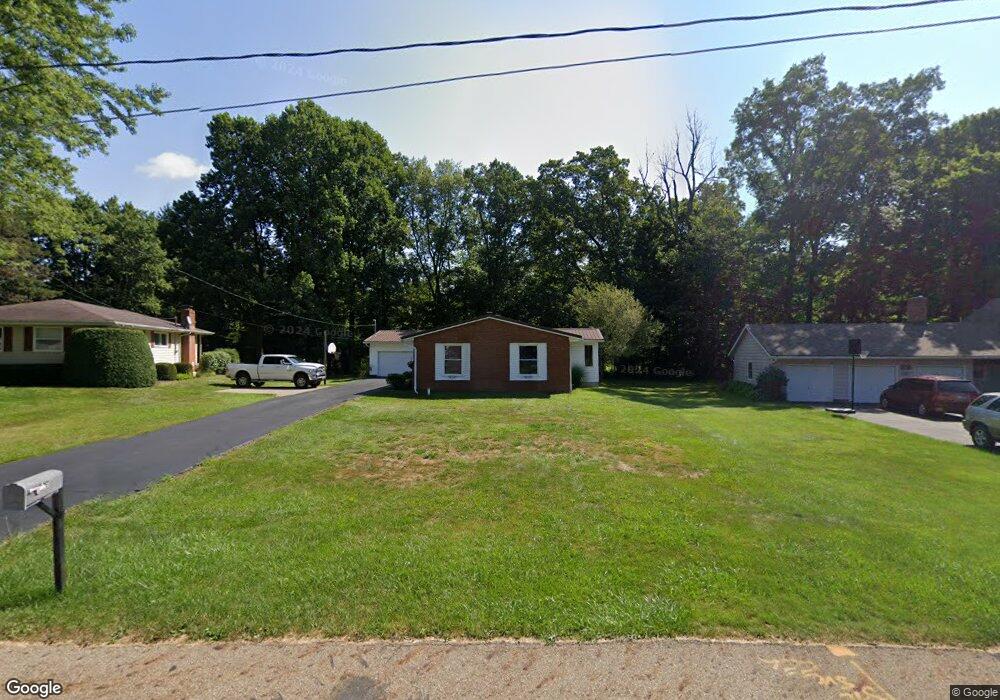
426 Walfield Dr Mansfield, OH 44904
Estimated Value: $244,464 - $275,000
4
Beds
2
Baths
1,792
Sq Ft
$146/Sq Ft
Est. Value
About This Home
This home is located at 426 Walfield Dr, Mansfield, OH 44904 and is currently estimated at $261,866, approximately $146 per square foot. 426 Walfield Dr is a home located in Richland County with nearby schools including Lexington High School, Mansfield Christian School, and Mansfield Seventh-day Adventist School.
Ownership History
Date
Name
Owned For
Owner Type
Purchase Details
Closed on
May 18, 2012
Sold by
Reichelderfer John
Bought by
Reichelderfer Sally
Current Estimated Value
Purchase Details
Closed on
Oct 22, 1996
Sold by
Fisher Terri D
Bought by
Reichelderfer John M and Reichelderfer Sally M
Home Financials for this Owner
Home Financials are based on the most recent Mortgage that was taken out on this home.
Original Mortgage
$80,400
Interest Rate
8.44%
Mortgage Type
Balloon
Purchase Details
Closed on
Jan 1, 1985
Create a Home Valuation Report for This Property
The Home Valuation Report is an in-depth analysis detailing your home's value as well as a comparison with similar homes in the area
Home Values in the Area
Average Home Value in this Area
Purchase History
| Date | Buyer | Sale Price | Title Company |
|---|---|---|---|
| Reichelderfer Sally | -- | Attorney | |
| Reichelderfer John M | $100,500 | -- | |
| -- | $36,000 | -- |
Source: Public Records
Mortgage History
| Date | Status | Borrower | Loan Amount |
|---|---|---|---|
| Closed | Reichelderfer John M | $80,400 |
Source: Public Records
Tax History
| Year | Tax Paid | Tax Assessment Tax Assessment Total Assessment is a certain percentage of the fair market value that is determined by local assessors to be the total taxable value of land and additions on the property. | Land | Improvement |
|---|---|---|---|---|
| 2025 | $3,370 | $64,940 | $7,150 | $57,790 |
| 2024 | $3,370 | $64,940 | $7,150 | $57,790 |
| 2023 | $1,845 | $64,940 | $7,150 | $57,790 |
| 2022 | $3,084 | $48,980 | $6,140 | $42,840 |
| 2021 | $3,128 | $48,980 | $6,140 | $42,840 |
| 2020 | $2,968 | $48,980 | $6,140 | $42,840 |
| 2019 | $2,713 | $41,060 | $5,150 | $35,910 |
| 2018 | $2,335 | $41,060 | $5,150 | $35,910 |
| 2017 | $1,384 | $41,060 | $5,150 | $35,910 |
| 2016 | $2,098 | $36,360 | $4,380 | $31,980 |
| 2015 | $1,104 | $36,360 | $4,380 | $31,980 |
| 2014 | $2,024 | $36,360 | $4,380 | $31,980 |
| 2012 | $986 | $37,490 | $4,520 | $32,970 |
Source: Public Records
Map
Nearby Homes
- 633 Princeton Ct
- 1938 Richwood Dr
- 515 W Hanley Rd
- 615 Bailey Dr
- 635 Karlson Dr
- 2226 Camden Ct
- 1759 Rocky Rill Ct
- 1702 Middle Bellville Rd
- 763 York St W
- 0 Rippling Brook Dr
- 213 Brushwood Dr
- 872 Red Oak Trail Unit 3
- 893 Greenfield Dr
- 1599 S Main St
- 0 Lot #23132 Hess Cir
- 0 Lot #23127 Hess Cir
- 0 Lot #23139 Hess Cir
- 0 Lot #23121 Hess Cir
- 0 Lot #23133 Hess Cir
- 50 Lilac Ct E
- 432 Walfield Dr
- 420 Walfield Dr
- 438 Walfield Dr
- 441 Walfield Dr
- 2045 Random Dr
- 450 Walfield Dr
- 2044 Random Dr
- 421 Marwood Dr
- 457 Walfield Dr
- 460 Walfield Dr
- 441 Marwood Dr
- 2050 Ranchwood Dr
- 2055 Random St
- 431 Marwood Dr
- 2056 Random Dr
- 451 Marwood Dr
- 467 Walfield Dr
- 1964 Ranchwood Dr
- 568 Orchard Dr E
- 2003 Farmbrook Dr Unit 2205
Your Personal Tour Guide
Ask me questions while you tour the home.