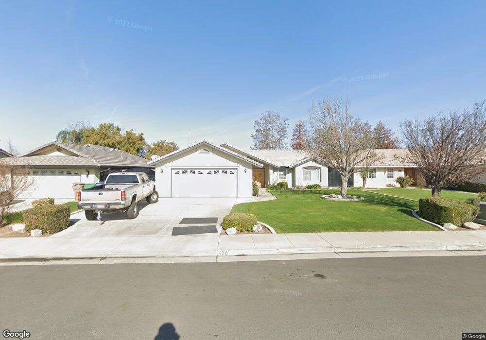
426 Windy Gap Ct Bakersfield, CA 93308
North Country Meadows NeighborhoodEstimated Value: $348,397 - $374,000
3
Beds
2
Baths
1,457
Sq Ft
$245/Sq Ft
Est. Value
About This Home
This home is located at 426 Windy Gap Ct, Bakersfield, CA 93308 and is currently estimated at $357,349, approximately $245 per square foot. 426 Windy Gap Ct is a home located in Kern County with nearby schools including Wingland Elementary School, Standard Middle School, and North High School.
Ownership History
Date
Name
Owned For
Owner Type
Purchase Details
Closed on
Jan 22, 2001
Sold by
Wattenbarger Donald G and Wattenbarger Connie R
Bought by
Qualle Robert L and Qualle Dorothy A
Current Estimated Value
Home Financials for this Owner
Home Financials are based on the most recent Mortgage that was taken out on this home.
Original Mortgage
$118,223
Outstanding Balance
$41,846
Interest Rate
6.98%
Estimated Equity
$315,503
Create a Home Valuation Report for This Property
The Home Valuation Report is an in-depth analysis detailing your home's value as well as a comparison with similar homes in the area
Home Values in the Area
Average Home Value in this Area
Purchase History
| Date | Buyer | Sale Price | Title Company |
|---|---|---|---|
| Qualle Robert L | $124,500 | Commonwealth Land Title Co |
Source: Public Records
Mortgage History
| Date | Status | Borrower | Loan Amount |
|---|---|---|---|
| Open | Qualle Robert L | $118,223 |
Source: Public Records
Tax History
| Year | Tax Paid | Tax Assessment Tax Assessment Total Assessment is a certain percentage of the fair market value that is determined by local assessors to be the total taxable value of land and additions on the property. | Land | Improvement |
|---|---|---|---|---|
| 2025 | $3,272 | $182,299 | $37,654 | $144,645 |
| 2024 | $3,164 | $178,725 | $36,916 | $141,809 |
| 2023 | $3,164 | $175,222 | $36,193 | $139,029 |
| 2022 | $3,068 | $171,787 | $35,484 | $136,303 |
| 2021 | $2,964 | $168,420 | $34,789 | $133,631 |
| 2020 | $2,862 | $166,694 | $34,433 | $132,261 |
| 2019 | $2,823 | $166,694 | $34,433 | $132,261 |
| 2018 | $2,724 | $160,223 | $33,097 | $127,126 |
| 2017 | $2,707 | $157,083 | $32,449 | $124,634 |
| 2016 | $2,474 | $154,004 | $31,813 | $122,191 |
| 2015 | $2,435 | $151,692 | $31,336 | $120,356 |
| 2014 | $2,383 | $148,722 | $30,723 | $117,999 |
Source: Public Records
Map
Nearby Homes
- 437 Rian Noelle Ct
- 423 Rian Noelle Ct
- 328 Deep Creek Dr
- 444 Rian Noelle Ct
- 329 W Pilot Ave
- 325 W Pilot Ave
- 3330 Floral Meadow Dr
- 327 Fern Meadow Dr
- 283 Bighorn Meadow Dr
- 608 Orchid Dr
- 624 W Day Ave
- 540 Shady Meadow Ct
- 202 Sunny Meadow Dr
- 243 Deep Creek Dr
- 3727 Park Mountain Dr
- 238 Tanner Michael Dr
- 514 Blue Meadow Ct
- 3724 Rock Meadow Ct
- 124 W Pilot Ave
- 803 Greenwood Meadow Ln
- 430 Windy Gap Ct
- 422 Windy Gap Ct
- 434 Windy Gap Ct
- 418 Windy Gap Ct
- 438 Windy Gap Ct
- 427 Windy Gap Ct
- 414 Windy Gap Ct
- 431 Windy Gap Ct
- 423 Windy Gap Ct
- 435 Windy Gap Ct
- 419 Windy Gap Ct
- 439 Windy Gap Ct
- 410 Windy Gap Ct
- 415 Windy Gap Ct
- 0 W Day Ave
- 428 Dry Meadow Ln
- 432 Dry Meadow Ln
- 424 Dry Meadow Ln
- 411 Windy Gap Ct
- 436 Dry Meadow Ln
Your Personal Tour Guide
Ask me questions while you tour the home.