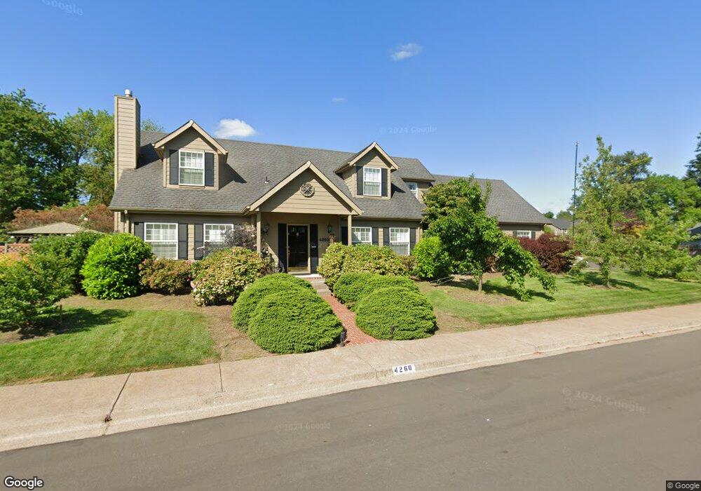
4260 Silverado Trail Eugene, OR 97404
Santa Clara NeighborhoodEstimated Value: $499,000 - $557,788
3
Beds
4
Baths
2,662
Sq Ft
$197/Sq Ft
Est. Value
About This Home
This home is located at 4260 Silverado Trail, Eugene, OR 97404 and is currently estimated at $524,447, approximately $197 per square foot. 4260 Silverado Trail is a home located in Lane County with nearby schools including Awbrey Park Elementary School, Madison Middle School, and North Eugene High School.
Ownership History
Date
Name
Owned For
Owner Type
Purchase Details
Closed on
Jul 8, 2016
Sold by
Moore Lester E and Moore Lynda S
Bought by
Benafel Eric J and Benafel Jacqueline
Current Estimated Value
Home Financials for this Owner
Home Financials are based on the most recent Mortgage that was taken out on this home.
Original Mortgage
$418,250
Outstanding Balance
$332,739
Interest Rate
3.64%
Mortgage Type
VA
Estimated Equity
$191,708
Purchase Details
Closed on
Sep 9, 2014
Sold by
Moore Lester E and Moore Lynda S
Bought by
Letser E & Lynda S Moore Family Trust
Purchase Details
Closed on
Oct 17, 2006
Sold by
Luby H Daniel and Luby Donna Lisbeth
Bought by
Moore Les E and Moore Lynda S
Home Financials for this Owner
Home Financials are based on the most recent Mortgage that was taken out on this home.
Original Mortgage
$344,800
Interest Rate
6.39%
Mortgage Type
Purchase Money Mortgage
Create a Home Valuation Report for This Property
The Home Valuation Report is an in-depth analysis detailing your home's value as well as a comparison with similar homes in the area
Home Values in the Area
Average Home Value in this Area
Purchase History
| Date | Buyer | Sale Price | Title Company |
|---|---|---|---|
| Benafel Eric J | $419,000 | Fidelity Natl Title Co Of Or | |
| Letser E & Lynda S Moore Family Trust | -- | None Available | |
| Moore Les E | $431,000 | Fidelity National Title Insu |
Source: Public Records
Mortgage History
| Date | Status | Borrower | Loan Amount |
|---|---|---|---|
| Open | Benafel Eric J | $418,250 | |
| Previous Owner | Moore Les E | $344,800 |
Source: Public Records
Tax History
| Year | Tax Paid | Tax Assessment Tax Assessment Total Assessment is a certain percentage of the fair market value that is determined by local assessors to be the total taxable value of land and additions on the property. | Land | Improvement |
|---|---|---|---|---|
| 2025 | $6,716 | $344,682 | -- | -- |
| 2024 | $6,632 | $334,643 | -- | -- |
| 2023 | $6,632 | $324,897 | $0 | $0 |
| 2022 | $6,213 | $315,434 | $0 | $0 |
| 2021 | $5,724 | $306,247 | $0 | $0 |
| 2020 | $5,589 | $297,328 | $0 | $0 |
| 2019 | $5,348 | $288,668 | $0 | $0 |
| 2018 | $4,987 | $272,098 | $0 | $0 |
| 2017 | $4,658 | $272,098 | $0 | $0 |
| 2016 | $4,493 | $264,173 | $0 | $0 |
| 2015 | $4,317 | $256,479 | $0 | $0 |
| 2014 | $4,228 | $249,009 | $0 | $0 |
Source: Public Records
Map
Nearby Homes
- 4278 Torrington Ave
- 212 Chimney Rock Ln
- 4490 Doyle St
- 420 Lynnbrook Dr
- 3985 Shenstone Dr
- 579 Sweetwater Ln
- 709 Tyson Ln
- 591 Argon Ave
- 47 van Fossen Ct
- 1133 Irvington Dr
- 4366 Berry Ln
- 110 Calumet Ave
- 90 Daniel Dr
- 4471 Spring Meadow Ave
- 4483 Thunderbird St
- 4795 Thunderbird St
- 329 Dean Ave
- 374 Blackfoot Ave
- 355 River Loop 2
- 3365 Goose Cross Ln
- 234 Beringer Ct
- 4244 Silverado Trail
- 4271 Silverado Trail
- 240 Beringer Ct
- 4261 Silverado Trail
- 4236 Silverado Trail
- 217 Beringer Ct
- 212 Beringer Ct
- 4253 Silverado Trail
- 245 Beringer Ct
- 4230 Silverado Trail
- 266 Beringer Ct
- 209 Beringer Ct
- 247 Stags Leap Ct
- 229 Beringer Ct
- 4222 Silverado Trail
- 237 Beringer Ct
- 4239 Silverado Trail
- 208 Beringer Ct
- 277 Beringer Ct
Your Personal Tour Guide
Ask me questions while you tour the home.