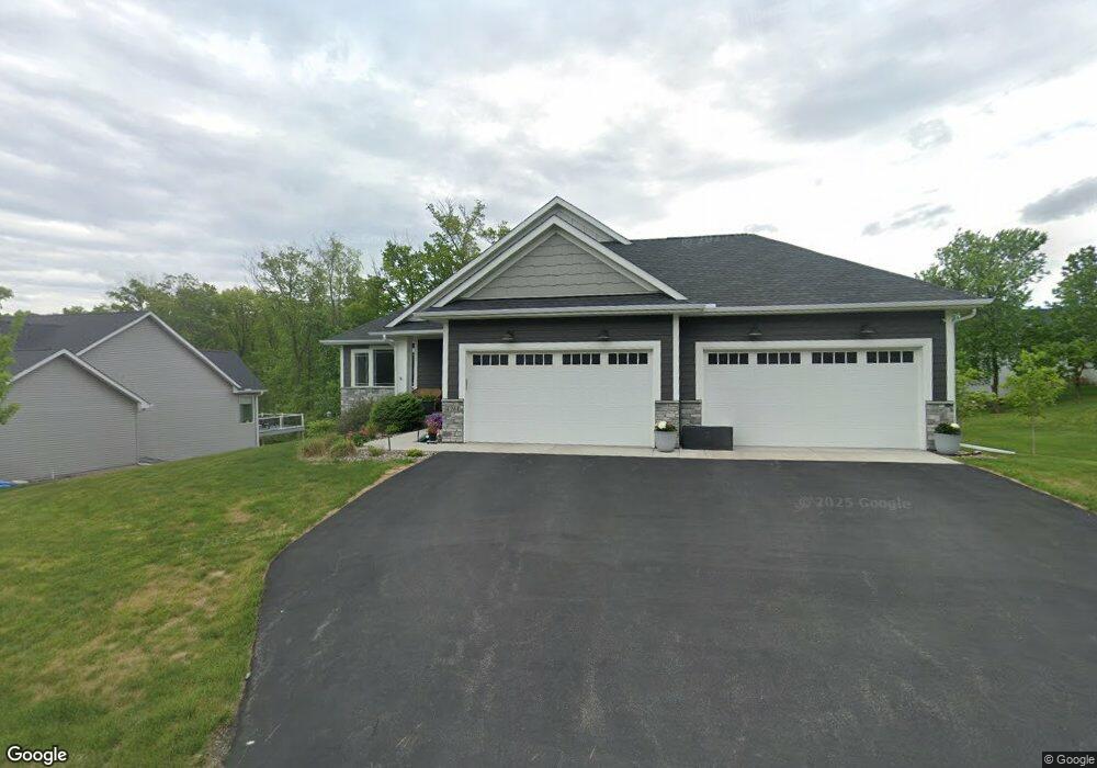
4261 Maple Hurst Dr N Rockford, MN 55373
Estimated Value: $492,000 - $593,000
3
Beds
2
Baths
1,596
Sq Ft
$344/Sq Ft
Est. Value
About This Home
This home is located at 4261 Maple Hurst Dr N, Rockford, MN 55373 and is currently estimated at $548,450, approximately $343 per square foot. 4261 Maple Hurst Dr N is a home located in Wright County with nearby schools including Rockford Elementary Arts Magnet School, Rockford Middle School - Center for Environmental Studies, and Rockford High School.
Ownership History
Date
Name
Owned For
Owner Type
Purchase Details
Closed on
Jul 10, 2020
Sold by
Adam Price Inc
Bought by
Phillips Michelle L
Current Estimated Value
Home Financials for this Owner
Home Financials are based on the most recent Mortgage that was taken out on this home.
Original Mortgage
$322,700
Outstanding Balance
$286,149
Interest Rate
3.1%
Mortgage Type
New Conventional
Estimated Equity
$262,301
Purchase Details
Closed on
Sep 30, 2019
Sold by
Laketown Builders Llc
Bought by
Adam Price Inc
Home Financials for this Owner
Home Financials are based on the most recent Mortgage that was taken out on this home.
Original Mortgage
$175,000
Interest Rate
3.6%
Mortgage Type
Construction
Create a Home Valuation Report for This Property
The Home Valuation Report is an in-depth analysis detailing your home's value as well as a comparison with similar homes in the area
Home Values in the Area
Average Home Value in this Area
Purchase History
| Date | Buyer | Sale Price | Title Company |
|---|---|---|---|
| Phillips Michelle L | $403,400 | Legacy Title | |
| Adam Price Inc | $75,900 | Title Mark Llc |
Source: Public Records
Mortgage History
| Date | Status | Borrower | Loan Amount |
|---|---|---|---|
| Open | Phillips Michelle L | $322,700 | |
| Previous Owner | Adam Price Inc | $175,000 |
Source: Public Records
Tax History Compared to Growth
Tax History
| Year | Tax Paid | Tax Assessment Tax Assessment Total Assessment is a certain percentage of the fair market value that is determined by local assessors to be the total taxable value of land and additions on the property. | Land | Improvement |
|---|---|---|---|---|
| 2025 | $5,686 | $509,300 | $90,000 | $419,300 |
| 2024 | $5,280 | $490,000 | $90,000 | $400,000 |
| 2023 | $5,324 | $468,000 | $90,000 | $378,000 |
| 2022 | $5,148 | $421,100 | $85,000 | $336,100 |
| 2021 | $2,848 | $364,800 | $70,000 | $294,800 |
| 2020 | $366 | $211,000 | $70,000 | $141,000 |
| 2019 | $240 | $55,000 | $0 | $0 |
| 2018 | $96 | $55,000 | $0 | $0 |
Source: Public Records
Map
Nearby Homes
- 4231 Maple Hurst Dr N
- 4040 Maple Hurst Dr S
- XXX Jansen Ave SE
- 4090 Maple Hurst Dr S
- 7021 Meadow Ct
- 8130 Ravenrock Rd
- 6761 Maple Dr
- 8041 Prairie Trail
- 6630 Maple Dr
- 8530 Fir St
- 3439 Hall Ave SE
- 8098 26th St SE
- 7040 Winfield Rd
- 8800 86th Ave N
- 6101 Boulder Ridge Dr
- 8833 Walnut Place
- XX Hamlin Ave SE
- 2169 Ibson Ave SE
- 8907 Foust Ln
- 5311 Greenwood Ln
- 4261 Maple Hurst Dr N
- 6020 Little Creek Ln
- XXX Little Creek Ln
- 2003 Little Creek Cir
- 6018 Little Creek Ln
- 4241 Maple Hurst Dr N
- 4241 4241 Maple Hurst-Drive-n
- 4241 4241 Maple Hurst Dr N
- 6022 Little Creek Ln
- 2005 Little Creek Cir
- 4260 Maple Hurst Dr N
- 4250 Maple Hurst Dr N
- 4231 4231 Maple Hurst-Drive-n
- 6024 Little Creek Ln
- 4240 Maple Hurst Dr N
- 4240 4240 Maple Hurst Dr N
- 2007 Little Creek Cir
- 6019 Little Creek Ln
- 2000 Little Creek Cir
- 3002 Red Maple Ct