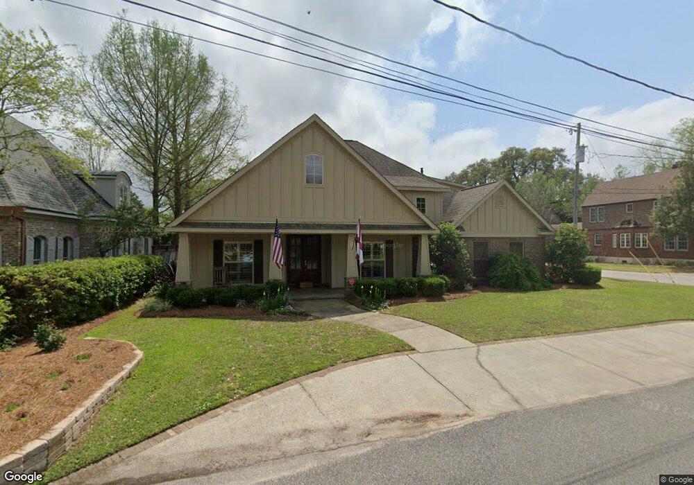
4261 the Cedars Ave Mobile, AL 36608
College Park NeighborhoodEstimated Value: $681,000 - $758,000
Studio
--
Bath
3,493
Sq Ft
$206/Sq Ft
Est. Value
About This Home
This home is located at 4261 the Cedars Ave, Mobile, AL 36608 and is currently estimated at $720,565, approximately $206 per square foot. 4261 the Cedars Ave is a home located in Mobile County with nearby schools including Mary B. Austin Elementary School, CL Scarborough Middle School, and Murphy High School.
Ownership History
Date
Name
Owned For
Owner Type
Purchase Details
Closed on
Jun 20, 2011
Sold by
Bay Bank
Bought by
Graves Eric D and Graves Pamela J
Current Estimated Value
Purchase Details
Closed on
Oct 1, 2010
Sold by
Kopf Investments Llc
Bought by
Bay Bank
Purchase Details
Closed on
Jun 6, 2008
Sold by
Grant Douglas H and Grant Gina S
Bought by
Kopf Investments Llc
Purchase Details
Closed on
Aug 16, 2000
Sold by
N S & G M Llc
Bought by
Grant Douglas H and Grant Gina S
Purchase Details
Closed on
Nov 20, 1998
Sold by
Joseph Burch
Bought by
N S & G M Llc
Create a Home Valuation Report for This Property
The Home Valuation Report is an in-depth analysis detailing your home's value as well as a comparison with similar homes in the area
Home Values in the Area
Average Home Value in this Area
Purchase History
| Date | Buyer | Sale Price | Title Company |
|---|---|---|---|
| Graves Eric D | $174,500 | Gtc | |
| Bay Bank | $176,000 | None Available | |
| Kopf Investments Llc | -- | Abb | |
| Grant Douglas H | -- | -- | |
| N S & G M Llc | -- | -- |
Source: Public Records
Tax History
| Year | Tax Paid | Tax Assessment Tax Assessment Total Assessment is a certain percentage of the fair market value that is determined by local assessors to be the total taxable value of land and additions on the property. | Land | Improvement |
|---|---|---|---|---|
| 2025 | $3,349 | $53,640 | $14,000 | $39,640 |
| 2024 | $3,349 | $50,450 | $14,000 | $36,450 |
| 2023 | $3,147 | $48,460 | $14,000 | $34,460 |
| 2022 | $2,834 | $45,680 | $14,000 | $31,680 |
| 2021 | $2,697 | $43,510 | $13,490 | $30,020 |
| 2020 | $2,677 | $43,200 | $12,850 | $30,350 |
| 2019 | $2,543 | $41,100 | $0 | $0 |
| 2018 | $2,562 | $41,400 | $0 | $0 |
| 2017 | $3,112 | $50,060 | $0 | $0 |
| 2016 | $3,131 | $50,360 | $0 | $0 |
| 2013 | -- | $97,200 | $0 | $0 |
Source: Public Records
Map
Nearby Homes
- 259 Dilston Ln
- 7230 Old Shell Rd
- 4009 Old Shell Rd Unit E12
- 4009 Old Shell Rd Unit C 14
- 4009 Old Shell Rd Unit C19
- 8 Lancaster Rd
- 13 Princess Anne Rd
- 3615 Stein St
- 21 Provident Ln
- 3816 Austill Ln
- 506 Mann Dr
- 0 Austill Place Unit 7729521
- 0 Austill Place Unit 7729248
- 0 Austill Place Unit 3
- 0 Austill Place Unit 7729645
- 0 Austill Place Unit 6
- 0 Austill Place Unit 7729259
- 0 Austill Place Unit 2
- 0 Austill Place Unit 7729531
- 0 Austill Place Unit 5
- 4253 the Cedars Ave
- 4251 the Cedars Ave
- 204 Dilston Ln
- 4301 the Cedars Ave
- 4254 the Cedars Ave
- 4232 the Cedars Ave
- 4300 the Cedars Ave
- 4254 Stein St
- 4303 the Cedars Ave
- 3763 the Cedars Ave
- 4302 the Cedars Ave
- 4250 Stein St
- 201 Dilston Ln
- 4068 Stein St
- 4304 the Cedars Ave
- 4302 Stein St
- 4305 the Cedars Ave
- 4064 Stein St
- 4306 the Cedars Ave
- 4304 Stein St
Your Personal Tour Guide
Ask me questions while you tour the home.