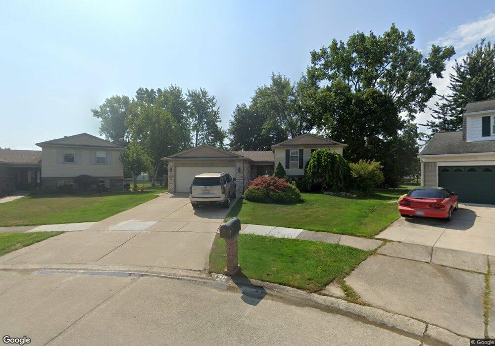
42615 Collingham Ct Canton, MI 48187
Estimated Value: $367,346 - $392,000
Studio
2
Baths
1,884
Sq Ft
$202/Sq Ft
Est. Value
About This Home
This home is located at 42615 Collingham Ct, Canton, MI 48187 and is currently estimated at $380,337, approximately $201 per square foot. 42615 Collingham Ct is a home located in Wayne County with nearby schools including Canton High School, Discovery Middle School, and Salem High School.
Ownership History
Date
Name
Owned For
Owner Type
Purchase Details
Closed on
Mar 24, 2023
Sold by
Glover Jacob A
Bought by
Glover Faron Alexis and Glover Ashton Elizabeth
Current Estimated Value
Purchase Details
Closed on
Jun 22, 2021
Sold by
Glover Jacob A
Bought by
Glover Jacob A
Purchase Details
Closed on
Jun 17, 2002
Sold by
Moore Mary E
Bought by
Glover Cynthia A
Purchase Details
Closed on
Mar 13, 1995
Sold by
Stafford Gary B
Bought by
Moore Roger E
Create a Home Valuation Report for This Property
The Home Valuation Report is an in-depth analysis detailing your home's value as well as a comparison with similar homes in the area
Home Values in the Area
Average Home Value in this Area
Purchase History
| Date | Buyer | Sale Price | Title Company |
|---|---|---|---|
| Glover Faron Alexis | -- | None Listed On Document | |
| Glover Jacob A | -- | None Available | |
| Glover Cynthia A | $211,000 | -- | |
| Moore Roger E | $138,000 | -- |
Source: Public Records
Tax History Compared to Growth
Tax History
| Year | Tax Paid | Tax Assessment Tax Assessment Total Assessment is a certain percentage of the fair market value that is determined by local assessors to be the total taxable value of land and additions on the property. | Land | Improvement |
|---|---|---|---|---|
| 2025 | $1,988 | $166,700 | $0 | $0 |
| 2024 | $1,931 | $154,200 | $0 | $0 |
| 2023 | $1,841 | $153,500 | $0 | $0 |
| 2022 | $4,052 | $131,100 | $0 | $0 |
| 2021 | $3,932 | $125,400 | $0 | $0 |
| 2020 | $3,882 | $124,600 | $0 | $0 |
| 2019 | $3,813 | $113,220 | $0 | $0 |
| 2018 | $1,565 | $112,980 | $0 | $0 |
| 2017 | $3,904 | $106,700 | $0 | $0 |
| 2016 | $3,623 | $106,300 | $0 | $0 |
| 2015 | $8,598 | $98,540 | $0 | $0 |
| 2013 | $8,329 | $89,560 | $0 | $0 |
| 2010 | -- | $86,700 | $48,119 | $38,581 |
Source: Public Records
Map
Nearby Homes
- 42764 Lilley Pointe Dr
- 42771 Lilley Pointe Dr Unit 154
- 1399 Copeland Cir
- 42789 Lilley Pointe Dr Unit 146
- 1550 Copeland Cir
- 1736 Morrison Blvd
- 5887 Northford
- 41260 Maplewood Dr Unit 5
- 41210 Maplewood Dr Unit 10
- 43726 Stuart Dr
- 43846 Cherry Grove Ct E
- 58560 Stuart Dr
- 43051 Fernwood St
- 446 Cherry Stone Dr Unit 54
- 41587 Pheasant Creek Dr
- 41512 Pheasant Creek Dr
- 1822 N Sheldon Rd
- 43625 Westminister Way
- 61673 Courtland Dr
- 61689 Courtland Dr
- 42603 Collingham Ct
- 42627 Collingham Ct
- 42591 Collingham Ct
- 42639 Collingham Ct
- 42606 Redfern St
- 42618 Redfern St
- 42494 Redfern St
- 42655 Collingham Ct
- 42630 Redfern St
- 42695 Saltz Rd
- 42482 Redfern St
- 1085 Terrel Ct
- 1085 Terrell Ct
- 1201 Terrell Ct
- 1201 Terrel Ct
- 42646 Redfern St
- 42707 Saltz Rd
- 42460 Redfern St
- 1223 Terrel Ct
- 42567 Collingham Ct