Estimated Value: $248,000 - $290,000
3
Beds
2
Baths
1,802
Sq Ft
$145/Sq Ft
Est. Value
About This Home
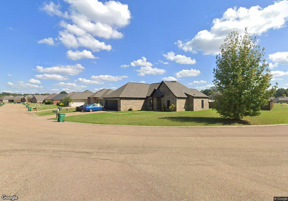
This home is located at 4262 Summerton Dr, Byram, MS 39272 and is currently estimated at $261,622, approximately $145 per square foot. 4262 Summerton Dr is a home with nearby schools including Gary Road Elementary School, Gary Road Intermediate School, and Byram Middle School.
Ownership History
Date
Name
Owned For
Owner Type
Purchase Details
Closed on
Jul 26, 2017
Sold by
Charter Constr & Project
Bought by
Jones April L and Joiner Boris
Current Estimated Value
Home Financials for this Owner
Home Financials are based on the most recent Mortgage that was taken out on this home.
Original Mortgage
$181,649
Interest Rate
3.82%
Mortgage Type
FHA
Purchase Details
Closed on
May 15, 2012
Sold by
Bankplus
Bought by
Charter Investment Llc
Create a Home Valuation Report for This Property
The Home Valuation Report is an in-depth analysis detailing your home's value as well as a comparison with similar homes in the area
Home Values in the Area
Average Home Value in this Area
Purchase History
| Date | Buyer | Sale Price | Title Company |
|---|---|---|---|
| Jones April L | -- | -- | |
| Charter Investment Llc | -- | -- |
Source: Public Records
Mortgage History
| Date | Status | Borrower | Loan Amount |
|---|---|---|---|
| Previous Owner | Jones April L | $181,649 |
Source: Public Records
Tax History
| Year | Tax Paid | Tax Assessment Tax Assessment Total Assessment is a certain percentage of the fair market value that is determined by local assessors to be the total taxable value of land and additions on the property. | Land | Improvement |
|---|---|---|---|---|
| 2025 | $2,065 | $15,557 | $2,500 | $13,057 |
| 2024 | $2,065 | $15,116 | $2,500 | $12,616 |
| 2023 | $2,065 | $15,116 | $2,500 | $12,616 |
| 2022 | $2,325 | $15,116 | $2,500 | $12,616 |
| 2021 | $1,995 | $15,116 | $2,500 | $12,616 |
| 2020 | $1,929 | $14,875 | $2,500 | $12,375 |
| 2019 | $280 | $1,875 | $1,875 | $12,375 |
| 2018 | $280 | $1,875 | $1,875 | $0 |
| 2017 | $274 | $1,875 | $1,875 | $0 |
| 2016 | $274 | $1,875 | $1,875 | $0 |
| 2015 | $274 | $1,875 | $1,875 | $0 |
| 2014 | $271 | $1,875 | $1,875 | $0 |
Source: Public Records
Map
Nearby Homes
- 5301 Gardens Way
- 0 Crossbridge Blvd Unit 4139885
- 0 Crossbridge Blvd Unit 4139884
- 0 S Siwell Rd Unit 4088750
- 0 S Siwell Rd Unit 24872982
- 6760 S Siwell Rd
- 0 Hinds Pkwy Unit 4079577
- 2723 Davis Rd
- 2720 Davis Rd
- 0 Hinds Pkwy
- 125 Churchill Place
- 107 Davis Road Cove
- 2120 Meagan Dr
- Oooo Big Creek Rd
- 217 Raulston Dr
- 220 Raulston Dr
- 224 Raulston Dr
- 228 Raulston Dr
- 244 Raulston Dr
- 252 Raulston Dr
- 4266 Summerton Dr
- 4266 Summerton Dr
- 701 Meadows Way
- 705 Meadows Way
- 4270 Summerton Dr
- 709 Meadows Way
- 709 Meadows Way
- 4273 Summerton Dr
- 4289 Summerton Dr
- 4285 Summerton Dr
- 4269 Summerton Dr
- 4293 Summerton Dr
- 713 Meadows Way
- 713 Meadows Way
- 4274 Summerton Dr
- 4265 Summerton Dr
- 4281 Summerton Dr
- 4297 Summerton Dr
- 705 Meadows Way
- 706 Meadows Way
Your Personal Tour Guide
Ask me questions while you tour the home.