Estimated Value: $212,000 - $268,395
--
Bed
1
Bath
2,772
Sq Ft
$85/Sq Ft
Est. Value
About This Home
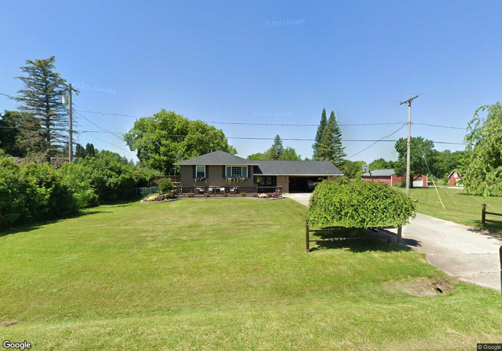
This home is located at 4265 N Vassar Rd, Flint, MI 48506 and is currently estimated at $236,349, approximately $85 per square foot. 4265 N Vassar Rd is a home located in Genesee County with nearby schools including Weston Elementary School, Leota Fiedler Elementary School, and Kate Dowdall Elementary School.
Ownership History
Date
Name
Owned For
Owner Type
Purchase Details
Closed on
Mar 28, 2005
Sold by
Hitch Angela M and Hitch Angelina M
Bought by
Hitch Angelina M
Current Estimated Value
Home Financials for this Owner
Home Financials are based on the most recent Mortgage that was taken out on this home.
Original Mortgage
$134,900
Outstanding Balance
$82,939
Interest Rate
8.99%
Mortgage Type
New Conventional
Estimated Equity
$153,410
Purchase Details
Closed on
Sep 17, 2004
Sold by
Garrett Michael and Garrett Patricia
Bought by
Hitch Angela M
Create a Home Valuation Report for This Property
The Home Valuation Report is an in-depth analysis detailing your home's value as well as a comparison with similar homes in the area
Home Values in the Area
Average Home Value in this Area
Purchase History
| Date | Buyer | Sale Price | Title Company |
|---|---|---|---|
| Hitch Angelina M | -- | Blue Sky Title Llc | |
| Hitch Angela M | $130,000 | Metropolitan Title Company |
Source: Public Records
Mortgage History
| Date | Status | Borrower | Loan Amount |
|---|---|---|---|
| Open | Hitch Angelina M | $134,900 |
Source: Public Records
Tax History Compared to Growth
Tax History
| Year | Tax Paid | Tax Assessment Tax Assessment Total Assessment is a certain percentage of the fair market value that is determined by local assessors to be the total taxable value of land and additions on the property. | Land | Improvement |
|---|---|---|---|---|
| 2025 | $2,669 | $123,700 | $0 | $0 |
| 2024 | $589 | $113,700 | $0 | $0 |
| 2023 | $526 | $99,500 | $0 | $0 |
| 2022 | $2,066 | $93,200 | $0 | $0 |
| 2021 | $2,029 | $81,600 | $0 | $0 |
| 2020 | $459 | $74,200 | $0 | $0 |
| 2019 | $452 | $65,100 | $0 | $0 |
| 2018 | $1,945 | $59,100 | $0 | $0 |
| 2017 | $1,899 | $56,900 | $0 | $0 |
| 2016 | $1,872 | $54,700 | $0 | $0 |
| 2015 | $1,248 | $51,600 | $0 | $0 |
| 2014 | $417 | $47,700 | $0 | $0 |
| 2012 | -- | $34,800 | $34,800 | $0 |
Source: Public Records
Map
Nearby Homes
- 4156 Bobwhite Dr
- 6363 Bluejay Dr
- 6298 Nightingale Dr
- 6323 Bluejay Dr
- 7020 E Carpenter Rd
- 3485 N Vassar Rd
- 6443 Richfield Rd
- 5141 N Vassar Rd
- 6077 Crown Point
- 4062 N Belsay Rd
- 3454 Eastdale Dr
- 5105 N Irish Rd
- 5165 N Irish Rd
- 3389 Eastdale Dr
- 5091 N Irish Rd
- 1240 N Irish Rd
- 3365 Eastdale Dr
- 5429 Hopkins Rd
- 7017 E Coldwater Rd
- 5467 Richfield Rd
- 4255 N Vassar Rd
- 6501 Nightingale Dr Unit Bldg-Unit
- 6501 Nightingale Dr
- 4277 N Vassar Rd
- 4231 N Vassar Rd
- 6504 Nightingale Dr Unit Bldg-Unit
- 6504 Nightingale Dr
- 4295 N Vassar Rd
- 6492 Nightingale Dr
- 6479 Nightingale Dr
- 4284 N Vassar Rd
- 4307 N Vassar Rd
- 6484 Nightingale Dr
- 4215 N Vassar Rd
- 6474 Nightingale Dr
- 4191 Red Bird Ln
- 4313 N Vassar Rd
- 4286 Pheasant Dr
- 4266 Pheasant Dr
- 4294 Pheasant Dr