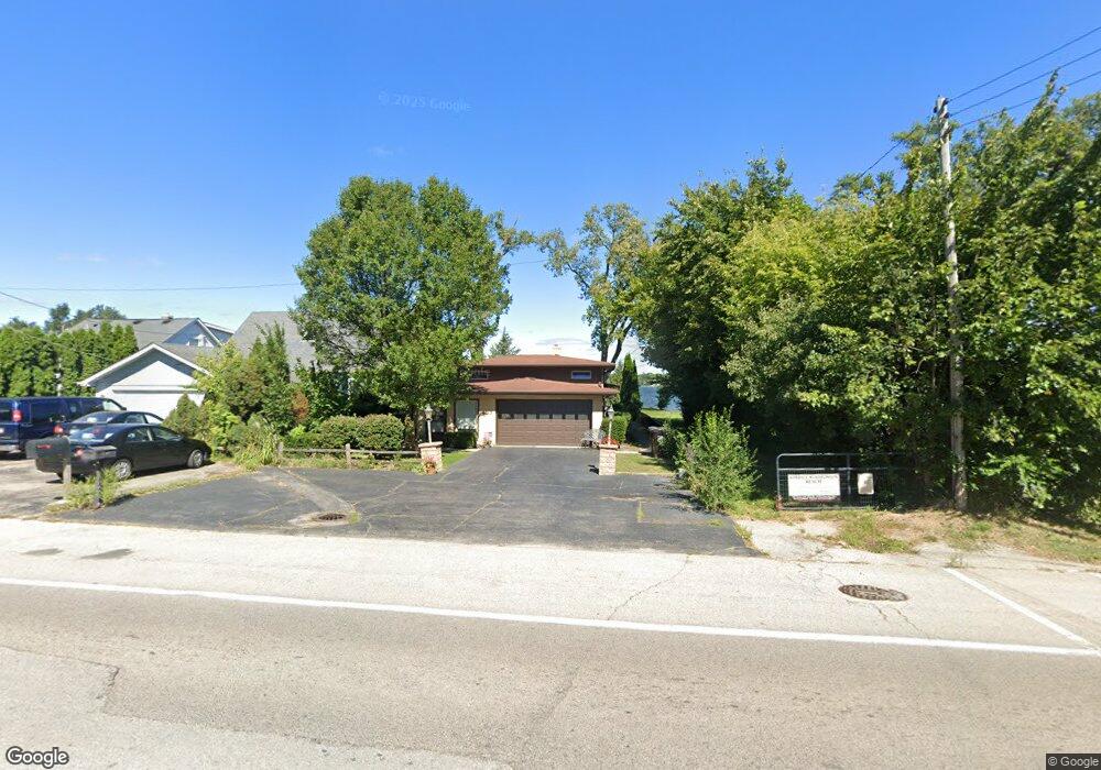
427 E Liberty St Wauconda, IL 60084
Estimated Value: $367,000 - $590,000
Studio
2
Baths
1,840
Sq Ft
$286/Sq Ft
Est. Value
About This Home
This home is located at 427 E Liberty St, Wauconda, IL 60084 and is currently estimated at $526,996, approximately $286 per square foot. 427 E Liberty St is a home located in Lake County with nearby schools including Wauconda Grade School, Wauconda Middle School, and Wauconda High School.
Ownership History
Date
Name
Owned For
Owner Type
Purchase Details
Closed on
Aug 10, 2021
Sold by
Wiggins Barbara A
Bought by
Shipner Daniel Winn
Current Estimated Value
Home Financials for this Owner
Home Financials are based on the most recent Mortgage that was taken out on this home.
Original Mortgage
$330,000
Interest Rate
2.75%
Mortgage Type
New Conventional
Create a Home Valuation Report for This Property
The Home Valuation Report is an in-depth analysis detailing your home's value as well as a comparison with similar homes in the area
Home Values in the Area
Average Home Value in this Area
Purchase History
| Date | Buyer | Sale Price | Title Company |
|---|---|---|---|
| Shipner Daniel Winn | $459,000 | Chicago Title |
Source: Public Records
Mortgage History
| Date | Status | Borrower | Loan Amount |
|---|---|---|---|
| Previous Owner | Shipner Daniel Winn | $330,000 |
Source: Public Records
Tax History
| Year | Tax Paid | Tax Assessment Tax Assessment Total Assessment is a certain percentage of the fair market value that is determined by local assessors to be the total taxable value of land and additions on the property. | Land | Improvement |
|---|---|---|---|---|
| 2024 | $12,020 | $142,584 | $55,499 | $87,085 |
| 2023 | $9,574 | $130,332 | $50,730 | $79,602 |
| 2022 | $9,574 | $93,738 | $34,210 | $59,528 |
| 2021 | $8,587 | $88,574 | $32,325 | $56,249 |
| 2020 | $8,284 | $84,420 | $30,809 | $53,611 |
| 2019 | $7,336 | $79,784 | $29,117 | $50,667 |
| 2018 | $10,256 | $100,121 | $34,527 | $65,594 |
| 2017 | $10,233 | $98,963 | $34,128 | $64,835 |
| 2016 | $9,587 | $93,715 | $32,318 | $61,397 |
| 2015 | $8,333 | $86,033 | $29,669 | $56,364 |
| 2014 | $8,306 | $80,687 | $32,168 | $48,519 |
| 2012 | $8,232 | $82,141 | $32,748 | $49,393 |
Source: Public Records
Map
Nearby Homes
- 155 E Mill St Unit 8
- 25586 W High St
- 25578 W High St
- 25570 W High St
- 27071 N Ridge St
- 360 Promontory Ln Unit D
- 365 Lake Ave Unit C
- 124 Hubbard Ct
- 450 N Main St Unit S208A
- 305 Crestview Dr Unit D
- 235 Crestview Dr Unit A
- 505 Woodland Ave
- 25235 W Hermosa Ave
- 701 Lake Shore Dr
- 26587 N Cherrywood Ln
- 225 Regency Ct Unit A
- 255 Regency Ct Unit D
- 255 Regency Ct Unit C
- 245 Regency Ct Unit B
- 245 Regency Ct Unit E
- 425 E Liberty St
- 423 E Liberty St
- 419 E Liberty St
- 511 E Liberty St
- 415 E Liberty St
- 515 E Liberty St
- 411 E Liberty St
- 426 E Liberty St
- 500 E Liberty St
- 422 E Liberty St
- 504 E Liberty St
- 420 E Liberty St
- 407 E Liberty St
- 506 E Liberty St
- 525 E Liberty St
- 414 E Liberty St
- 403 E Liberty St
- 113 Ridge St
- 410 E Liberty St
- 510 E Liberty St
Your Personal Tour Guide
Ask me questions while you tour the home.