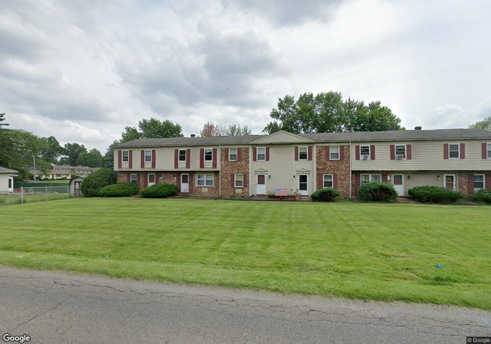
427 Mathews Rd Youngstown, OH 44512
Estimated Value: $94,000 - $158,000
3
Beds
1
Bath
1,092
Sq Ft
$112/Sq Ft
Est. Value
About This Home
This home is located at 427 Mathews Rd, Youngstown, OH 44512 and is currently estimated at $122,222, approximately $111 per square foot. 427 Mathews Rd is a home located in Mahoning County with nearby schools including Robinwood Lane Elementary School, Boardman Glenwood Junior High School, and Boardman High School.
Ownership History
Date
Name
Owned For
Owner Type
Purchase Details
Closed on
Dec 11, 2015
Bought by
Kelar Properties Holdings
Current Estimated Value
Purchase Details
Closed on
Sep 27, 2005
Sold by
Boardman Condominium Development Inc
Bought by
Stanton & Daughters Llc
Home Financials for this Owner
Home Financials are based on the most recent Mortgage that was taken out on this home.
Original Mortgage
$2,500,000
Interest Rate
5.93%
Mortgage Type
Purchase Money Mortgage
Create a Home Valuation Report for This Property
The Home Valuation Report is an in-depth analysis detailing your home's value as well as a comparison with similar homes in the area
Home Values in the Area
Average Home Value in this Area
Purchase History
| Date | Buyer | Sale Price | Title Company |
|---|---|---|---|
| Kelar Properties Holdings | -- | -- | |
| Stanton & Daughters Llc | -- | -- |
Source: Public Records
Mortgage History
| Date | Status | Borrower | Loan Amount |
|---|---|---|---|
| Previous Owner | Stanton & Daughters Llc | $2,500,000 |
Source: Public Records
Tax History Compared to Growth
Tax History
| Year | Tax Paid | Tax Assessment Tax Assessment Total Assessment is a certain percentage of the fair market value that is determined by local assessors to be the total taxable value of land and additions on the property. | Land | Improvement |
|---|---|---|---|---|
| 2024 | $1,279 | $24,500 | $5,250 | $19,250 |
| 2023 | $1,262 | $24,500 | $5,250 | $19,250 |
| 2022 | $1,127 | $16,700 | $5,250 | $11,450 |
| 2021 | $1,127 | $16,700 | $5,250 | $11,450 |
| 2020 | $1,133 | $16,700 | $5,250 | $11,450 |
| 2019 | $1,070 | $13,920 | $4,380 | $9,540 |
| 2018 | $910 | $13,920 | $4,380 | $9,540 |
| 2017 | $1,016 | $13,920 | $4,380 | $9,540 |
| 2016 | $1,125 | $17,120 | $4,380 | $12,740 |
| 2015 | $1,104 | $17,120 | $4,380 | $12,740 |
| 2014 | $1,107 | $17,120 | $4,380 | $12,740 |
| 2013 | $1,094 | $17,120 | $4,380 | $12,740 |
Source: Public Records
Map
Nearby Homes
- 796 Edenridge Dr
- 792 Forest Ridge Dr
- 767 Forest Ridge Dr
- 0 Mathews Rd Unit 5038026
- 0 Moyer Ave
- 6001 Applecrest Dr
- 0 Mulberry Ln Unit 5119623
- 928 Edenridge Dr
- 857 Maple Ridge Dr
- 642 Oakridge Dr
- 707 Oakridge Dr
- 6278 Appleridge Dr
- 0 Cranberry Ln Unit 5119702
- 772 Teakwood Dr
- 323 Melrose Ave
- 268 Erskine Ave
- 197 Mathews Rd Unit B
- 178 Mathews Rd
- 220 Afton Ave
- 167 Afton Ave
- 429 Mathews Rd
- 425 Mathews Rd
- 431 Mathews Rd
- 423 Mathews Rd
- 421 Mathews Rd
- 5904 Glenridge Rd
- 414 Ridgefield Ave
- 406 Ridgefield Ave
- 398 Ridgefield Ave
- 400 Mathews Rd
- 5928 Glenridge Rd
- 390 Ridgefield Ave
- 424 Mathews Rd
- 403 Mathews Rd
- 382 Ridgefield Ave
- 401 Mathews Rd
- 1 Midwood Cir
- 5903 Glenridge Rd
- 5911 Glenridge Rd
- 5936 Glenridge Rd