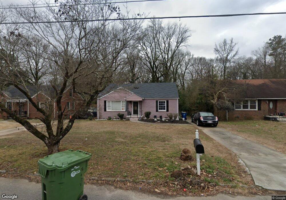
427 Sargent Dr SE Unit 1 Atlanta, GA 30315
Lakewood NeighborhoodEstimated Value: $230,036 - $274,000
2
Beds
1
Bath
1,483
Sq Ft
$167/Sq Ft
Est. Value
About This Home
This home is located at 427 Sargent Dr SE Unit 1, Atlanta, GA 30315 and is currently estimated at $248,259, approximately $167 per square foot. 427 Sargent Dr SE Unit 1 is a home located in Fulton County with nearby schools including Dobbs Elementary School, Long Middle School, and South Atlanta High School.
Ownership History
Date
Name
Owned For
Owner Type
Purchase Details
Closed on
Jul 26, 1996
Sold by
Pugh Sherry D
Bought by
Wray Roosevelt
Current Estimated Value
Purchase Details
Closed on
May 9, 1996
Sold by
Fleet Finance Inc Ga
Bought by
Pugh Sherry D
Purchase Details
Closed on
Nov 7, 1995
Sold by
Cooke James W
Bought by
Fleet Finance Inc Ga
Purchase Details
Closed on
Jun 4, 1995
Sold by
Robinson Herman K Vicki D
Bought by
Alliance Mtg Co Fla and *
Create a Home Valuation Report for This Property
The Home Valuation Report is an in-depth analysis detailing your home's value as well as a comparison with similar homes in the area
Home Values in the Area
Average Home Value in this Area
Purchase History
| Date | Buyer | Sale Price | Title Company |
|---|---|---|---|
| Wray Roosevelt | $58,000 | -- | |
| Pugh Sherry D | $33,700 | -- | |
| Fleet Finance Inc Ga | $27,400 | -- | |
| Alliance Mtg Co Fla | $35,600 | -- |
Source: Public Records
Mortgage History
| Date | Status | Borrower | Loan Amount |
|---|---|---|---|
| Closed | Wray Roosevelt | $0 |
Source: Public Records
Tax History Compared to Growth
Tax History
| Year | Tax Paid | Tax Assessment Tax Assessment Total Assessment is a certain percentage of the fair market value that is determined by local assessors to be the total taxable value of land and additions on the property. | Land | Improvement |
|---|---|---|---|---|
| 2025 | $1,168 | $65,760 | $25,920 | $39,840 |
| 2023 | $3,915 | $94,560 | $55,560 | $39,000 |
| 2022 | $644 | $69,000 | $29,240 | $39,760 |
| 2021 | $374 | $35,600 | $11,280 | $24,320 |
| 2020 | $1,442 | $35,200 | $11,160 | $24,040 |
| 2019 | $488 | $26,520 | $10,640 | $15,880 |
| 2018 | $553 | $13,360 | $3,400 | $9,960 |
| 2017 | $536 | $12,400 | $2,680 | $9,720 |
| 2016 | $537 | $12,400 | $2,680 | $9,720 |
| 2015 | $1,021 | $12,400 | $2,680 | $9,720 |
| 2014 | $562 | $12,400 | $2,680 | $9,720 |
Source: Public Records
Map
Nearby Homes
- 444 Sargent Dr SE
- 388 Sargent Dr SE
- 2318 Browns Mill Rd SE
- 2209 Browns Mill Rd SE
- 322 E Rhinehill Rd SE
- 2276 Sargent Place SE
- 2203 Browns Mill Rd SE
- 309 E Rhinehill Rd SE
- 2242 Jernigan Dr SE
- 296 Bromack Dr SE
- 568 Mcwilliams Rd SE
- 2197 Jernigan Dr SE
- 270 Bromack Dr SE
- 2306 Carey Dr SE
- 2210 Rhinehill Rd SE
- 305 Banberry Dr SE
- 2239 Carey Dr SE
- 433 Sargent Dr SE
- 439 Sargent Dr SE
- 411 Sargent Dr SE
- 426 Sargent Dr SE
- 407 Sargent Dr SE
- 432 Sargent Dr SE
- 432 Sargent Dr SE
- 445 Sargent Dr SE
- 420 Sargent Dr SE
- 0 Sargent Dr SE Unit 7327789
- 0 Sargent Dr SE Unit 7062924
- 0 Sargent Dr SE Unit 8689723
- 0 Sargent Dr SE Unit 8635521
- 0 Sargent Dr SE Unit 8639726
- 0 Sargent Dr SE Unit 8548567
- 0 Sargent Dr SE Unit 3256336
- 0 Sargent Dr SE Unit 8090174
- 419 Sargent Dr SE
- 419 Sargent Dr SE Unit 2
- 438 Sargent Dr SE