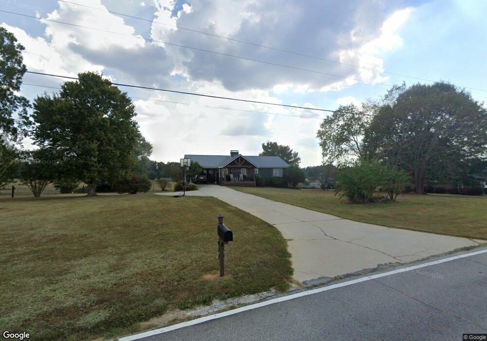
427 Willie Walker Rd Carrollton, GA 30117
Estimated Value: $295,519 - $333,000
3
Beds
3
Baths
1,530
Sq Ft
$204/Sq Ft
Est. Value
About This Home
This home is located at 427 Willie Walker Rd, Carrollton, GA 30117 and is currently estimated at $312,130, approximately $204 per square foot. 427 Willie Walker Rd is a home located in Carroll County with nearby schools including Central Elementary School, Central Middle School, and Central High School.
Ownership History
Date
Name
Owned For
Owner Type
Purchase Details
Closed on
Mar 21, 2023
Sold by
Bssm Lp
Bought by
Stone Sydney
Current Estimated Value
Purchase Details
Closed on
Jan 5, 2000
Sold by
Bssm Lp
Bought by
Bssm Lp
Purchase Details
Closed on
May 26, 1995
Sold by
Christopher Christopher T and Christopher D
Bought by
Bssm Lp
Purchase Details
Closed on
Oct 1, 1993
Bought by
Christopher Christopher T and Christopher D
Create a Home Valuation Report for This Property
The Home Valuation Report is an in-depth analysis detailing your home's value as well as a comparison with similar homes in the area
Home Values in the Area
Average Home Value in this Area
Purchase History
| Date | Buyer | Sale Price | Title Company |
|---|---|---|---|
| Stone Sydney | $275,000 | -- | |
| Bssm Lp | -- | -- | |
| Bssm Lp | $97,200 | -- | |
| Christopher Christopher T | $97,500 | -- |
Source: Public Records
Tax History Compared to Growth
Tax History
| Year | Tax Paid | Tax Assessment Tax Assessment Total Assessment is a certain percentage of the fair market value that is determined by local assessors to be the total taxable value of land and additions on the property. | Land | Improvement |
|---|---|---|---|---|
| 2024 | $2,436 | $107,699 | $8,391 | $99,308 |
| 2023 | $2,436 | $97,019 | $6,713 | $90,306 |
| 2022 | $1,930 | $76,967 | $4,476 | $72,491 |
| 2021 | $1,684 | $65,696 | $3,580 | $62,116 |
| 2020 | $1,495 | $58,250 | $3,255 | $54,995 |
| 2019 | $1,432 | $55,327 | $3,255 | $52,072 |
| 2018 | $1,277 | $48,646 | $3,042 | $45,604 |
| 2017 | $1,139 | $43,230 | $2,300 | $40,930 |
| 2016 | $1,139 | $43,230 | $2,300 | $40,930 |
| 2015 | $1,415 | $50,615 | $9,200 | $41,416 |
| 2014 | $1,421 | $50,616 | $9,200 | $41,416 |
Source: Public Records
Map
Nearby Homes
- 105 Woodbine Dr
- 1531 Tyus Carrollton Rd
- 345 Piney Grove Rd
- 399 Old Camp Church Rd
- 0 Bonner Rd Unit 10635754
- 20 Camp Ct
- 0 Buffalo Creek Rd Unit 10624169
- 533 Buffalo Creek Rd
- 95 Camp Ln
- 915 Oak Grove Rd
- The Coleman Plan at Summerfield Place
- The Pearson Plan at Summerfield Place
- The Piedmont Plan at Summerfield Place
- The Harrington Plan at Summerfield Place
- The McGinnis Plan at Summerfield Place
- The Telfair Plan at Summerfield Place
- 21 Crabapple Place
- 40 Red Holly Gap
- 1585 Hays Mill Rd
- 115 Greenwood Ln
- 145 S Lake Dr
- 58 Walker Lake Dr Unit 3
- 58 Walker Lake Dr
- 34 Walker Lake Dr Unit 1
- 70 Walker Lake Dr Unit 4
- 70 Walker Lake Dr
- 0 Walker Lake Dr Unit 7117753
- 0 Walker Lake Dr Unit 8758822
- 0 Walker Lake Dr Unit 8880410
- 0 Walker Lake Dr Unit 3249783
- 0 Walker Lake Dr Unit 7164914
- 0 Walker Lake Dr Unit 7466766
- 341 Willie Walker Rd
- 84 Walker Lake Dr
- 321 Willie Walker Rd Unit 26
- 321 Willie Walker Rd
- 46 Walker Lake Dr Unit 2
- 377 Willie Walker Rd
- 53 S Walker Lake Dr
- 39 S Walker Lake Dr