Estimated Value: $321,000 - $379,000
3
Beds
4
Baths
1,936
Sq Ft
$179/Sq Ft
Est. Value
About This Home
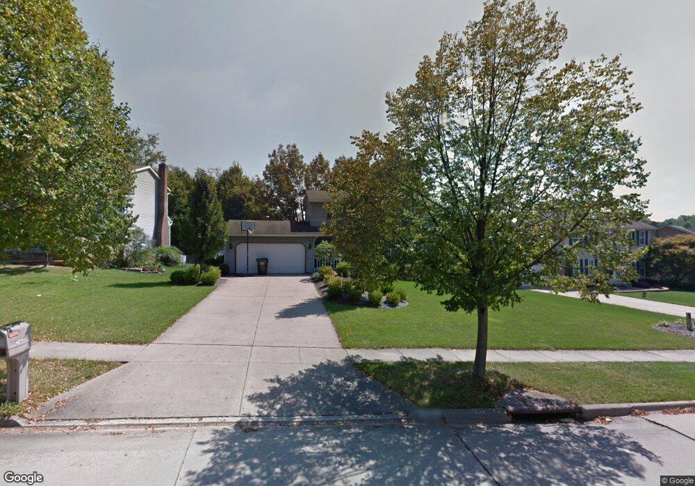
This home is located at 4271 Bunker Ln, Stow, OH 44224 and is currently estimated at $347,118, approximately $179 per square foot. 4271 Bunker Ln is a home located in Summit County with nearby schools including Stow-Munroe Falls High School and Walsh Jesuit High School.
Ownership History
Date
Name
Owned For
Owner Type
Purchase Details
Closed on
Feb 28, 2013
Sold by
Newton Norman and Newton Franscia
Bought by
Newton Norman and Newton Franscia
Current Estimated Value
Home Financials for this Owner
Home Financials are based on the most recent Mortgage that was taken out on this home.
Original Mortgage
$138,800
Interest Rate
4.25%
Mortgage Type
New Conventional
Purchase Details
Closed on
Dec 28, 2000
Sold by
Patrick Joseph M and Patrick Robyn D
Bought by
Newton Norman S and Ortega Franscia
Home Financials for this Owner
Home Financials are based on the most recent Mortgage that was taken out on this home.
Original Mortgage
$151,875
Interest Rate
7.8%
Mortgage Type
VA
Create a Home Valuation Report for This Property
The Home Valuation Report is an in-depth analysis detailing your home's value as well as a comparison with similar homes in the area
Home Values in the Area
Average Home Value in this Area
Purchase History
| Date | Buyer | Sale Price | Title Company |
|---|---|---|---|
| Newton Norman | -- | None Available | |
| Newton Norman S | $170,000 | Guardian Title |
Source: Public Records
Mortgage History
| Date | Status | Borrower | Loan Amount |
|---|---|---|---|
| Previous Owner | Newton Norman | $138,800 | |
| Previous Owner | Newton Norman S | $151,875 |
Source: Public Records
Tax History Compared to Growth
Tax History
| Year | Tax Paid | Tax Assessment Tax Assessment Total Assessment is a certain percentage of the fair market value that is determined by local assessors to be the total taxable value of land and additions on the property. | Land | Improvement |
|---|---|---|---|---|
| 2025 | $5,615 | $99,730 | $16,230 | $83,500 |
| 2024 | $5,615 | $99,730 | $16,230 | $83,500 |
| 2023 | $5,615 | $99,730 | $16,230 | $83,500 |
| 2022 | $4,905 | $76,868 | $12,485 | $64,383 |
| 2021 | $4,391 | $76,868 | $12,485 | $64,383 |
| 2020 | $4,316 | $76,870 | $12,490 | $64,380 |
| 2019 | $3,951 | $65,700 | $12,360 | $53,340 |
| 2018 | $3,886 | $65,700 | $12,360 | $53,340 |
| 2017 | $3,460 | $65,700 | $12,360 | $53,340 |
| 2016 | $3,627 | $57,820 | $12,360 | $45,460 |
| 2015 | $3,460 | $57,820 | $12,360 | $45,460 |
| 2014 | $3,516 | $57,630 | $12,360 | $45,270 |
| 2013 | $3,584 | $59,160 | $12,360 | $46,800 |
Source: Public Records
Map
Nearby Homes
- 2831 Saybrooke Blvd
- 2908 Wexford Blvd
- 2714 Wexford Blvd
- 4444 Hickory Trail
- 4445 Kenneth Trail
- 4556 Fishcreek Rd
- 3788 Woodbury Oval Unit 60
- 3860 Lake Run Blvd
- 4638 Dresher Trail
- 4078 Pardee Rd
- 4155 Burton Dr
- 4131 Burton Dr
- 0 Vira Rd
- 4910 Independence Cir Unit D
- 4916 Friar Rd Unit B
- 3801 Baird Rd
- 76 Wanda Ct
- 2410 Wrens Dr S
- 2260 E Gilwood Dr
- 1302 Carol Dr
- 4279 Bunker Ln
- 4259 Bunker Ln
- 2891 Saybrooke Blvd
- 4287 Bunker Ln
- 2877 Saybrooke Blvd
- 2899 Saybrooke Blvd
- 4266 Bunker Ln
- 4272 Bunker Ln
- 4258 Bunker Ln
- 4295 Bunker Ln
- 2907 Saybrooke Blvd
- 4252 Bunker Ln
- 4286 Bunker Ln
- 2978 Wexford Blvd
- 2869 Saybrooke Blvd
- 2915 Saybrooke Blvd
- 2968 Wexford Blvd
- 4296 Bunker Ln
- 2880 Saybrooke Blvd
- 2923 Williamsburg Cir