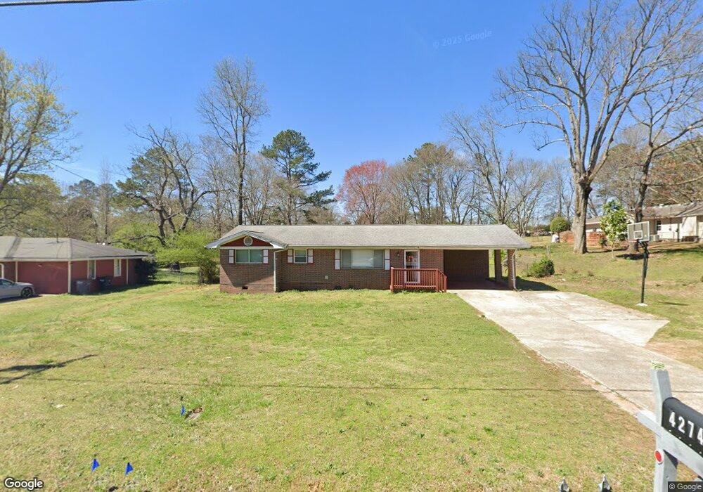
4274 Ewing Rd Austell, GA 30106
Estimated Value: $228,000 - $256,000
3
Beds
1
Bath
1,134
Sq Ft
$216/Sq Ft
Est. Value
About This Home
This home is located at 4274 Ewing Rd, Austell, GA 30106 and is currently estimated at $244,569, approximately $215 per square foot. 4274 Ewing Rd is a home located in Cobb County with nearby schools including Clarkdale Elementary School, Cooper Middle School, and South Cobb High School.
Ownership History
Date
Name
Owned For
Owner Type
Purchase Details
Closed on
Dec 3, 2020
Sold by
Crews Johnny B
Bought by
Mitchell Glaston John
Current Estimated Value
Home Financials for this Owner
Home Financials are based on the most recent Mortgage that was taken out on this home.
Original Mortgage
$116,800
Interest Rate
2.7%
Mortgage Type
New Conventional
Create a Home Valuation Report for This Property
The Home Valuation Report is an in-depth analysis detailing your home's value as well as a comparison with similar homes in the area
Home Values in the Area
Average Home Value in this Area
Purchase History
| Date | Buyer | Sale Price | Title Company |
|---|---|---|---|
| Mitchell Glaston John | $146,000 | None Available |
Source: Public Records
Mortgage History
| Date | Status | Borrower | Loan Amount |
|---|---|---|---|
| Previous Owner | Mitchell Glaston John | $116,800 |
Source: Public Records
Tax History
| Year | Tax Paid | Tax Assessment Tax Assessment Total Assessment is a certain percentage of the fair market value that is determined by local assessors to be the total taxable value of land and additions on the property. | Land | Improvement |
|---|---|---|---|---|
| 2025 | $2,487 | $82,532 | $16,000 | $66,532 |
| 2024 | $2,488 | $82,532 | $16,000 | $66,532 |
| 2023 | $2,488 | $82,532 | $16,000 | $66,532 |
Source: Public Records
Map
Nearby Homes
- 2889 Chestnut Grove Dr
- 4160 Ewing Rd
- 2702 Beecher Dr
- 2731 Double Iron Dr SW
- 3989 Flint Hill Rd
- 4798 Victoria Ln
- 2776 Parcel Rd
- 0 Clay Rd SW
- 4280 Creek Crest Trail
- 3832 Abbott Ln Unit 1
- 3411 Lynne Rd
- 3916 Abbott Way Unit 2
- 3311 Clay Rd
- 3289 Clay Rd SW
- 3917 Abbott Way Unit 19
- 2373 Buckley Ct
- 2711 Greystone Ct
- 4769 Nature Trail
- 3233 Abbott Dr SW
- 2349 Shire Ct
- 4298 Ewing Rd
- 4272 Ewing Rd
- 4301 Ewing Rd
- 4311 Ewing Rd
- 4275 Ewing Rd
- 4308 Ewing Rd
- 4267 Ewing Rd
- 4303 Chestnut Grove Ln
- 2880 Chestnut Grove Dr
- 4289 Chestnut Grove Ln
- 4122 Bunker Dr SW
- 4122 Bunker Dr SW
- 4279 Chestnut Grove Ln
- 4321 Ewing Rd
- 4118 Bunker Dr SW
- 4118 Bunker Dr SW
- 2890 Chestnut Grove Dr
- 4260 Ewing Rd
- 4269 Chestnut Grove Ln
- 4331 Ewing Rd
Your Personal Tour Guide
Ask me questions while you tour the home.