Estimated Value: $298,000 - $345,000
3
Beds
2
Baths
1,862
Sq Ft
$173/Sq Ft
Est. Value
About This Home
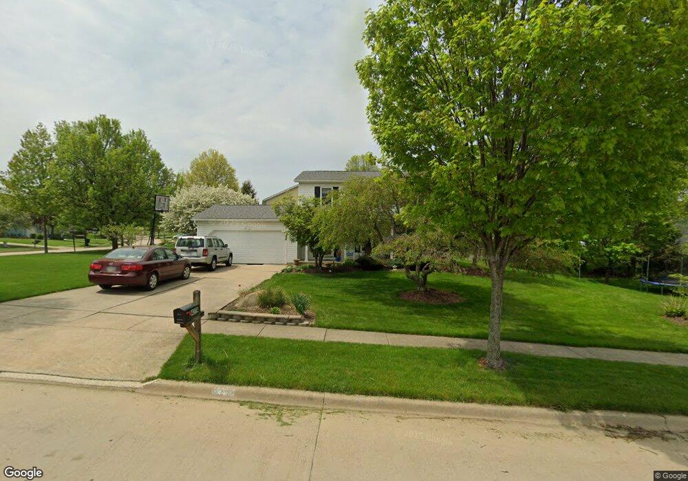
This home is located at 4274 Williamsburg Dr, Stow, OH 44224 and is currently estimated at $321,876, approximately $172 per square foot. 4274 Williamsburg Dr is a home located in Summit County with nearby schools including Stow-Munroe Falls High School, St Patrick Elementary School, and Walsh Jesuit High School.
Ownership History
Date
Name
Owned For
Owner Type
Purchase Details
Closed on
Apr 22, 2020
Sold by
Bradbury Sandra K and Bradbury Robert
Bought by
Lazar Cameron and Lazar Kelly Ann
Current Estimated Value
Home Financials for this Owner
Home Financials are based on the most recent Mortgage that was taken out on this home.
Original Mortgage
$101,000
Outstanding Balance
$89,107
Interest Rate
3.3%
Mortgage Type
New Conventional
Estimated Equity
$232,769
Create a Home Valuation Report for This Property
The Home Valuation Report is an in-depth analysis detailing your home's value as well as a comparison with similar homes in the area
Home Values in the Area
Average Home Value in this Area
Purchase History
| Date | Buyer | Sale Price | Title Company |
|---|---|---|---|
| Lazar Cameron | $200,000 | None Listed On Document |
Source: Public Records
Mortgage History
| Date | Status | Borrower | Loan Amount |
|---|---|---|---|
| Open | Lazar Cameron | $101,000 |
Source: Public Records
Tax History Compared to Growth
Tax History
| Year | Tax Paid | Tax Assessment Tax Assessment Total Assessment is a certain percentage of the fair market value that is determined by local assessors to be the total taxable value of land and additions on the property. | Land | Improvement |
|---|---|---|---|---|
| 2025 | $5,232 | $92,866 | $15,537 | $77,329 |
| 2024 | $5,232 | $92,866 | $15,537 | $77,329 |
| 2023 | $5,232 | $92,866 | $15,537 | $77,329 |
| 2022 | $4,562 | $71,432 | $11,949 | $59,483 |
| 2021 | $4,084 | $71,432 | $11,949 | $59,483 |
| 2020 | $3,981 | $70,850 | $11,950 | $58,900 |
| 2019 | $3,903 | $64,910 | $11,830 | $53,080 |
| 2018 | $3,839 | $64,910 | $11,830 | $53,080 |
| 2017 | $3,510 | $64,910 | $11,830 | $53,080 |
| 2016 | $3,612 | $57,600 | $11,830 | $45,770 |
| 2015 | $3,510 | $57,600 | $11,830 | $45,770 |
| 2014 | $3,513 | $57,600 | $11,830 | $45,770 |
| 2013 | $3,556 | $58,710 | $11,830 | $46,880 |
Source: Public Records
Map
Nearby Homes
- 2908 Wexford Blvd
- 2831 Saybrooke Blvd
- 2714 Wexford Blvd
- 4444 Hickory Trail
- 4445 Kenneth Trail
- 4556 Fishcreek Rd
- 4638 Dresher Trail
- 4910 Independence Cir Unit D
- 4155 Burton Dr
- 3788 Woodbury Oval Unit 60
- 4131 Burton Dr
- 4078 Pardee Rd
- 4916 Friar Rd Unit B
- 3860 Lake Run Blvd
- 0 Vira Rd
- 2410 Wrens Dr S
- 76 Wanda Ct
- 2260 E Gilwood Dr
- 3801 Baird Rd
- 4322 Lorwood Dr
- 2851 Williamsburg Cir
- 4277 Williamsburg Dr
- 2876 Wexford Blvd
- 2864 Wexford Blvd
- 2843 Williamsburg Cir
- 2854 Williamsburg Cir
- 2854 Wexford Blvd
- 2890 Wexford Blvd
- 2879 Williamsburg Cir
- 2876 Williamsburg Cir
- 2835 Williamsburg Cir
- 2846 Wexford Blvd
- 2900 Wexford Blvd
- 4253 Williamsburg Dr
- 4248 Williamsburg Dr
- 2887 Williamsburg Cir
- 2836 Wexford Blvd
- 2827 Williamsburg Cir
- 2886 Williamsburg Cir
- 2879 Wexford Blvd