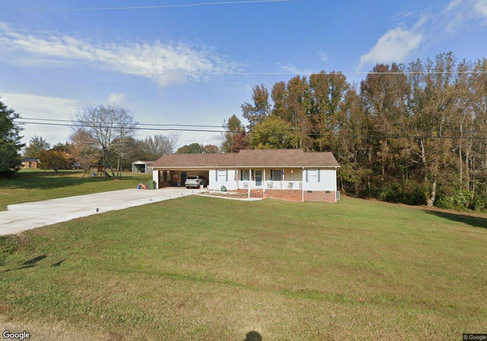
4276 Buford Cir Lancaster, SC 29720
Estimated Value: $236,000 - $346,000
Studio
2
Baths
1,320
Sq Ft
$215/Sq Ft
Est. Value
About This Home
This home is located at 4276 Buford Cir, Lancaster, SC 29720 and is currently estimated at $283,910, approximately $215 per square foot. 4276 Buford Cir is a home located in Lancaster County with nearby schools including Buford Elementary School, Buford Middle School, and Buford High School.
Ownership History
Date
Name
Owned For
Owner Type
Purchase Details
Closed on
Nov 20, 2020
Sold by
Clemmer Timothy A and Clemmer Teresa A
Bought by
Jenkins Richard Bryan and Jenkins Megan Deese
Current Estimated Value
Home Financials for this Owner
Home Financials are based on the most recent Mortgage that was taken out on this home.
Original Mortgage
$209,000
Outstanding Balance
$183,417
Interest Rate
2.8%
Mortgage Type
New Conventional
Estimated Equity
$100,494
Create a Home Valuation Report for This Property
The Home Valuation Report is an in-depth analysis detailing your home's value as well as a comparison with similar homes in the area
Home Values in the Area
Average Home Value in this Area
Purchase History
| Date | Buyer | Sale Price | Title Company |
|---|---|---|---|
| Jenkins Richard Bryan | $220,000 | None Available |
Source: Public Records
Mortgage History
| Date | Status | Borrower | Loan Amount |
|---|---|---|---|
| Open | Jenkins Richard Bryan | $209,000 |
Source: Public Records
Tax History
| Year | Tax Paid | Tax Assessment Tax Assessment Total Assessment is a certain percentage of the fair market value that is determined by local assessors to be the total taxable value of land and additions on the property. | Land | Improvement |
|---|---|---|---|---|
| 2024 | $1,352 | $8,812 | $680 | $8,132 |
| 2023 | $1,347 | $8,812 | $680 | $8,132 |
| 2022 | $1,342 | $8,812 | $680 | $8,132 |
| 2021 | $1,313 | $8,812 | $680 | $8,132 |
| 2020 | $751 | $4,904 | $680 | $4,224 |
| 2019 | $1,613 | $4,772 | $680 | $4,092 |
| 2018 | $1,552 | $4,772 | $680 | $4,092 |
| 2017 | $715 | $0 | $0 | $0 |
| 2016 | $697 | $0 | $0 | $0 |
| 2015 | $575 | $0 | $0 | $0 |
| 2014 | $575 | $0 | $0 | $0 |
| 2013 | $575 | $0 | $0 | $0 |
Source: Public Records
Map
Nearby Homes
- 3966 Red Doc Rd
- TBD Willie Usher Rd
- 2248 Willie Usher Rd
- 1069 Kinship Dr
- 529 Langley Rd
- 3227 Legend Rd
- 000 Daystar Rd Unit 9
- 000 Daystar Rd Unit 14
- 000 Daystar Rd Unit 7
- 000 Daystar Rd Unit 8
- 3236 Daystar Rd
- 861 Union Church Rd
- 0 Old Farm Rd
- 3008 Lamplight Rd
- 2436 Campbell Lake Rd
- 3987 Taxahaw Rd
- 0 Pageland Hwy Unit CAR4343176
- 6590 Camp Creek Rd
- 2716 Camp Creek Rd
- 135 Old Gregory Ln
- 4294 Buford Cir
- 4277 Buford Cir
- 4289 Buford Cir
- 4258 Buford Cir
- 4299 Buford Cir
- 4322 Buford Cir
- 4311 Buford Cir
- 4209 Buford Cir
- 4332 Buford Cir
- 1936 Rondo Ln
- 4195 Buford Cir
- 1924 Rondo Ln
- 4346 Buford Cir
- 4183 Buford Cir
- 4341 Buford Cir
- 4220 Buford Cir
- 4230 Buford Cir
- 1910 Rondo Ln
- 4358 Buford Cir
- 4188 Buford Cir
Your Personal Tour Guide
Ask me questions while you tour the home.