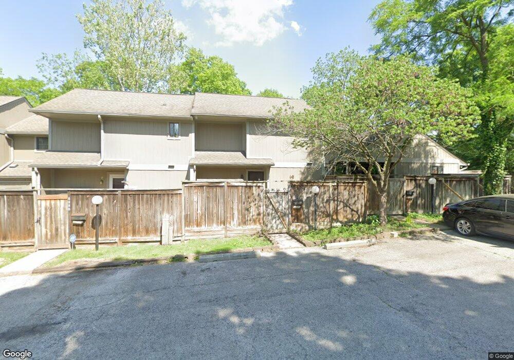
4277 Woodsage Trace Indianapolis, IN 46237
University Heights NeighborhoodEstimated Value: $109,000 - $137,633
1
Bed
2
Baths
1,126
Sq Ft
$111/Sq Ft
Est. Value
About This Home
This home is located at 4277 Woodsage Trace, Indianapolis, IN 46237 and is currently estimated at $125,158, approximately $111 per square foot. 4277 Woodsage Trace is a home located in Marion County with nearby schools including Clinton Young Elementary School, Southport 6th Grade Academy, and Southport Middle School.
Ownership History
Date
Name
Owned For
Owner Type
Purchase Details
Closed on
Nov 13, 2009
Sold by
Liew Ah Lan
Bought by
Lam Doreen Wei Sau
Current Estimated Value
Purchase Details
Closed on
Jul 22, 2009
Sold by
Wells Fargo Bank Na
Bought by
Liew Ah Lan
Purchase Details
Closed on
Jun 8, 2009
Sold by
Fox Pamela S
Bought by
Wells Fargo Bank Na
Purchase Details
Closed on
May 2, 2005
Sold by
Wright Gerald R and Wright Ruth Anne
Bought by
Fox Pamela S
Home Financials for this Owner
Home Financials are based on the most recent Mortgage that was taken out on this home.
Original Mortgage
$50,350
Interest Rate
6.13%
Mortgage Type
Unknown
Create a Home Valuation Report for This Property
The Home Valuation Report is an in-depth analysis detailing your home's value as well as a comparison with similar homes in the area
Home Values in the Area
Average Home Value in this Area
Purchase History
| Date | Buyer | Sale Price | Title Company |
|---|---|---|---|
| Lam Doreen Wei Sau | -- | Federated Land Title Agency | |
| Liew Ah Lan | -- | Federated Land Title Agency | |
| Wells Fargo Bank Na | $19,500 | None Available | |
| Fox Pamela S | -- | None Available |
Source: Public Records
Mortgage History
| Date | Status | Borrower | Loan Amount |
|---|---|---|---|
| Previous Owner | Fox Pamela S | $50,350 |
Source: Public Records
Tax History Compared to Growth
Tax History
| Year | Tax Paid | Tax Assessment Tax Assessment Total Assessment is a certain percentage of the fair market value that is determined by local assessors to be the total taxable value of land and additions on the property. | Land | Improvement |
|---|---|---|---|---|
| 2024 | $1,176 | $111,600 | $7,400 | $104,200 |
| 2023 | $1,176 | $115,300 | $7,400 | $107,900 |
| 2022 | $1,021 | $102,800 | $7,400 | $95,400 |
| 2021 | $682 | $81,200 | $7,300 | $73,900 |
| 2020 | $544 | $72,600 | $7,300 | $65,300 |
| 2019 | $509 | $68,300 | $7,300 | $61,000 |
| 2018 | $439 | $59,000 | $7,300 | $51,700 |
| 2017 | $392 | $53,300 | $7,300 | $46,000 |
| 2016 | $409 | $55,000 | $7,300 | $47,700 |
| 2014 | $245 | $44,900 | $7,300 | $37,600 |
| 2013 | $450 | $68,600 | $7,300 | $61,300 |
Source: Public Records
Map
Nearby Homes
- 4235 Foxglove Trace
- 4261 Foxglove Trace
- 4219 Terra Dr
- 3731 Owster Ln
- 3510 Chamberlin Dr
- 14 Melody Ct
- 3830 S Olney St
- 508 S 9th Ave
- 3611 Owster Ln
- 703 Redfern Dr
- 3220 Chamberlin Dr
- 402 Cherry St
- 1445 Biloxi Ln
- 725 S 4th Ave
- 602 Memorial Dr
- 1117 Byland Dr
- 619 Memorial Dr
- 1701 S 9th Ave
- 3905 Shelbyville Rd
- 227 S 12th Ave
- 4273 Woodsage Trace
- 4281 Woodsage Trace
- 4269 Woodsage Trace
- 3930 Wilderness Trail
- 4265 Woodsage Trace
- 4261 Woodsage Trace
- 4257 Woodsage Trace
- 4260 Foxglove Trace
- 4264 Foxglove Trace
- 3912 Wilderness Trail
- 3912 Wilderness Trail Unit 1
- 4272 Foxglove Trace
- 4282 Woodsage Trace
- 4272 Foxglove Trace
- 4278 Woodsage Trace
- 3908 Wilderness Trail
- 4276 Foxglove Trace
- 4274 Woodsage Trace
- 4251 Woodsage Trace
- 3906 Wilderness Trail