Estimated Value: $247,000 - $266,000
Studio
3
Baths
1,944
Sq Ft
$132/Sq Ft
Est. Value
About This Home
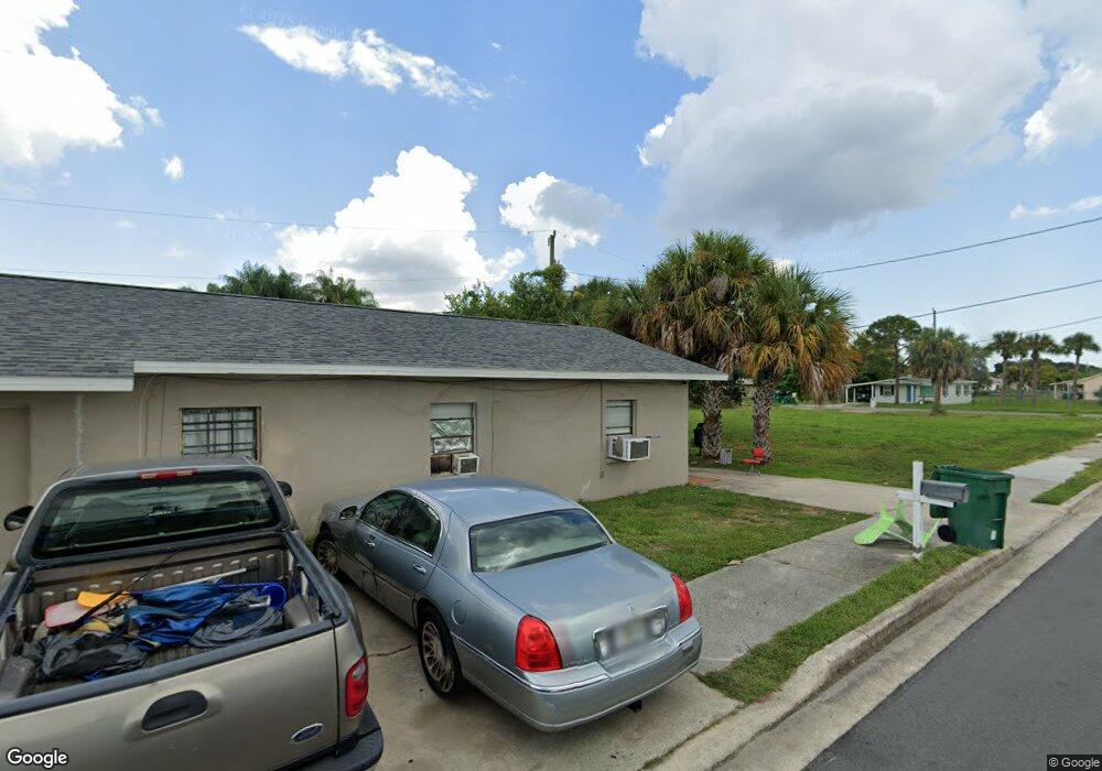
This home is located at 428 Bernard Ave Unit B, Cocoa, FL 32922 and is currently estimated at $256,590, approximately $131 per square foot. 428 Bernard Ave Unit B is a home located in Brevard County with nearby schools including Endeavour Elementary Magnet, Ronald McNair Magnet Middle School, and Rockledge Senior High School.
Ownership History
Date
Name
Owned For
Owner Type
Purchase Details
Closed on
Apr 13, 2020
Sold by
Bogart Place Properties Llc
Bought by
United Excel Investments Inc
Current Estimated Value
Create a Home Valuation Report for This Property
The Home Valuation Report is an in-depth analysis detailing your home's value as well as a comparison with similar homes in the area
Home Values in the Area
Average Home Value in this Area
Purchase History
| Date | Buyer | Sale Price | Title Company |
|---|---|---|---|
| United Excel Investments Inc | $186,000 | None Available |
Source: Public Records
Tax History
| Year | Tax Paid | Tax Assessment Tax Assessment Total Assessment is a certain percentage of the fair market value that is determined by local assessors to be the total taxable value of land and additions on the property. | Land | Improvement |
|---|---|---|---|---|
| 2025 | $4,320 | $226,800 | -- | -- |
| 2024 | $3,708 | $226,800 | -- | -- |
| 2023 | $3,708 | $181,440 | -- | -- |
| 2022 | $3,127 | $139,970 | $0 | $0 |
| 2021 | $2,878 | $108,740 | $6,300 | $102,440 |
| 2020 | $2,002 | $60,620 | $6,300 | $54,320 |
| 2019 | $1,944 | $57,740 | $6,300 | $51,440 |
| 2018 | $1,790 | $55,000 | $0 | $55,000 |
| 2017 | $1,709 | $50,000 | $0 | $50,000 |
| 2016 | $1,633 | $46,000 | $0 | $0 |
| 2015 | $1,602 | $44,000 | $6,000 | $38,000 |
| 2014 | $1,383 | $40,000 | $4,000 | $36,000 |
Source: Public Records
Map
Nearby Homes
- 610 Paw St
- 614 Paw St
- 801 Washington Ave
- 515 S Wilson Ave
- 817 Paw St
- 535 Bernard St
- 714 Johnson St
- 506 Stone St
- 000 Unknown Ln
- 0 W State Road 520 - Lot #24
- 222 Rosa L Jones Dr
- 0 Highway Us 1 Unit 1000884
- Xxxx S Fiske Blvd
- 840 Florida Ave Unit 5
- 821 Peachtree St Unit D3
- 433 King St
- Xxxx Fiske
- 989 S Fiske Blvd Unit 989 & 991
- 989 S Fiske Blvd
- 618 S Varr Ave
Your Personal Tour Guide
Ask me questions while you tour the home.