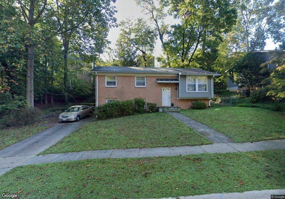
428 Branch Dr Silver Spring, MD 20901
Woodmoor NeighborhoodEstimated Value: $518,504 - $759,000
Studio
2
Baths
1,118
Sq Ft
$588/Sq Ft
Est. Value
About This Home
This home is located at 428 Branch Dr, Silver Spring, MD 20901 and is currently estimated at $656,876, approximately $587 per square foot. 428 Branch Dr is a home located in Montgomery County with nearby schools including Montgomery Knolls Elementary School, Pine Crest Elementary School, and Eastern Middle School.
Ownership History
Date
Name
Owned For
Owner Type
Purchase Details
Closed on
Jun 8, 2000
Sold by
Partridge Leslie A
Bought by
Battistone Christopher L
Current Estimated Value
Purchase Details
Closed on
Dec 21, 1993
Sold by
Solis M
Bought by
Partridge Leslie A
Home Financials for this Owner
Home Financials are based on the most recent Mortgage that was taken out on this home.
Original Mortgage
$142,500
Interest Rate
7.03%
Create a Home Valuation Report for This Property
The Home Valuation Report is an in-depth analysis detailing your home's value as well as a comparison with similar homes in the area
Home Values in the Area
Average Home Value in this Area
Purchase History
| Date | Buyer | Sale Price | Title Company |
|---|---|---|---|
| Battistone Christopher L | $157,000 | -- | |
| Partridge Leslie A | $150,000 | -- |
Source: Public Records
Mortgage History
| Date | Status | Borrower | Loan Amount |
|---|---|---|---|
| Previous Owner | Partridge Leslie A | $142,500 |
Source: Public Records
Tax History
| Year | Tax Paid | Tax Assessment Tax Assessment Total Assessment is a certain percentage of the fair market value that is determined by local assessors to be the total taxable value of land and additions on the property. | Land | Improvement |
|---|---|---|---|---|
| 2025 | $6,141 | $493,500 | $275,300 | $218,200 |
| 2024 | $6,141 | $469,900 | $0 | $0 |
| 2023 | $5,153 | $446,300 | $0 | $0 |
| 2022 | $4,626 | $422,700 | $275,300 | $147,400 |
| 2021 | $4,418 | $417,867 | $0 | $0 |
| 2020 | $4,418 | $413,033 | $0 | $0 |
| 2019 | $4,330 | $408,200 | $275,300 | $132,900 |
| 2018 | $4,294 | $407,033 | $0 | $0 |
| 2017 | $4,351 | $405,867 | $0 | $0 |
| 2016 | -- | $404,700 | $0 | $0 |
| 2015 | $3,563 | $403,100 | $0 | $0 |
| 2014 | $3,563 | $401,500 | $0 | $0 |
Source: Public Records
Map
Nearby Homes
- 414 Hillmoor Dr
- 413 Williamsburg Dr
- 10018 Brookmoor Dr
- 130 Eastmoor Dr
- 10605 Meadowhill Rd
- 414 Waterford Rd
- 314 Whitestone Rd
- 9714 Nassau Ln
- 10708 Woodsdale Dr
- 1030 Cresthaven Dr
- 10832 Margate Rd
- 10706 Stoneyhill Dr
- 10149 Sutherland Rd
- 135 Kinsman View Cir
- 211 E Indian Spring Dr
- 11001 Lockwood Dr
- 9801 Arbor Hill Dr
- 11004 Oakwood St
- 11006 Childs St
- 9720 Hedin Dr
- 433 Saint Lawrence Dr
- 431 Saint Lawrence Dr
- 426 Branch Dr
- 429 Saint Lawrence Dr
- 427 Branch Dr
- 429 Branch Dr
- 432 Branch Dr
- 427 Saint Lawrence Dr
- 424 Branch Dr
- 425 Branch Dr
- 433 Branch Dr
- 10227 Big Rock Rd
- 425 Saint Lawrence Dr
- 423 Branch Dr
- 422 Branch Dr
- 422 Saint Lawrence Dr
- 423 Saint Lawrence Dr
- 10225 Big Rock Rd
- 421 Branch Dr
- 420 Branch Dr
Your Personal Tour Guide
Ask me questions while you tour the home.