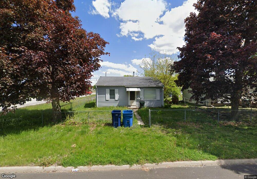
428 Hartman Ave Waterloo, IA 50701
Edison NeighborhoodEstimated Value: $100,840 - $119,000
2
Beds
1
Bath
676
Sq Ft
$165/Sq Ft
Est. Value
About This Home
This home is located at 428 Hartman Ave, Waterloo, IA 50701 and is currently estimated at $111,460, approximately $164 per square foot. 428 Hartman Ave is a home located in Black Hawk County with nearby schools including Becker Elementary School, Central Middle School, and East High School.
Ownership History
Date
Name
Owned For
Owner Type
Purchase Details
Closed on
Mar 28, 2008
Sold by
Baker Ann L
Bought by
Christiansen Leslie M
Current Estimated Value
Home Financials for this Owner
Home Financials are based on the most recent Mortgage that was taken out on this home.
Original Mortgage
$64,275
Outstanding Balance
$39,784
Interest Rate
5.62%
Mortgage Type
Assumption
Estimated Equity
$71,676
Purchase Details
Closed on
Mar 11, 2005
Sold by
Not Provided
Bought by
Baker Ann L
Purchase Details
Closed on
Feb 18, 2005
Sold by
Baker Ann L
Bought by
Iowa Northland Regional Council Of Gover
Create a Home Valuation Report for This Property
The Home Valuation Report is an in-depth analysis detailing your home's value as well as a comparison with similar homes in the area
Home Values in the Area
Average Home Value in this Area
Purchase History
| Date | Buyer | Sale Price | Title Company |
|---|---|---|---|
| Christiansen Leslie M | $65,000 | None Available | |
| Baker Ann L | $8,745 | None Available | |
| Iowa Northland Regional Council Of Gover | $2,900 | None Available |
Source: Public Records
Mortgage History
| Date | Status | Borrower | Loan Amount |
|---|---|---|---|
| Open | Christiansen Leslie M | $64,275 |
Source: Public Records
Tax History Compared to Growth
Tax History
| Year | Tax Paid | Tax Assessment Tax Assessment Total Assessment is a certain percentage of the fair market value that is determined by local assessors to be the total taxable value of land and additions on the property. | Land | Improvement |
|---|---|---|---|---|
| 2025 | $1,668 | $94,380 | $16,080 | $78,300 |
| 2024 | $1,668 | $76,850 | $16,080 | $60,770 |
| 2023 | $1,362 | $76,850 | $16,080 | $60,770 |
| 2022 | $1,465 | $62,010 | $16,080 | $45,930 |
| 2021 | $1,814 | $62,010 | $16,080 | $45,930 |
| 2020 | $1,665 | $55,820 | $9,890 | $45,930 |
| 2019 | $2,488 | $55,820 | $9,890 | $45,930 |
| 2018 | $1,485 | $55,820 | $9,890 | $45,930 |
| 2017 | $1,981 | $55,820 | $9,890 | $45,930 |
| 2016 | $1,266 | $55,820 | $9,890 | $45,930 |
| 2015 | $1,266 | $55,820 | $9,890 | $45,930 |
| 2014 | $1,290 | $55,820 | $9,890 | $45,930 |
Source: Public Records
Map
Nearby Homes
- 323 Hartman Ave
- 131 Axlewood Dr
- 1129 Wallgate Ave
- 124 Axlewood Dr
- 119 Axlewood Dr
- 118 Axlewood Dr
- 117 Axlewood Dr
- 725 Harwood Ave
- 2320 University Ave
- 631 Wallgate Ave
- 610 Wallgate Ave
- 608 Wallgate Ave
- 404 Black Hawk Rd
- 330 Black Hawk Rd
- 525 Evergreen Ave
- 516 Upton Ave
- 1.56 Acres Duryea St
- 640 Maxwell St
- 2.29 Acres Ansborough Ave
- 1221 Downing Ave
- 422 Hartman Ave
- 418 Hartman Ave
- 412 Hartman Ave
- 504 Hartman Ave
- 1101 Magnolia Pkwy
- 2027 Falls Ave
- 2019 Falls Ave
- 408 Hartman Ave
- 2101 Falls Ave
- 2101 Falls Ave Unit 1-2-3
- 2101 Falls Ave Unit 1
- 507 Hartman Ave
- 1006 Magnolia Pkwy
- 419 Hartman Ave
- 508 Hartman Ave
- 2011 Falls Ave
- 415 Hartman Ave
- 406 Hartman Ave
- 411 Hartman Ave
- 400 Hartman Ave