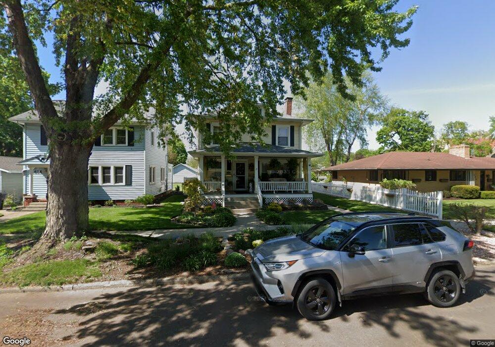
428 Maple Row Elkhart, IN 46514
Riverside NeighborhoodEstimated Value: $192,000 - $225,902
3
Beds
2
Baths
1,838
Sq Ft
$114/Sq Ft
Est. Value
About This Home
This home is located at 428 Maple Row, Elkhart, IN 46514 and is currently estimated at $208,976, approximately $113 per square foot. 428 Maple Row is a home located in Elkhart County with nearby schools including Beardsley Elementary School, North Side Middle School, and Elkhart High School.
Ownership History
Date
Name
Owned For
Owner Type
Purchase Details
Closed on
Aug 23, 2018
Sold by
Denton Peter L and Denton Julie A
Bought by
Frank Timothy A and Frank Nanette M
Current Estimated Value
Purchase Details
Closed on
Apr 18, 2001
Sold by
Frank Timothy A and Frank Nanette M
Bought by
St Pauls United Methodist Church Inc
Create a Home Valuation Report for This Property
The Home Valuation Report is an in-depth analysis detailing your home's value as well as a comparison with similar homes in the area
Home Values in the Area
Average Home Value in this Area
Purchase History
| Date | Buyer | Sale Price | Title Company |
|---|---|---|---|
| Frank Timothy A | -- | None Available | |
| St Pauls United Methodist Church Inc | -- | Meridian Title Corp |
Source: Public Records
Tax History Compared to Growth
Tax History
| Year | Tax Paid | Tax Assessment Tax Assessment Total Assessment is a certain percentage of the fair market value that is determined by local assessors to be the total taxable value of land and additions on the property. | Land | Improvement |
|---|---|---|---|---|
| 2024 | $1,849 | $190,700 | $18,500 | $172,200 |
| 2022 | $1,849 | $164,600 | $18,500 | $146,100 |
| 2021 | $1,402 | $135,100 | $18,500 | $116,600 |
| 2020 | $1,376 | $126,100 | $18,500 | $107,600 |
| 2019 | $1,251 | $115,300 | $18,500 | $96,800 |
| 2018 | $1,201 | $110,400 | $18,500 | $91,900 |
| 2017 | $1,111 | $101,900 | $18,500 | $83,400 |
| 2016 | $1,082 | $99,500 | $18,500 | $81,000 |
| 2014 | $1,021 | $96,100 | $18,500 | $77,600 |
| 2013 | $955 | $93,700 | $18,500 | $75,200 |
Source: Public Records
Map
Nearby Homes
- 509 Prospect St
- 507 Prospect St
- 120 W Sycamore St
- TBD W Washington St
- 626 Bower St
- 225 W Washington St
- 1105 Edwardsburg Ave
- 207 N 2nd St
- 1111 Edwardsburg Ave
- 1117 Edwardsburg Ave
- 1126 Edwardsburg Ave
- 154 N 6th St
- 302 W Jackson Blvd
- 710 Kilbourn St
- 226/228 & 230 W Jackson St
- 301 W Jackson Blvd
- 219 W Simonton St
- 915 Fulton St
- 100 S Michigan St
- 709 Strong Ave
- 434 Maple Row
- 424 Maple Row
- 700 Liberty St
- 714 Liberty St
- 718 Liberty St
- 414 Maple Row
- 724 Liberty St
- 628 Liberty St
- 617 N Riverside Dr
- 711 Liberty St
- 500 Maple Row
- 615 N Riverside Dr
- 715 Liberty St
- 441 W Beardsley Ave
- 717 Liberty St
- 508 Maple Row
- 501 W Beardsley Ave
- 616 Liberty St
- 512 Maple Row
- 621 Liberty St