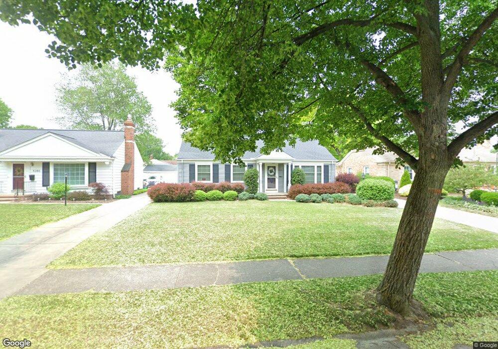
4280 Grannis Rd Cleveland, OH 44126
Estimated Value: $271,015 - $330,000
3
Beds
2
Baths
1,116
Sq Ft
$264/Sq Ft
Est. Value
About This Home
This home is located at 4280 Grannis Rd, Cleveland, OH 44126 and is currently estimated at $295,004, approximately $264 per square foot. 4280 Grannis Rd is a home located in Cuyahoga County with nearby schools including Gilles-Sweet Elementary School, Lewis F Mayer Middle School, and Fairview High School.
Ownership History
Date
Name
Owned For
Owner Type
Purchase Details
Closed on
Nov 27, 1990
Sold by
Olds Bruce A and Maureen Flynn
Bought by
Flynn-Olds Maureen
Current Estimated Value
Purchase Details
Closed on
Oct 18, 1984
Sold by
Zink Laverne M
Bought by
Olds Bruce A and Maureen Flynn
Purchase Details
Closed on
Apr 18, 1978
Sold by
Zink Laverne M
Bought by
Zink Laverne M
Purchase Details
Closed on
Jan 1, 1975
Bought by
Zink Laverne M
Create a Home Valuation Report for This Property
The Home Valuation Report is an in-depth analysis detailing your home's value as well as a comparison with similar homes in the area
Home Values in the Area
Average Home Value in this Area
Purchase History
| Date | Buyer | Sale Price | Title Company |
|---|---|---|---|
| Flynn-Olds Maureen | -- | -- | |
| Olds Bruce A | $71,000 | -- | |
| Zink Laverne M | -- | -- | |
| Zink Laverne M | -- | -- |
Source: Public Records
Tax History Compared to Growth
Tax History
| Year | Tax Paid | Tax Assessment Tax Assessment Total Assessment is a certain percentage of the fair market value that is determined by local assessors to be the total taxable value of land and additions on the property. | Land | Improvement |
|---|---|---|---|---|
| 2024 | $5,171 | $74,865 | $22,190 | $52,675 |
| 2023 | $4,630 | $57,270 | $16,770 | $40,500 |
| 2022 | $4,517 | $57,260 | $16,770 | $40,500 |
| 2021 | $4,608 | $57,260 | $16,770 | $40,500 |
| 2020 | $4,484 | $48,930 | $14,320 | $34,620 |
| 2019 | $3,988 | $139,800 | $40,900 | $98,900 |
| 2018 | $3,397 | $48,930 | $14,320 | $34,620 |
| 2017 | $2,935 | $32,940 | $11,870 | $21,070 |
| 2016 | $2,916 | $32,940 | $11,870 | $21,070 |
| 2015 | $2,764 | $32,940 | $11,870 | $21,070 |
| 2014 | $2,764 | $31,370 | $11,310 | $20,060 |
Source: Public Records
Map
Nearby Homes
- 20187 Grannis Rd
- 20688 Belvidere Ave
- 19560 Lorain Rd
- 19510 Lorain Rd Unit 201
- 20778 Woodstock Ave
- 19575 Henry Rd
- 3959 W 210th St
- 19270 Lorain Rd
- 3826 W 210th St
- 3167 Linden Rd Unit 508
- 3167 Linden Rd Unit 103
- 3167 Linden Rd Unit 309
- 3400 Wooster Rd Unit 401
- 3400 Wooster Rd Unit 412
- 3400 Wooster Rd Unit 301
- 3712 Addington Ct
- 3394 Wooster Rd
- 3420 W 210th St
- 21143 Westwood Rd
- 21236 Northwood Ave
- 4276 Grannis Rd
- 4286 Grannis Rd
- 4266 Grannis Rd
- 4296 Grannis Rd
- 4275 W 202nd St
- 4267 W 202nd St
- 4285 W 202nd St
- 4259 W 202nd St
- 4295 W 202nd St
- 4256 Grannis Rd
- 4314 Grannis Rd
- 4289 Grannis Rd
- 4273 Grannis Rd
- 4297 Grannis Rd
- 4251 W 202nd St
- 4301 W 202nd St
- 4265 Grannis Rd
- 4246 Grannis Rd
- 4322 Grannis Rd
- 4305 Grannis Rd