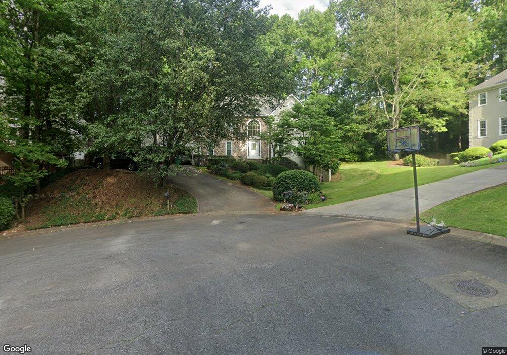
4286 Parish Trace Unit 7 Marietta, GA 30066
Sandy Plains NeighborhoodEstimated Value: $736,000 - $931,000
4
Beds
3
Baths
3,507
Sq Ft
$230/Sq Ft
Est. Value
About This Home
This home is located at 4286 Parish Trace Unit 7, Marietta, GA 30066 and is currently estimated at $808,127, approximately $230 per square foot. 4286 Parish Trace Unit 7 is a home located in Cobb County with nearby schools including Davis Elementary School, Mabry Middle School, and Lassiter High School.
Ownership History
Date
Name
Owned For
Owner Type
Purchase Details
Closed on
Sep 27, 2020
Sold by
Edelen William Stiles and Edelen Janet Ramelle
Bought by
Edelen William S and Edelen Janet R
Current Estimated Value
Purchase Details
Closed on
May 21, 1997
Sold by
Procacci Louis M and Procacci Margaret L
Bought by
Edelen William S and Edelen Janet R
Home Financials for this Owner
Home Financials are based on the most recent Mortgage that was taken out on this home.
Original Mortgage
$150,000
Outstanding Balance
$19,157
Interest Rate
7.75%
Mortgage Type
New Conventional
Estimated Equity
$788,970
Create a Home Valuation Report for This Property
The Home Valuation Report is an in-depth analysis detailing your home's value as well as a comparison with similar homes in the area
Home Values in the Area
Average Home Value in this Area
Purchase History
| Date | Buyer | Sale Price | Title Company |
|---|---|---|---|
| Edelen William S | -- | None Available | |
| Edelen William S | $238,000 | -- |
Source: Public Records
Mortgage History
| Date | Status | Borrower | Loan Amount |
|---|---|---|---|
| Open | Edelen William S | $150,000 |
Source: Public Records
Tax History Compared to Growth
Tax History
| Year | Tax Paid | Tax Assessment Tax Assessment Total Assessment is a certain percentage of the fair market value that is determined by local assessors to be the total taxable value of land and additions on the property. | Land | Improvement |
|---|---|---|---|---|
| 2025 | $1,405 | $244,000 | $64,000 | $180,000 |
| 2024 | $1,410 | $244,000 | $64,000 | $180,000 |
| 2023 | $1,218 | $248,664 | $50,000 | $198,664 |
| 2022 | $1,295 | $205,372 | $44,000 | $161,372 |
| 2021 | $1,204 | $175,128 | $40,800 | $134,328 |
| 2020 | $1,204 | $175,128 | $40,800 | $134,328 |
| 2019 | $1,144 | $154,944 | $38,000 | $116,944 |
| 2018 | $1,144 | $154,944 | $38,000 | $116,944 |
| 2017 | $1,023 | $154,944 | $38,000 | $116,944 |
| 2016 | $994 | $143,636 | $36,000 | $107,636 |
| 2015 | $1,067 | $143,636 | $36,000 | $107,636 |
| 2014 | $3,225 | $126,184 | $0 | $0 |
Source: Public Records
Map
Nearby Homes
- 4259 Arbor Club Dr
- 2713 Arbor Summit
- 2696 S Arbor Dr
- 3130 Maley Ct
- 3798 Upland Dr
- 3901 Hazelhurst Dr
- 3043 Sawyer Trace NE
- 4397 Windsor Oaks Cir
- 4464 Windsor Oaks Dr
- 3333 Devaughn Dr NE
- 2855 Lamer Trace
- 2578 Middle Coray Cir
- 3147 Swallow Dr NE
- 3350 Brookhill Cir
- 4563 Ashmore Cir NE
- 3238 Mountain Hollow Dr
- 4302 Highborne Dr NE Unit 3
- 3851 Timber Hollow Way
- 2842 Forest Chase Dr NE
- 4294 Parish Trace
- 4284 Parish Trace
- 4171 Liberty Trace
- 4300 Parish Trace
- 4169 Liberty Trace
- 4283 Parish Trace
- 4167 Liberty Trace
- 4285 Parish Trace
- 4297 Parish Trace
- 4170 Liberty Trace
- 4293 Parish Trace
- 4287 Parish Trace
- 4168 Liberty Trace
- 4163 Liberty Trace
- 4175 Liberty Trace
- 4291 Parish Trace
- 4289 Parish Trace Unit 7
- 4289 Parish Trace NE
- 4166 Liberty Trace Unit 7
- 4172 Liberty Trace