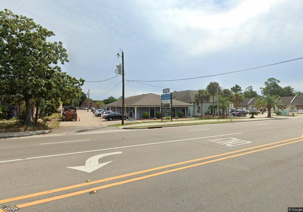
428A 428 Courthouse Road Dr Unit A Gulfport, MS 39507
Mississippi City NeighborhoodEstimated Value: $455,205
--
Bed
--
Bath
1,160
Sq Ft
$392/Sq Ft
Est. Value
About This Home
This home is located at 428A 428 Courthouse Road Dr Unit A, Gulfport, MS 39507 and is currently estimated at $455,205, approximately $392 per square foot. 428A 428 Courthouse Road Dr Unit A is a home located in Harrison County with nearby schools including Pass Road Elementary School, Bayou View Middle School, and Gulfport High School.
Ownership History
Date
Name
Owned For
Owner Type
Purchase Details
Closed on
Oct 11, 2023
Sold by
Mcneil James M and Aquadro Mary Ann
Bought by
Mary Ann Aquadro and Mary James Marshall
Current Estimated Value
Purchase Details
Closed on
Apr 11, 2016
Sold by
Dea Investments Llc
Bought by
Dapremont Edgar M
Home Financials for this Owner
Home Financials are based on the most recent Mortgage that was taken out on this home.
Original Mortgage
$260,000
Interest Rate
3.73%
Mortgage Type
Commercial
Create a Home Valuation Report for This Property
The Home Valuation Report is an in-depth analysis detailing your home's value as well as a comparison with similar homes in the area
Home Values in the Area
Average Home Value in this Area
Purchase History
| Date | Buyer | Sale Price | Title Company |
|---|---|---|---|
| Mary Ann Aquadro | -- | None Listed On Document | |
| Dapremont Edgar M | -- | -- |
Source: Public Records
Mortgage History
| Date | Status | Borrower | Loan Amount |
|---|---|---|---|
| Previous Owner | Dapremont Edgar M | $260,000 | |
| Previous Owner | Dapremont Edgar M | $250,000 | |
| Previous Owner | Stewart Richard Brent | $0 | |
| Previous Owner | Dapremont Edgar M | $0 |
Source: Public Records
Tax History Compared to Growth
Tax History
| Year | Tax Paid | Tax Assessment Tax Assessment Total Assessment is a certain percentage of the fair market value that is determined by local assessors to be the total taxable value of land and additions on the property. | Land | Improvement |
|---|---|---|---|---|
| 2024 | $5,387 | $40,822 | $0 | $0 |
| 2023 | $5,582 | $41,266 | $0 | $0 |
| 2022 | $5,582 | $41,266 | $0 | $0 |
| 2021 | $5,582 | $41,266 | $0 | $0 |
| 2020 | $5,417 | $40,046 | $0 | $0 |
| 2019 | $5,417 | $40,046 | $0 | $0 |
| 2018 | $5,417 | $40,046 | $0 | $0 |
| 2017 | $5,417 | $40,046 | $0 | $0 |
| 2015 | $6,813 | $50,369 | $0 | $0 |
| 2014 | -- | $58,372 | $0 | $0 |
| 2013 | -- | $50,369 | $12,004 | $38,365 |
Source: Public Records
Map
Nearby Homes
- 0 Courthouse Rd Unit 4115290
- 28 Woodglen Dr
- 15 Oakwood Dr
- 25 Oakwood Dr
- 30 31st St
- 102 Dogwood Dr
- 22 E Park St
- 247 Oakwood Dr
- 218 Pinewood Cir
- 30 Independence Dr
- 445 Evans Ave
- 14 Independence Dr
- 24 Independence Dr
- 554 Loposser Ave
- 610 W Oak Dr
- 267 Dolan Ave
- 207 Palmetto Ln
- 519 16th St
- 631 Mcintosh St
- 311 16th St
- 428A 428 Courthouse Road Dr
- 428 Courthouse Rd
- 446 Courthouse Rd
- 412 Security Square
- 432 Courthouse Rd
- 414 Security Square
- 420 Security Square
- 11 30th St
- 418 Security Square
- 424 Security Square
- 00 30th St
- 452 Courthouse Rd Unit F
- 452 Courthouse Rd Unit D
- 452 Courthouse Rd Unit H
- 452 Courthouse Rd Unit Suite F
- 452 Courthouse Rd Unit G
- 452 Courthouse Rd Unit C & D
- 452 Courthouse Rd Unit E
- 452 Courthouse Rd
- 452 Courthouse Rd Unit C