Estimated Value: $182,000 - $202,000
3
Beds
2
Baths
1,107
Sq Ft
$174/Sq Ft
Est. Value
About This Home
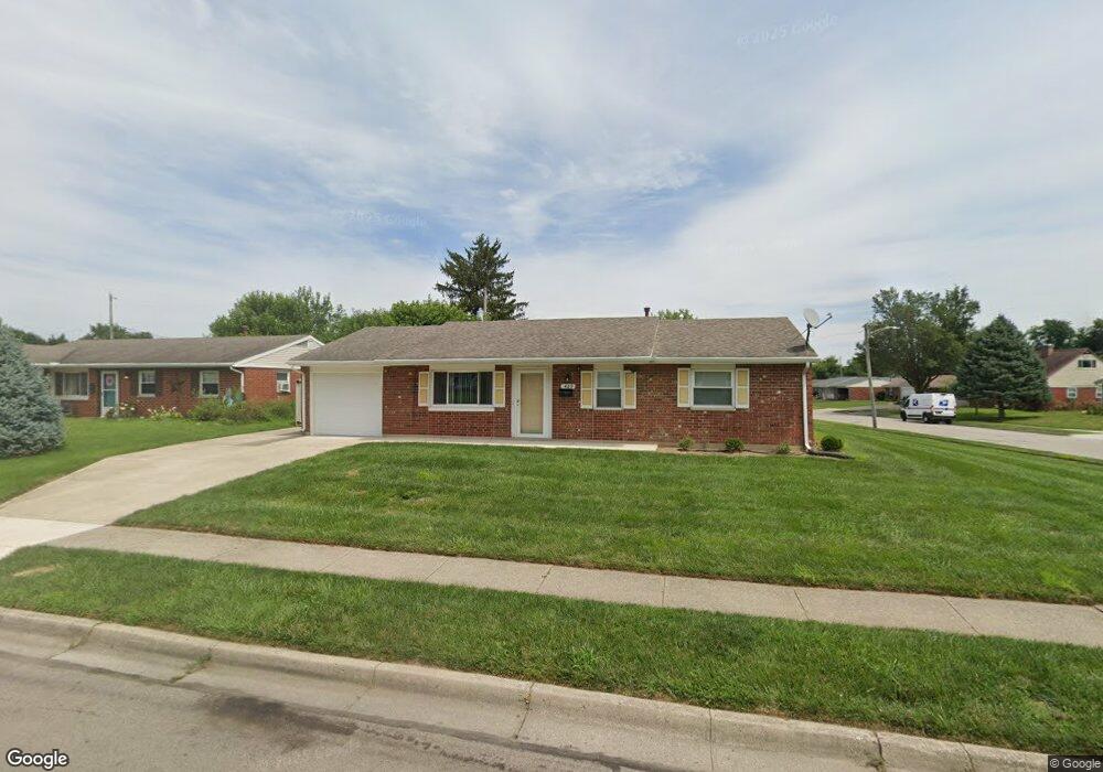
This home is located at 429 Colorado Dr, Xenia, OH 45385 and is currently estimated at $192,263, approximately $173 per square foot. 429 Colorado Dr is a home located in Greene County with nearby schools including Xenia High School and Summit Academy Community School for Alternative Learners - Xenia.
Ownership History
Date
Name
Owned For
Owner Type
Purchase Details
Closed on
Oct 30, 2023
Sold by
Lewis Charles E
Bought by
Lewis Mattie E
Current Estimated Value
Purchase Details
Closed on
Jan 30, 2007
Sold by
Wilson Marilyn F
Bought by
Lewis Charles E
Home Financials for this Owner
Home Financials are based on the most recent Mortgage that was taken out on this home.
Original Mortgage
$94,000
Interest Rate
6.22%
Mortgage Type
VA
Purchase Details
Closed on
Sep 21, 2006
Sold by
Beatty James R and Beatty Delores A
Bought by
Wilson Marilyn F
Purchase Details
Closed on
Jul 6, 1995
Sold by
Poe Harry A
Bought by
Beatty James R
Home Financials for this Owner
Home Financials are based on the most recent Mortgage that was taken out on this home.
Original Mortgage
$47,000
Interest Rate
7.9%
Mortgage Type
New Conventional
Create a Home Valuation Report for This Property
The Home Valuation Report is an in-depth analysis detailing your home's value as well as a comparison with similar homes in the area
Home Values in the Area
Average Home Value in this Area
Purchase History
| Date | Buyer | Sale Price | Title Company |
|---|---|---|---|
| Lewis Mattie E | -- | None Listed On Document | |
| Lewis Charles E | $94,000 | Attorney | |
| Wilson Marilyn F | $58,000 | None Available | |
| Beatty James R | $65,000 | -- |
Source: Public Records
Mortgage History
| Date | Status | Borrower | Loan Amount |
|---|---|---|---|
| Previous Owner | Lewis Charles E | $94,000 | |
| Previous Owner | Beatty James R | $47,000 |
Source: Public Records
Tax History Compared to Growth
Tax History
| Year | Tax Paid | Tax Assessment Tax Assessment Total Assessment is a certain percentage of the fair market value that is determined by local assessors to be the total taxable value of land and additions on the property. | Land | Improvement |
|---|---|---|---|---|
| 2024 | $1,625 | $48,770 | $12,840 | $35,930 |
| 2023 | $1,625 | $48,770 | $12,840 | $35,930 |
| 2022 | $1,252 | $34,350 | $7,550 | $26,800 |
| 2021 | $1,269 | $34,350 | $7,550 | $26,800 |
| 2020 | $1,214 | $34,350 | $7,550 | $26,800 |
| 2019 | $996 | $28,510 | $7,490 | $21,020 |
| 2018 | $1,000 | $28,510 | $7,490 | $21,020 |
| 2017 | $883 | $28,510 | $7,490 | $21,020 |
| 2016 | $884 | $25,900 | $7,490 | $18,410 |
| 2015 | $886 | $25,900 | $7,490 | $18,410 |
| 2014 | $848 | $25,900 | $7,490 | $18,410 |
Source: Public Records
Map
Nearby Homes
- 414 Whisper Ln
- 2142 Michigan Dr
- 219 Kansas Dr
- 2758 Wyoming Dr
- 2545 Harmony Dr
- 161 Montana Dr
- 1653 Seneca Dr
- 2257 Maryland Dr
- 1769 Gayhart Dr
- 1829 Gayhart Dr
- 1618 Navajo Dr
- 1403 Texas Dr
- 1568 Cheyenne Dr
- 1908 Whitt St
- 1778 Arapaho Dr
- 1107 Arkansas Dr
- 2345 Tennessee Dr
- 1255 Colorado Dr
- 1866 Roxbury Dr
- 2499 Jenny Marie Dr
- 415 Colorado Dr
- 1986 Iowa Dr
- 401 Colorado Dr
- 2001 Iowa Dr
- 442 Colorado Dr
- 1972 Iowa Dr
- 428 Colorado Dr
- 1987 Iowa Dr
- 414 Colorado Dr
- 385 Colorado Dr
- 1985 Oklahoma Dr
- 458 Colorado Dr
- 1973 Iowa Dr
- 1958 Iowa Dr
- 400 Colorado Dr
- 1971 Oklahoma Dr
- 2014 Pennsylvania Dr
- 2028 Pennsylvania Dr
- 2000 Pennsylvania Dr
- 472 Colorado Dr