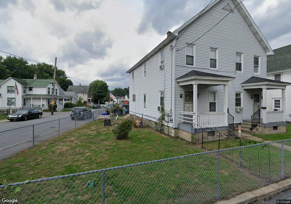
429 Laurel St Scranton, PA 18508
Tripp's Park NeighborhoodEstimated Value: $125,759 - $208,000
Studio
--
Bath
--
Sq Ft
5,271
Sq Ft Lot Lot
About This Home
This home is located at 429 Laurel St, Scranton, PA 18508 and is currently estimated at $172,940. 429 Laurel St is a home located in Lackawanna County with nearby schools including Neil Armstrong Elementary School, Northeast Scranton Intermediate School, and Scranton High School.
Ownership History
Date
Name
Owned For
Owner Type
Purchase Details
Closed on
Jun 4, 2012
Sold by
Lipinski Catherine T
Bought by
George William J and George Marjorie
Current Estimated Value
Create a Home Valuation Report for This Property
The Home Valuation Report is an in-depth analysis detailing your home's value as well as a comparison with similar homes in the area
Home Values in the Area
Average Home Value in this Area
Purchase History
We collect this data history from publicly available records. To have your information removed, we recommend requesting removal directly through your county’s website.
| Date | Buyer | Sale Price | Title Company |
|---|---|---|---|
| George William J | $33,000 | None Available |
Source: Public Records
Tax History
| Year | Tax Paid | Tax Assessment Tax Assessment Total Assessment is a certain percentage of the fair market value that is determined by local assessors to be the total taxable value of land and additions on the property. | Land | Improvement |
|---|---|---|---|---|
| 2026 | $21,453 | $134,090 | $26,080 | $108,010 |
| 2025 | $3,384 | $10,500 | $1,700 | $8,800 |
| 2024 | $3,093 | $10,500 | $1,700 | $8,800 |
| 2023 | $3,093 | $10,500 | $1,700 | $8,800 |
| 2022 | $3,025 | $10,500 | $1,700 | $8,800 |
| 2021 | $3,025 | $10,500 | $1,700 | $8,800 |
| 2020 | $2,968 | $10,500 | $1,700 | $8,800 |
| 2019 | $2,792 | $10,500 | $1,700 | $8,800 |
| 2018 | $2,792 | $10,500 | $1,700 | $8,800 |
| 2017 | $2,743 | $10,500 | $1,700 | $8,800 |
| 2016 | $840 | $10,500 | $1,700 | $8,800 |
| 2015 | $2,059 | $10,500 | $1,700 | $8,800 |
| 2014 | -- | $10,500 | $1,700 | $8,800 |
Source: Public Records
Map
Nearby Homes
- 1928 Brick Ave
- 401 Putnam St
- 429 Leggett St
- 546 Leggett St
- 339 Ferdinand St
- 215- 215 & 1 2 William St
- 220 Ferdinand St
- 214 William St
- 240 Theodore St
- 2115-2117 Wayne Ave
- 805 Ferdinand St
- 2045 Edna Ave
- 1425 N Rebecca Ave
- 1402 N Rebecca Ave
- 514 Albion St
- 1438 Church Ave Unit 1440
- 1817 Ross Ave
- 245 W Parker St
- 1436 Church Ave
- 2217 Golden Ave
Your Personal Tour Guide
Ask me questions while you tour the home.