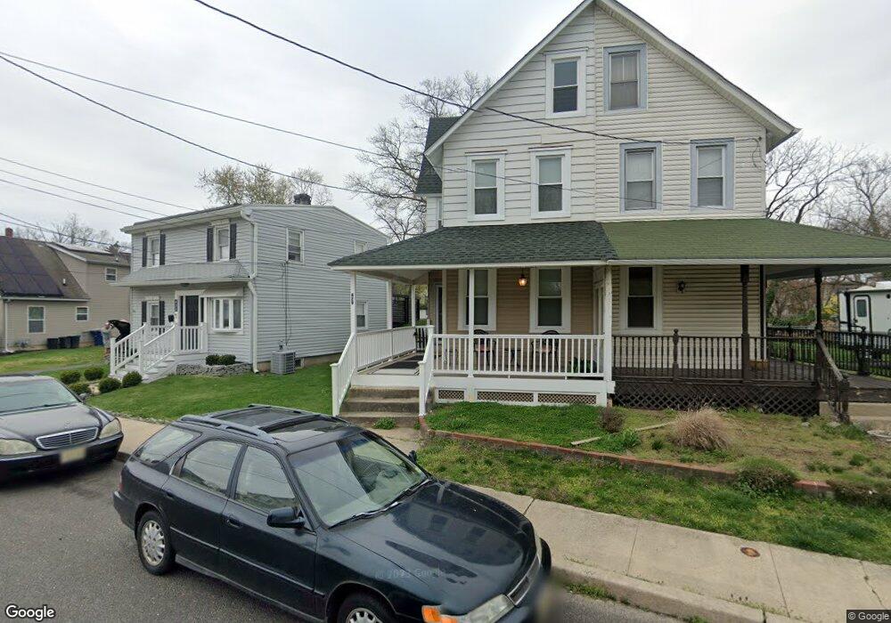
429 Locust St Moorestown, NJ 08057
Estimated Value: $282,000 - $422,000
--
Bed
--
Bath
1,472
Sq Ft
$226/Sq Ft
Est. Value
About This Home
This home is located at 429 Locust St, Moorestown, NJ 08057 and is currently estimated at $333,364, approximately $226 per square foot. 429 Locust St is a home located in Burlington County with nearby schools including George C. Baker Elementary School, Moorestown Upper Elementary School, and William Allen Middle School.
Ownership History
Date
Name
Owned For
Owner Type
Purchase Details
Closed on
Apr 8, 2022
Sold by
Nice Edward H and Nice Brandi L
Bought by
Kagan Alicia and Redman Daniel
Current Estimated Value
Purchase Details
Closed on
Jul 29, 1996
Sold by
Gerber Eileen
Bought by
Nice Edward Horace and Nice Brandi L
Purchase Details
Closed on
Mar 29, 1996
Sold by
Nice Edward H and Smith Brandi L
Bought by
Nice Edward H and Smith Brandi L
Create a Home Valuation Report for This Property
The Home Valuation Report is an in-depth analysis detailing your home's value as well as a comparison with similar homes in the area
Home Values in the Area
Average Home Value in this Area
Purchase History
| Date | Buyer | Sale Price | Title Company |
|---|---|---|---|
| Kagan Alicia | $230,000 | Voorhees Gregory X | |
| Nice Edward Horace | $173,000 | Infinity Title Agency Inc | |
| Nice Edward H | -- | -- |
Source: Public Records
Tax History Compared to Growth
Tax History
| Year | Tax Paid | Tax Assessment Tax Assessment Total Assessment is a certain percentage of the fair market value that is determined by local assessors to be the total taxable value of land and additions on the property. | Land | Improvement |
|---|---|---|---|---|
| 2025 | $4,122 | $145,300 | $76,600 | $68,700 |
| 2024 | $3,997 | $145,300 | $76,600 | $68,700 |
| 2023 | $3,997 | $145,300 | $76,600 | $68,700 |
| 2022 | $3,957 | $145,300 | $76,600 | $68,700 |
| 2021 | $3,904 | $145,300 | $76,600 | $68,700 |
| 2020 | $3,880 | $145,300 | $76,600 | $68,700 |
| 2019 | $3,811 | $145,300 | $76,600 | $68,700 |
| 2018 | $3,708 | $145,300 | $76,600 | $68,700 |
| 2017 | $3,740 | $145,300 | $76,600 | $68,700 |
| 2016 | $3,727 | $145,300 | $76,600 | $68,700 |
| 2015 | $3,682 | $145,300 | $76,600 | $68,700 |
| 2014 | $3,496 | $145,300 | $76,600 | $68,700 |
Source: Public Records
Map
Nearby Homes
- 493 N Church St
- 313 Fairview Ave
- 308 Farmdale Rd
- 316 W 3rd St
- 316 Farmdale Rd
- 543 Bethel Ave
- 423 Park Blvd
- 4 W Close
- 129 S Church St
- 531 Covington Terrace
- 15 E 2nd St
- 50 E 3rd St
- 66 E 3rd St
- 600 Stratford Dr
- 601 Stratford Dr
- 82 E 3rd St
- 80 E 3rd St
- 310 S Washington Ave
- 308 Kenwood Dr
- 133 Plum St Unit 6