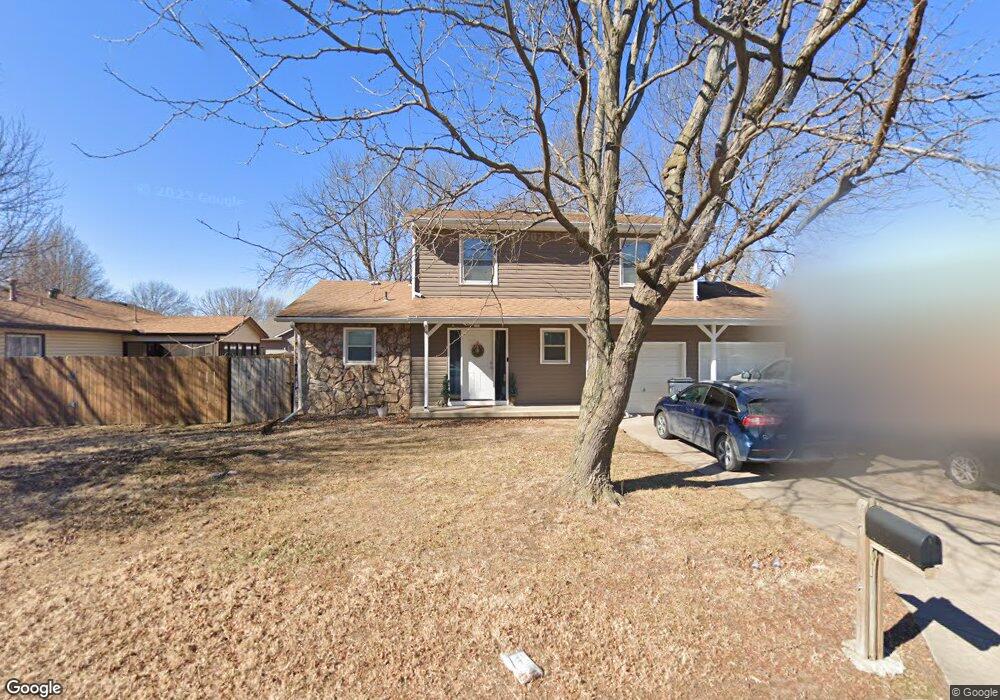
429 Ranger St Haysville, KS 67060
Estimated Value: $238,000
3
Beds
2
Baths
2,247
Sq Ft
$106/Sq Ft
Est. Value
About This Home
This home is located at 429 Ranger St, Haysville, KS 67060 and is currently estimated at $238,000, approximately $105 per square foot. 429 Ranger St is a home located in Sedgwick County with nearby schools including Freeman Elementary School, Haysville Middle School, and Campus High School.
Ownership History
Date
Name
Owned For
Owner Type
Purchase Details
Closed on
Jan 2, 2023
Sold by
Gomm Michael and Gomm Valarie
Bought by
Gomm Holdings Llc
Current Estimated Value
Purchase Details
Closed on
Mar 22, 2012
Sold by
Secretary Of Housing & Urban Development
Bought by
Gomm Michael and Gomm Valarie
Home Financials for this Owner
Home Financials are based on the most recent Mortgage that was taken out on this home.
Original Mortgage
$68,475
Interest Rate
3.9%
Mortgage Type
New Conventional
Purchase Details
Closed on
Aug 27, 2008
Sold by
Giron Manuel and Giron Ruperta
Bought by
Edwards Brian K and Edwards Christina J
Home Financials for this Owner
Home Financials are based on the most recent Mortgage that was taken out on this home.
Original Mortgage
$110,988
Interest Rate
6.29%
Mortgage Type
New Conventional
Create a Home Valuation Report for This Property
The Home Valuation Report is an in-depth analysis detailing your home's value as well as a comparison with similar homes in the area
Home Values in the Area
Average Home Value in this Area
Purchase History
| Date | Buyer | Sale Price | Title Company |
|---|---|---|---|
| Gomm Holdings Llc | -- | Meridian Title | |
| Gomm Michael | -- | Sec 1St | |
| Edwards Brian K | -- | Lawyers Title Ins Corp |
Source: Public Records
Mortgage History
| Date | Status | Borrower | Loan Amount |
|---|---|---|---|
| Previous Owner | Gomm Michael | $68,475 | |
| Previous Owner | Edwards Brian K | $110,988 |
Source: Public Records
Tax History Compared to Growth
Tax History
| Year | Tax Paid | Tax Assessment Tax Assessment Total Assessment is a certain percentage of the fair market value that is determined by local assessors to be the total taxable value of land and additions on the property. | Land | Improvement |
|---|---|---|---|---|
| 2025 | $2,449 | $19,366 | $4,577 | $14,789 |
| 2023 | $2,449 | $18,102 | $3,278 | $14,824 |
| 2022 | $2,543 | $17,366 | $3,094 | $14,272 |
| 2021 | $2,394 | $16,078 | $2,680 | $13,398 |
| 2020 | $2,285 | $15,100 | $2,680 | $12,420 |
| 2019 | $2,235 | $14,709 | $2,680 | $12,029 |
| 2018 | $2,133 | $14,145 | $2,461 | $11,684 |
| 2017 | $2,075 | $0 | $0 | $0 |
| 2016 | $2,077 | $0 | $0 | $0 |
| 2015 | $2,077 | $0 | $0 | $0 |
| 2014 | $2,080 | $0 | $0 | $0 |
Source: Public Records
Map
Nearby Homes
- 1204 W Leonard St
- 504 S Shira Cir
- 1509 W 4th St
- 238 Western Ave
- 181 Sunset Ave
- 200 Sunset Ave
- 214 Stearns Ave
- 150 Sunset Ave
- 242 Wire Ave
- 449 W 4th St
- 2103 W Schoolhouse St
- 115 Hungerford Ave
- 812 S Saddle Brooke Ct
- 415 Spring Dr
- 213 Timberlane Ct
- 221 River Birch St
- 988 Alexander Dr
- 523 Alexander Dr
- 1307 W Hannah Ln
- 400 Alexander Dr