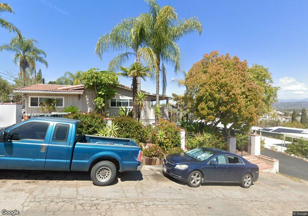
429 S Upas St Escondido, CA 92025
Central Escondido NeighborhoodEstimated Value: $166,261 - $964,000
--
Bed
--
Bath
--
Sq Ft
9,583
Sq Ft Lot
About This Home
This home is located at 429 S Upas St, Escondido, CA 92025 and is currently estimated at $611,815. 429 S Upas St is a home located in San Diego County with nearby schools including Felicita Elementary, Del Dios Academy of Arts & Sciences, and San Pasqual High School.
Ownership History
Date
Name
Owned For
Owner Type
Purchase Details
Closed on
Apr 11, 2016
Sold by
Bita Trading Inc
Bought by
Rhead Edward Duncan
Current Estimated Value
Purchase Details
Closed on
Jul 6, 2015
Sold by
Rismani Hossein and Rismani Amanda
Bought by
Bita Trading Inc
Purchase Details
Closed on
Mar 15, 2010
Sold by
Azufra Samson V and Azufra Elena A
Bought by
Rismani Hossein and Rismani Amanda
Purchase Details
Closed on
Jul 6, 2001
Sold by
Azufra Samson V and Azufra Elena A
Bought by
Azufra Samson and Azufra Elena A
Purchase Details
Closed on
Nov 23, 1999
Sold by
Frank Romy Sue
Bought by
Frank Warren
Purchase Details
Closed on
Jan 30, 1989
Purchase Details
Closed on
Oct 10, 1986
Create a Home Valuation Report for This Property
The Home Valuation Report is an in-depth analysis detailing your home's value as well as a comparison with similar homes in the area
Home Values in the Area
Average Home Value in this Area
Purchase History
| Date | Buyer | Sale Price | Title Company |
|---|---|---|---|
| Rhead Edward Duncan | $91,000 | California T Title Company | |
| Bita Trading Inc | $500,000 | California Title Company | |
| Rismani Hossein | $50,000 | California Title Company | |
| Azufra Samson | -- | -- | |
| Frank Warren | -- | Commonwealth Land Title Co | |
| -- | $35,000 | -- | |
| -- | $299,000 | -- |
Source: Public Records
Tax History Compared to Growth
Tax History
| Year | Tax Paid | Tax Assessment Tax Assessment Total Assessment is a certain percentage of the fair market value that is determined by local assessors to be the total taxable value of land and additions on the property. | Land | Improvement |
|---|---|---|---|---|
| 2025 | $1,227 | $107,444 | $107,444 | -- |
| 2024 | $1,227 | $105,338 | $105,338 | -- |
| 2023 | $1,199 | $103,273 | $103,273 | $0 |
| 2022 | $1,187 | $101,249 | $101,249 | $0 |
| 2021 | $1,168 | $99,264 | $99,264 | $0 |
| 2020 | $1,161 | $98,247 | $98,247 | $0 |
| 2019 | $1,134 | $96,321 | $96,321 | $0 |
| 2018 | $1,103 | $94,433 | $94,433 | $0 |
| 2017 | $1,085 | $92,582 | $92,582 | $0 |
| 2016 | $712 | $60,000 | $60,000 | $0 |
| 2015 | $643 | $53,591 | $53,591 | $0 |
| 2014 | $618 | $52,542 | $52,542 | $0 |
Source: Public Records
Map
Nearby Homes
- 1049 W 5th Ave
- 401 S Vine St
- 880 La Terraza Blvd
- 936 W 3rd Ave
- 967 W 2nd Ave
- 308 S Tulip St
- 819 W 7th Ave
- 1001 Ontario St
- 752 W 9th Ave
- 759 W 10th Ave
- 509 W 2nd Ave
- 1369 W 11th Ave
- 215 Antoni Glen Unit 1112
- 1711 Alhudson Dr
- 225 Royal Glen Unit 408
- 514 W 10th Ave
- 1756 Alhudson Dr
- 1575 W Valley Pkwy Unit 25
- 335 W 3rd Ave
- 320 W 8th Ave
- 429 S Underpass Unit 429
- 429 S Underpass Unit 1
- 429 S Quince St
- 427 S Upas St
- 437 S Upas St
- 1040 W 5th Ave
- 1030 W 5th Ave
- 411 S Upas St
- 1020 W 5th Ave
- 447 S Upas St
- 1050 W 5th Ave
- 457 S Upas St
- 422 S Vine St
- 440 S Vine St
- 351 S Quince St
- 351 S Upas St
- 1062 W 5th Ave
- 981 W 4th Ave
- 992 W 5th Ave
- 321 S Upas St