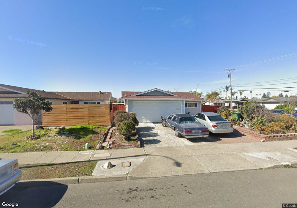
429 Sunset Rd Alameda, CA 94501
South Shore NeighborhoodEstimated Value: $1,126,408 - $1,412,000
3
Beds
2
Baths
1,438
Sq Ft
$894/Sq Ft
Est. Value
About This Home
This home is located at 429 Sunset Rd, Alameda, CA 94501 and is currently estimated at $1,285,102, approximately $893 per square foot. 429 Sunset Rd is a home located in Alameda County with nearby schools including William G. Paden Elementary School, Will C. Wood Middle School, and Encinal Junior/Senior High.
Ownership History
Date
Name
Owned For
Owner Type
Purchase Details
Closed on
Mar 30, 2001
Sold by
Smithson Floyd G and Smithson Living Trust
Bought by
Aquino Romeo R
Current Estimated Value
Home Financials for this Owner
Home Financials are based on the most recent Mortgage that was taken out on this home.
Original Mortgage
$340,000
Outstanding Balance
$126,923
Interest Rate
7.19%
Estimated Equity
$1,158,179
Purchase Details
Closed on
Jan 30, 2001
Sold by
Smithson Floyd G and Hansen Trust
Bought by
Smithson Floyd G and Smithson Frances A
Home Financials for this Owner
Home Financials are based on the most recent Mortgage that was taken out on this home.
Original Mortgage
$340,000
Outstanding Balance
$126,923
Interest Rate
7.19%
Estimated Equity
$1,158,179
Create a Home Valuation Report for This Property
The Home Valuation Report is an in-depth analysis detailing your home's value as well as a comparison with similar homes in the area
Home Values in the Area
Average Home Value in this Area
Purchase History
| Date | Buyer | Sale Price | Title Company |
|---|---|---|---|
| Aquino Romeo R | $425,000 | Placer Title Company | |
| Smithson Floyd G | -- | -- |
Source: Public Records
Mortgage History
| Date | Status | Borrower | Loan Amount |
|---|---|---|---|
| Open | Aquino Romeo R | $340,000 | |
| Closed | Aquino Romeo R | $42,500 |
Source: Public Records
Tax History
| Year | Tax Paid | Tax Assessment Tax Assessment Total Assessment is a certain percentage of the fair market value that is determined by local assessors to be the total taxable value of land and additions on the property. | Land | Improvement |
|---|---|---|---|---|
| 2025 | $8,796 | $633,360 | $192,108 | $448,252 |
| 2024 | $8,796 | $620,805 | $188,341 | $439,464 |
| 2023 | $9,273 | $615,497 | $184,649 | $430,848 |
| 2022 | $9,063 | $596,431 | $181,029 | $422,402 |
| 2021 | $8,843 | $584,600 | $177,480 | $414,120 |
| 2020 | $8,734 | $585,534 | $175,660 | $409,874 |
| 2019 | $8,240 | $574,055 | $172,216 | $401,839 |
| 2018 | $8,032 | $562,801 | $168,840 | $393,961 |
| 2017 | $7,669 | $551,768 | $165,530 | $386,238 |
| 2016 | $7,672 | $540,951 | $162,285 | $378,666 |
| 2015 | $7,643 | $532,830 | $159,849 | $372,981 |
| 2014 | $7,252 | $522,397 | $156,719 | $365,678 |
Source: Public Records
Map
Nearby Homes
- 400 Harbor Light Rd
- 1246 Otis Dr
- 955 Shorepoint Ct Unit 110
- 955 Shorepoint Ct Unit 216
- 960 Shorepoint Ct Unit 215
- 2000 Clinton Ave
- 2031 Otis Dr Unit H
- 1822 San Antonio Ave
- 2106 Otis Dr Unit A
- 2101 Shoreline Dr Unit 153
- 2101 Shoreline Dr Unit 475
- 610 Grand St
- 1211 Paru St
- 1203 Benton St
- 1500 Alameda Ave Unit G
- 1220 9th St
- 1000 Central Ave
- 1401 Cottage St Unit D
- 1427 Bay St
- 1211 Santa Clara Ave
- 425 Sunset Rd
- 428 Coral Reef Rd
- 421 Sunset Rd
- 424 Coral Reef Rd
- 1221 Coral Reef Place
- 1217 Coral Reef Place
- 420 Coral Reef Rd
- 428 Sunset Rd
- 417 Sunset Rd
- 1213 Coral Reef Place
- 432 Sunset Rd
- 424 Sunset Rd
- 1225 Coral Reef Place
- 416 Coral Reef Rd
- 1209 Coral Reef Place
- 420 Sunset Rd
- 1229 Coral Reef Place
- 413 Sunset Rd
- 416 Sunset Rd
- 412 Coral Reef Rd
Your Personal Tour Guide
Ask me questions while you tour the home.