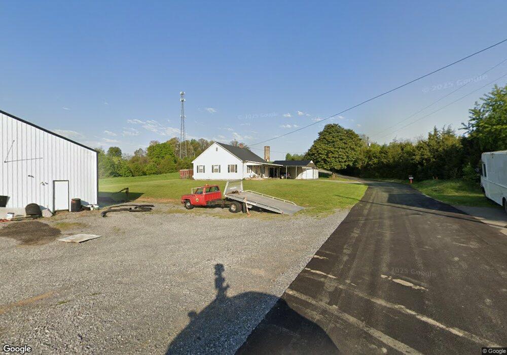
4292 Old Lowland Rd Morristown, TN 37813
Estimated Value: $309,000 - $878,890
3
Beds
1
Bath
1,112
Sq Ft
$534/Sq Ft
Est. Value
About This Home
This home is located at 4292 Old Lowland Rd, Morristown, TN 37813 and is currently estimated at $593,945, approximately $534 per square foot. 4292 Old Lowland Rd is a home located in Hamblen County with nearby schools including Union Heights Elementary School, East Ridge Middle School, and Morristown East High School.
Ownership History
Date
Name
Owned For
Owner Type
Purchase Details
Closed on
Jul 17, 2025
Sold by
Matthews Frank
Bought by
Matthews Frank and Claiborne Todd T
Current Estimated Value
Purchase Details
Closed on
Jun 10, 2022
Sold by
Frank Matthews
Bought by
Morristown Utilities Commission
Purchase Details
Closed on
Aug 4, 2014
Sold by
Matthews Franklin Riley
Bought by
Circle C Cowboy Church
Purchase Details
Closed on
Aug 1, 1941
Bought by
Matthews Frank
Create a Home Valuation Report for This Property
The Home Valuation Report is an in-depth analysis detailing your home's value as well as a comparison with similar homes in the area
Home Values in the Area
Average Home Value in this Area
Purchase History
| Date | Buyer | Sale Price | Title Company |
|---|---|---|---|
| Matthews Frank | $3,700,000 | First Priority Title Company | |
| Matthews Frank | $3,700,000 | First Priority Title Company | |
| Morristown Utilities Commission | $5,000 | New Title Company Name | |
| Circle C Cowboy Church | $12,500 | -- | |
| Matthews Frank | -- | -- |
Source: Public Records
Tax History Compared to Growth
Tax History
| Year | Tax Paid | Tax Assessment Tax Assessment Total Assessment is a certain percentage of the fair market value that is determined by local assessors to be the total taxable value of land and additions on the property. | Land | Improvement |
|---|---|---|---|---|
| 2024 | $1,238 | $62,825 | $44,825 | $18,000 |
| 2023 | $1,238 | $62,825 | $0 | $0 |
| 2022 | $1,238 | $62,825 | $44,825 | $18,000 |
| 2021 | $1,238 | $62,825 | $44,825 | $18,000 |
| 2020 | $1,238 | $62,825 | $44,825 | $18,000 |
| 2019 | $1,031 | $48,425 | $36,725 | $11,700 |
| 2018 | $1,031 | $48,425 | $36,725 | $11,700 |
| 2017 | $1,031 | $48,425 | $36,725 | $11,700 |
| 2016 | $959 | $48,175 | $36,725 | $11,450 |
| 2015 | $891 | $48,175 | $36,725 | $11,450 |
| 2014 | -- | $48,175 | $36,725 | $11,450 |
| 2013 | -- | $47,925 | $0 | $0 |
Source: Public Records
Map
Nearby Homes
- 2036 River View Dr
- 2034 River View Dr
- 2034 River View Dr Unit 1
- 4520 Enka Hwy
- 58/Ac Tbd River View Dr
- 58/Ac Tbd River View Dr Unit 2
- 0 Tbd River View Dr Unit Lot@WP001
- 4207 Clyde Thomas Rd
- 0 Springvale Rd
- 2840-2830 Robinson Creek Rd
- 4996 Saint Paul Rd
- TBD Buell Chapel Rd
- 5262 Buell Chapel Rd
- 1163 Nathan Dr
- 848 Spencer Hale Rd
- 3080 Chucky River Rd
- 2205 Kingswood Dr
- 2280 Kingswood Dr
- 2137 Highview Dr
- 1051 Wilson Hale Rd
- 4291 Old Lowland Rd
- 4315 Enka Hwy
- 4357 Old Lowland Rd
- 2926 Cobble Ln
- 4327 Toni Ave
- 2311 Amanda Ave
- 4133 Sandria Ln
- 2331 Amanda Ave
- 2911 Cobble Ln
- 4330 Toni Ave
- 2291 Amanda Ave
- 4375 Toni Ave
- 2300 Amanda Ave
- 4360 Toni Ave
- 2290 Amanda Ave
- 2250 Amanda Ave
- 4195 Cooper Dr
- 2925 Cobble Ln
- 2068 River View Dr
- 2931 Cobble Ln