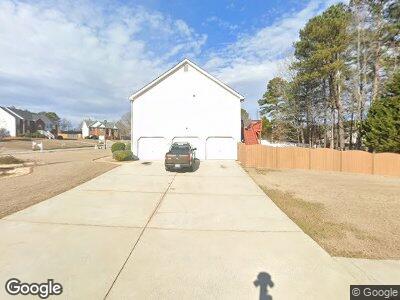
4298 Tillage Path Unit 1 Douglasville, GA 30135
Anneewakee NeighborhoodEstimated Value: $331,250 - $369,000
3
Beds
2
Baths
1,772
Sq Ft
$193/Sq Ft
Est. Value
About This Home
This home is located at 4298 Tillage Path Unit 1, Douglasville, GA 30135 and is currently estimated at $341,813, approximately $192 per square foot. 4298 Tillage Path Unit 1 is a home located in Douglas County with nearby schools including New Manchester Elementary School, Chapel Hill Middle School, and New Manchester High School.
Ownership History
Date
Name
Owned For
Owner Type
Purchase Details
Closed on
Feb 26, 2012
Sold by
Betts Steve
Bought by
Betts Robin
Current Estimated Value
Purchase Details
Closed on
Dec 29, 2005
Sold by
Apex Homes Inc
Bought by
Betts Robin B
Home Financials for this Owner
Home Financials are based on the most recent Mortgage that was taken out on this home.
Original Mortgage
$34,760
Interest Rate
6.18%
Mortgage Type
New Conventional
Create a Home Valuation Report for This Property
The Home Valuation Report is an in-depth analysis detailing your home's value as well as a comparison with similar homes in the area
Home Values in the Area
Average Home Value in this Area
Purchase History
| Date | Buyer | Sale Price | Title Company |
|---|---|---|---|
| Betts Robin | -- | -- | |
| Betts Robin B | $173,800 | -- |
Source: Public Records
Mortgage History
| Date | Status | Borrower | Loan Amount |
|---|---|---|---|
| Open | Betts Robin | $118,000 | |
| Closed | Betts Robin | $117,000 | |
| Closed | Betts Robin | $111,690 | |
| Previous Owner | Betts Steve | $133,000 | |
| Previous Owner | Betts Steve | $45,000 | |
| Previous Owner | Betts Robin B | $34,760 |
Source: Public Records
Tax History Compared to Growth
Tax History
| Year | Tax Paid | Tax Assessment Tax Assessment Total Assessment is a certain percentage of the fair market value that is determined by local assessors to be the total taxable value of land and additions on the property. | Land | Improvement |
|---|---|---|---|---|
| 2024 | $3,354 | $131,680 | $25,200 | $106,480 |
| 2023 | $3,354 | $131,680 | $25,200 | $106,480 |
| 2022 | $3,054 | $111,160 | $19,240 | $91,920 |
| 2021 | $2,366 | $76,560 | $16,000 | $60,560 |
| 2020 | $2,399 | $76,560 | $16,000 | $60,560 |
| 2019 | $1,936 | $63,960 | $13,680 | $50,280 |
| 2018 | $1,899 | $62,480 | $13,680 | $48,800 |
| 2017 | $1,558 | $50,640 | $12,240 | $38,400 |
| 2016 | $1,522 | $48,760 | $12,240 | $36,520 |
| 2015 | $1,243 | $47,440 | $12,240 | $35,200 |
| 2014 | $1,243 | $38,680 | $10,800 | $27,880 |
| 2013 | -- | $36,600 | $10,240 | $26,360 |
Source: Public Records
Map
Nearby Homes
- 4348 Tillage Path
- 3681 Auger Trail
- 4419 White Rd
- 4880 Bald Eagle Way
- 4524 Glider Cir
- 3577 N Winds Trail
- 3270 Forest Green Dr
- 3290 Forest Green Dr
- 4030 Staghorn Ct
- 4438 Tuckahoe Ct
- 3694 Arrowhead Place
- 4506 White Rd
- 4015 Soaring Dr
- 4069 High Country Dr
- 4542 White Rd
- 4615 Thermal Ct
- 4625 Thermal Ct Unit 1
- 4050 Harvest Ridge Dr
- 4298 Tillage Path Unit 1
- 0 Grist Mill Dr Unit 8447208
- 0 Grist Mill Dr Unit 8309644
- 0 Grist Mill Dr
- 4288 Tillage Path
- 4291 Singletree Dr
- 3843 Grist Mill
- 4318 Tillage Path
- 4281 Singletree Dr
- 3833 Grist Mill Unit 2
- 4299 Tillage Path
- 3823 Grist Mill
- 4278 Tillage Path
- 4278 Tillage Path Unit 15
- 4271 Singletree Dr Unit 1
- 3863 Grist Mill Dr
- 4289 Tillage Path
- 4271 Single Tree Dr
- 3863 Grist Mill
- 4328 Tillage Path