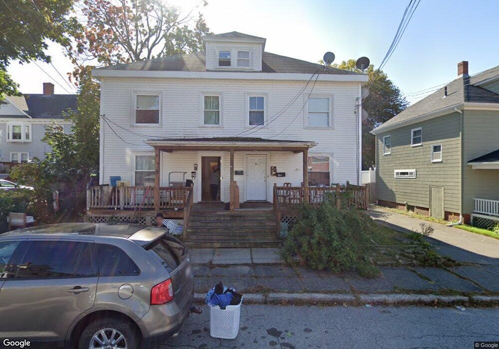
43 Ahland St Unit 1 Haverhill, MA 01830
Highlands NeighborhoodEstimated Value: $565,000 - $803,000
1
Bed
1
Bath
750
Sq Ft
$879/Sq Ft
Est. Value
About This Home
This home is located at 43 Ahland St Unit 1, Haverhill, MA 01830 and is currently estimated at $659,000, approximately $878 per square foot. 43 Ahland St Unit 1 is a home located in Essex County with nearby schools including Dr. Paul Nettle Middle School and Haverhill High School.
Ownership History
Date
Name
Owned For
Owner Type
Purchase Details
Closed on
Feb 18, 2000
Sold by
Mccomiskey Mark A
Bought by
Jimenez Greisy M
Current Estimated Value
Home Financials for this Owner
Home Financials are based on the most recent Mortgage that was taken out on this home.
Original Mortgage
$112,400
Interest Rate
8.11%
Mortgage Type
Purchase Money Mortgage
Create a Home Valuation Report for This Property
The Home Valuation Report is an in-depth analysis detailing your home's value as well as a comparison with similar homes in the area
Home Values in the Area
Average Home Value in this Area
Purchase History
| Date | Buyer | Sale Price | Title Company |
|---|---|---|---|
| Jimenez Greisy M | $124,900 | -- |
Source: Public Records
Mortgage History
| Date | Status | Borrower | Loan Amount |
|---|---|---|---|
| Open | Jimenez Greisy M | $315,000 | |
| Closed | Jimenez Greisy M | $160,000 | |
| Closed | Jimenez Greisy M | $112,400 |
Source: Public Records
Tax History Compared to Growth
Tax History
| Year | Tax Paid | Tax Assessment Tax Assessment Total Assessment is a certain percentage of the fair market value that is determined by local assessors to be the total taxable value of land and additions on the property. | Land | Improvement |
|---|---|---|---|---|
| 2025 | $6,866 | $641,100 | $161,300 | $479,800 |
| 2024 | $5,836 | $548,500 | $153,600 | $394,900 |
| 2023 | $5,607 | $502,900 | $153,600 | $349,300 |
| 2022 | $5,467 | $429,800 | $141,300 | $288,500 |
| 2021 | $5,111 | $380,300 | $126,000 | $254,300 |
| 2020 | $4,933 | $362,700 | $119,800 | $242,900 |
| 2019 | $4,687 | $336,000 | $104,500 | $231,500 |
| 2018 | $4,702 | $329,700 | $98,300 | $231,400 |
| 2017 | $4,395 | $293,200 | $84,500 | $208,700 |
| 2016 | $3,474 | $226,200 | $64,500 | $161,700 |
| 2015 | $3,472 | $226,200 | $64,500 | $161,700 |
Source: Public Records
Map
Nearby Homes
- 20 Ashland St
- 7 Clinton St Unit 4
- 23 Arlington St
- 17 Arlington St
- 13-15 Arlington St
- 27 Webster St
- 8 Bartlett Ave Unit 5
- 16 Fountain St
- 48 Portland St
- 16 Dudley St
- 25 Portland St
- 25-27 Dover St
- 17 Vine St
- 4 Michael Anthony Rd
- 2 Michael Anthony Rd
- 8 Dustin St
- 34 7th Ave
- 151 Franklin St
- 100 Lawrence St Unit 5
- 6 Dexter St
- 43 Ashland St
- 41 Ashland St
- 92 Webster St Unit 2
- 92 Webster St Unit 1
- 37 Ashland St
- 98 Webster St
- 104 Webster St
- 90 Webster St
- 108 Webster St
- 86 Webster St
- 31 Ashland St Unit 6
- 31 Ashland St Unit 4
- 31 Ashland St Unit 1
- 31 Ashland St Unit 2
- 31 Ashland St Unit 1-33
- 31 Ashland St Unit 3
- 31 Ashland St Unit 3R
- 31 Ashland St Unit 7
- 31-33 Ashland Street 3
- 91 Webster St Unit 2