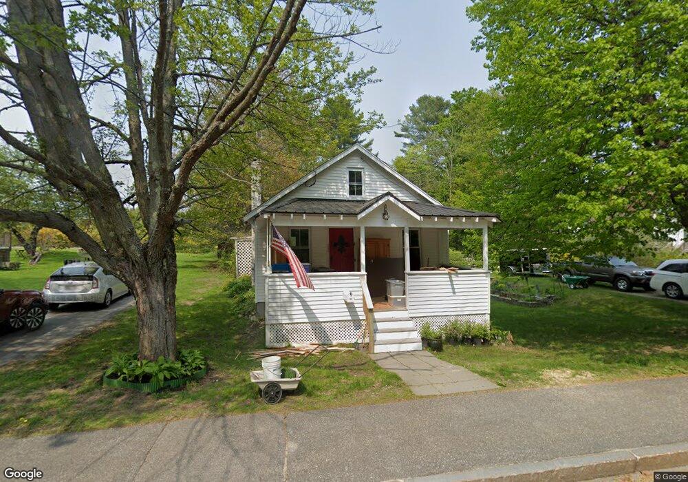
43 Bow St Freeport, ME 04032
Estimated Value: $292,937 - $436,000
2
Beds
1
Bath
736
Sq Ft
$483/Sq Ft
Est. Value
About This Home
This home is located at 43 Bow St, Freeport, ME 04032 and is currently estimated at $355,234, approximately $482 per square foot. 43 Bow St is a home located in Cumberland County with nearby schools including Morse Street School, Mast Landing School, and Freeport Middle School.
Create a Home Valuation Report for This Property
The Home Valuation Report is an in-depth analysis detailing your home's value as well as a comparison with similar homes in the area
Home Values in the Area
Average Home Value in this Area
Tax History
| Year | Tax Paid | Tax Assessment Tax Assessment Total Assessment is a certain percentage of the fair market value that is determined by local assessors to be the total taxable value of land and additions on the property. | Land | Improvement |
|---|---|---|---|---|
| 2025 | $2,830 | $204,300 | $123,800 | $80,500 |
| 2024 | $3,041 | $227,800 | $147,300 | $80,500 |
| 2023 | $2,802 | $203,800 | $134,000 | $69,800 |
| 2022 | $2,585 | $189,400 | $119,600 | $69,800 |
| 2021 | $2,528 | $189,400 | $119,600 | $69,800 |
| 2020 | $2,426 | $173,300 | $110,800 | $62,500 |
| 2019 | $2,325 | $162,600 | $104,500 | $58,100 |
| 2018 | $2,267 | $150,600 | $96,800 | $53,800 |
| 2017 | $2,186 | $146,200 | $94,900 | $51,300 |
| 2016 | $2,071 | $131,100 | $85,600 | $45,500 |
| 2015 | $1,987 | $118,300 | $78,200 | $40,100 |
| 2014 | $1,875 | $118,700 | $78,200 | $40,500 |
| 2013 | $1,929 | $121,700 | $78,200 | $43,500 |
Source: Public Records
Map
Nearby Homes
- 5 Holbrook St
- 212 Main St
- 11 Orchard Hill Rd
- 67 Farmview Ln
- 10 Durham Rd
- 15 Linwood Rd Unit 15
- 42 Durham Rd
- 39 Hunter Rd
- 26 Harvest Ridge Rd Unit 24
- 20 Harvest Ridge Rd Unit 23
- 52 Birch Point Rd
- 1260 Us Route 1
- 15 Tinkers Way
- 1 Wardtown Rd
- 10 Prout Rd
- 8 Statler Ln
- 0 Prout Rd
- 143 Bragdon Rd
- 21 Renee Rd
- 62 Webster Rd
Your Personal Tour Guide
Ask me questions while you tour the home.