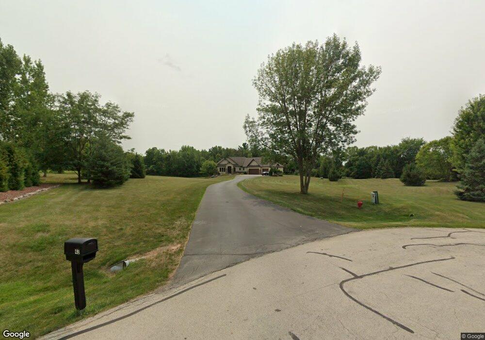
43 Golden Wheat Ln Wrightstown, WI 54180
Estimated Value: $665,000 - $780,193
Studio
--
Bath
--
Sq Ft
99,273
Sq Ft Lot
About This Home
This home is located at 43 Golden Wheat Ln, Wrightstown, WI 54180 and is currently estimated at $717,048. 43 Golden Wheat Ln is a home with nearby schools including Wrightstown Elementary School, Wrightstown Middle School, and Wrightstown High School.
Ownership History
Date
Name
Owned For
Owner Type
Purchase Details
Closed on
Mar 5, 2007
Sold by
Verstegen Keith J and Verstegen Pamela S
Bought by
Pamela Keith J and Pamela S Verstegen Revocable L
Current Estimated Value
Purchase Details
Closed on
May 31, 2006
Sold by
Lamers Michael J and Lamers Brenda L
Bought by
Verstegen Keith J and Verstegen Pamela S
Purchase Details
Closed on
Mar 30, 2001
Sold by
Micke Ronald F and Micke Sonia K
Bought by
Lamers Michael J and Lamers Brenda L
Create a Home Valuation Report for This Property
The Home Valuation Report is an in-depth analysis detailing your home's value as well as a comparison with similar homes in the area
Home Values in the Area
Average Home Value in this Area
Purchase History
| Date | Buyer | Sale Price | Title Company |
|---|---|---|---|
| Pamela Keith J | -- | None Available | |
| Verstegen Keith J | $84,000 | None Available | |
| Lamers Michael J | $65,000 | Bay Title & Abstract |
Source: Public Records
Tax History
| Year | Tax Paid | Tax Assessment Tax Assessment Total Assessment is a certain percentage of the fair market value that is determined by local assessors to be the total taxable value of land and additions on the property. | Land | Improvement |
|---|---|---|---|---|
| 2025 | $10,965 | $671,800 | $118,100 | $553,700 |
| 2024 | $9,649 | $671,800 | $118,100 | $553,700 |
| 2023 | $10,516 | $671,800 | $118,100 | $553,700 |
| 2022 | $10,945 | $444,100 | $88,600 | $355,500 |
| 2021 | $10,563 | $444,100 | $88,600 | $355,500 |
| 2020 | $10,180 | $444,100 | $88,600 | $355,500 |
| 2019 | $9,640 | $444,100 | $88,600 | $355,500 |
| 2018 | $9,000 | $444,100 | $88,600 | $355,500 |
| 2017 | $8,497 | $403,100 | $74,900 | $328,200 |
| 2016 | $8,893 | $403,100 | $74,900 | $328,200 |
| 2015 | $8,926 | $403,100 | $74,900 | $328,200 |
| 2014 | $1,431 | $125,600 | $65,600 | $60,000 |
| 2013 | $1,431 | $65,600 | $65,600 | $0 |
Source: Public Records
Map
Nearby Homes
- 30 Golden Wheat Ln
- 735 Park St
- 109 Nicole Ln
- 361 Main St
- 548 Nicole Ln
- 421 Fawnwood Ct
- 309 Louise Dr
- 217 Patricia Ln
- 119 Main St
- 4207 Lost Dauphin Rd
- 113 Beckerae Ct
- 248 Kerrigan Dr
- 269 Kerrigan Dr
- 278 Kerrigan Dr
- 110 Beckerae Ct
- 287 Kerrigan Dr
- 308 Kerrigan Dr
- 263 Kerrigan Dr
- 302 Kerrigan Dr
- 215 Theunis Dr
- 39 Golden Wheat Ln
- 47 Golden Wheat Ln
- 38 Golden Wheat Ln
- 10 Golden Wheat Ct
- 42 Golden Wheat Ln
- 34 Golden Wheat Ln
- 6 Golden Wheat Ct
- 31 Golden Wheat Ln
- 6 Red Clover Ln
- 22 Corn Silk Ct
- 18 Corn Silk Ct
- 10 Red Clover Ln
- 2 Corn Silk Ct
- 14 Red Clover Ln
- 0 Red Clover Ln Unit 50257506
- 23 Corn Silk Ct
- 10 Corn Silk Ct
- 3 Corn Silk Ct
- 23 Golden Wheat Ln
- 11 Red Clover Ln
Your Personal Tour Guide
Ask me questions while you tour the home.