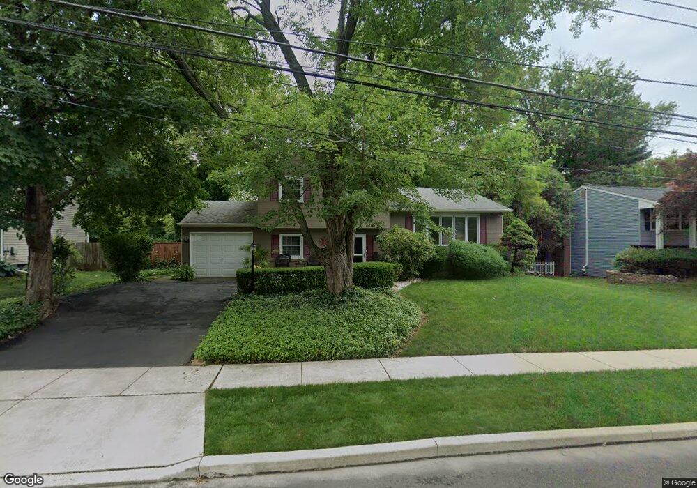
43 Kirby Dr Morrisville, PA 19067
Estimated Value: $396,000 - $466,018
3
Beds
2
Baths
1,147
Sq Ft
$366/Sq Ft
Est. Value
About This Home
This home is located at 43 Kirby Dr, Morrisville, PA 19067 and is currently estimated at $420,255, approximately $366 per square foot. 43 Kirby Dr is a home located in Bucks County with nearby schools including Eleanor Roosevelt Elementary School, Pennwood Middle School, and Pennsbury High School.
Ownership History
Date
Name
Owned For
Owner Type
Purchase Details
Closed on
Oct 23, 2025
Sold by
Marrazzo Norman F and Marrazzo Yvonne C
Bought by
Marrazzo Family Irrevocable Trust
Current Estimated Value
Purchase Details
Closed on
Jul 24, 2012
Sold by
Marrazzo Mary Louise and Marrazzo Norman F
Bought by
Marrazzo Norman F and Marrazzo Yvonne C
Purchase Details
Closed on
Jul 18, 2008
Sold by
Marrazzo Mary Louise
Bought by
Marrazzo Mary Louise and Marrazzo Norman F
Purchase Details
Closed on
Apr 29, 2004
Sold by
Marrazzo Norman F and Marrazzo Yvonne C
Bought by
Marrazzo Mary Louise
Create a Home Valuation Report for This Property
The Home Valuation Report is an in-depth analysis detailing your home's value as well as a comparison with similar homes in the area
Home Values in the Area
Average Home Value in this Area
Purchase History
| Date | Buyer | Sale Price | Title Company |
|---|---|---|---|
| Marrazzo Family Irrevocable Trust | -- | None Listed On Document | |
| Marrazzo Norman F | -- | None Available | |
| Marrazzo Mary Louise | -- | None Available | |
| Marrazzo Mary Louise | $184,536 | -- |
Source: Public Records
Tax History Compared to Growth
Tax History
| Year | Tax Paid | Tax Assessment Tax Assessment Total Assessment is a certain percentage of the fair market value that is determined by local assessors to be the total taxable value of land and additions on the property. | Land | Improvement |
|---|---|---|---|---|
| 2025 | $5,882 | $26,410 | $5,640 | $20,770 |
| 2024 | $5,882 | $26,410 | $5,640 | $20,770 |
| 2023 | $5,633 | $26,400 | $5,640 | $20,760 |
| 2022 | $5,458 | $26,400 | $5,640 | $20,760 |
| 2021 | $5,353 | $26,400 | $5,640 | $20,760 |
| 2020 | $5,353 | $26,400 | $5,640 | $20,760 |
| 2019 | $5,259 | $26,400 | $5,640 | $20,760 |
| 2018 | $5,194 | $26,400 | $5,640 | $20,760 |
| 2017 | $5,063 | $26,400 | $5,640 | $20,760 |
| 2016 | $5,063 | $26,400 | $5,640 | $20,760 |
| 2015 | $4,621 | $26,400 | $5,640 | $20,760 |
| 2014 | $4,621 | $26,400 | $5,640 | $20,760 |
Source: Public Records
Map
Nearby Homes
- 115 Winding Way
- 229 Walton Dr
- 5 Patrick Ln
- 199 Share Dr
- 10 Makefield Rd
- 184 Crestview Way
- 404 Alden Ave
- 413 Alden Ave
- 942 Roeloffs Ct
- 113 Juliet Rd
- 866 Weber Dr
- 670 Lincoln Hwy
- 581 Nottingham Dr
- 494 Keating Dr
- 432 Schindler Dr
- 1080 Roelofs Rd Unit A
- 1706 Makefield Rd
- 79 Sutphin Pines
- 120 Vermont Ln
- 5 Sutphin Pines